GIS user technology news

News, Business, AI, Technology, IOS, Android, Google, Mobile, GIS, Crypto Currency, Economics

  • Advertising & Sponsored Posts
    • Advertising & Sponsored Posts
    • Submit Press
  • PRESS
    • Submit PR
    • Top Press
    • Business
    • Software
    • Hardware
    • UAV News
    • Mobile Technology
  • FEATURES
    • Around the Web
    • Social Media Features
    • EXPERTS & Guests
    • Tips
    • Infographics
  • Blog
  • Events
  • Shop
  • Tradepubs
  • CAREERS
You are here: Home / Archives for * PRESS / Earth Imaging - Remote Sensing

Imagery, earth imaging and remote sensing

Esri and Planet Expand Imagery Accessibility for Users

July 17, 2020 By GISuser

New Agreement Gives Shared Customers a More Streamlined Way to Integrate Satellite Data

Filed Under: DATA, Earth Imaging - Remote Sensing Tagged With: ESRI, esriuc, planet

ATLANTIC PURCHASES FIRST PHASE ONE INDUSTRIAL LARGE-FORMAT CAMERA IN THE USA
July 8, 2020 By GISuser

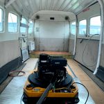
HUNTSVILLE, Ala. (July 8, 2020) – Atlantic recently purchased a new Phase One Industrial 280MP large-format Aerial Solution to better serve its clients. The upgrade substantially increases Atlantic’s ability to efficiently capture a large area with extreme accuracy and quality.

Filed Under: Business, Earth Imaging - Remote Sensing

Fugro partners with Australian Space Agency on new robotics control complex

June 26, 2020 By GISuser

The Australian government’s newly formed Australian Space Agency (ASA) has partnered with Fugro to design, build and operate the Australian Space Automation, Artificial Intelligence and Robotics Control Complex (SpAARC) in Western Australia (WA). 

Filed Under: Business, Earth Imaging - Remote Sensing Tagged With: Fugro

Saharan Air Layer Leaves Cuban Storm in the Dust
June 25, 2020 By GISuser

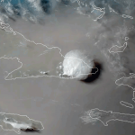
On June 23, 2020, the GOES-East satellite viewed the Saharan Air Layer (or SAL) over Cuba, while a storm erupted through its dusty haze. During this time of year, the SAL often blows westward from Africa’s Saharan Desert and can travel thousands of miles away. The SAL’s activity usually results in reduced severity— or in some cases […]

Filed Under: Earth Imaging - Remote Sensing, Top Text Lead Story Tagged With: NOAA

Maxar Technologies Announces its Intention to Acquire Vricon, Inc.

June 24, 2020 By GISuser

Maxar Technologies Announces its Intention to Acquire Vricon, Inc. to Accelerate Growth in Emerging Markets for 3D Technology and Extend its Lead in Earth Intelligence

Filed Under: acquisitions and funding, Business, Earth Imaging - Remote Sensing Tagged With: acquisition, maxar

Satellite Imagery: Galwan Valley and Disputed India-China Border

June 23, 2020 By GISuser

tank company and artillery_north of gogra_22may2020

Maxar Technologies collected new high-resolution satellite imagery yesterday (June 22nd) of the disputed Galwan Valley and the Line of Actual Control (LAC) between India and China.  In the recent imagery, personnel are actively working with earth moving equipment on the dirt road that approaches the forward position (known as Patrol Point 14) near the LAC […]

Filed Under: Earth Imaging - Remote Sensing Tagged With: maxar, Satellite Imagery

SkyWatch and AgIntegrated to Work Together to Bring Earth Observation Satellite Data to the Agriculture Industry

June 23, 2020 By GISuser

AgIntegrated’s customers will now have access to satellite imagery ranging from 15m to 45cm resolution, thanks to a new integration with SkyWatch EarthCache

Filed Under: Business, Earth Imaging - Remote Sensing Tagged With: satellite data

Astronomers find mystery object in ‘mass gap’

June 23, 2020 By GISuser

Scientists puzzle over the mysterious astrophysical objec

For decades astronomers have been puzzled by a gap that lies between neutron stars and black holes, but a major new discovery has found a mystery object in this so-called ‘mass gap’.

Filed Under: Earth Imaging - Remote Sensing

India: researchers to predict flood damage using satellite data
June 18, 2020 By GISuser

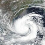
June 2020, Ref: PR 20-41 – As India recovers from the devastating effects of cyclones Amphan and Nisarga, world-renowned water researchers, HR Wallingford, will develop a method to predict damage from future flooding.

Filed Under: Earth Imaging - Remote Sensing, Emergency Response, Top Press Tagged With: satellite data

World Oceans Week and Mapping “Hope Spots”

June 10, 2020 By GISuser

As part of World Oceans Week, on Monday, June 8, Esri is teamed up with Napa, Calif.-based Mission Blue to map “Hope Spots” to preserve protected marine areas. Using Esri’s ArcGIS, Mission Blue is able to identify areas to inspire community engagement and engage policymakers in conservation efforts.

Filed Under: Earth Imaging - Remote Sensing, Environment, Maps and Cartography, Top Press Tagged With: earth, environment, ESRI

« Previous Page
Next Page »

Top Press

The Global Expansion of Aueshah: A New Era of High Jewelry

April 11, 2026 By GISuser

KARACHI, PAKISTAN. The international luxury market is experiencing a profound shift. Consumers are increasingly rejecting mass-produced goods in favor of rarity, authenticity, and emotional depth. … [Read More...]

State of Data Science Report – AI and Open Source at Work

September 10, 2025 By GISuser

AI and Open Source at Work … [Read More...]

Topcon Announces Landmark Expansion of Topnet Live Network Across USA

January 26, 2025 By GISuser

LIVERMORE, Calif.---Topcon Positioning Systems has announced a significant expansion of its Topnet Live reference station network, introducing 200 new geodetic stations strategically positioned across … [Read More...]

Space Flight Laboratory (SFL) Announces Launch and Deployment of NorSat-4 Maritime Monitoring Microsatellite

January 19, 2025 By GISuser

Seventh Satellite Developed by SFL for Norway … [Read More...]

HERE and BMW Group extend partnership on AI-powered mapping system

January 8, 2025 By GISuser

HERE and BMW Group extend partnership on AI-powered mapping system for automated driving and enhanced road safety … [Read More...]

Everest Base Camp Helicopter Tour, Helicopter Return Trek, and Manaslu Circuit Trek: Which Nepal Adventure Is Right for You?

November 6, 2026 By GISuser

Almost everyone planning a Nepal trip runs into the same wall. You want the big mountains, you have a fixed number of days, and every itinerary you read seems to promise something … [Read More...]

SFL Missions Inc. Confirms Successful Deployment of Six HawkEye 360 Radio Frequency Detection Satellites with Advanced Capabilities

October 27, 2026 By GISuser

MĀHIA, New Zealand, 26 October 2026 – SFL Missions Inc. today confirmed the successful deployment of six radio frequency (RF) detection and geolocation satellites for HawkEye 360 … [Read More...]

Canadian-Built RoadEng 12 Uses AI to Find the Best Location for New Resource and Rural Roads

October 17, 2026 By GISuser

Vancouver, BC, Canada, October 15, 2026 – North Vancouver-based Softree Technical Systems today released RoadEng Version 12, used in more than 75 countries to locate and design … [Read More...]

Beyond the Map: How AI Image and Video Generation Is Changing Geospatial Communication

October 14, 2026 By GISuser

Ask anyone who has shipped a GIS project what the hardest part was, and the answer is rarely the spatial analysis. It is almost always the communication. A site suitability … [Read More...]

From Maternity to Everyday Wear: Building a Wardrobe That Grows With You

October 14, 2026 By GISuser

When I think about maternity clothing, I feel the biggest mistake is buying too many things at once. During pregnancy, your body keeps changing, and something that fits well today … [Read More...]

Copyright gletham Communications 2015 - 2026

Go to mobile version