Combination of Cesium plus iTwin offers developers the most comprehensive digital platform for the built and natural environment
Hexagon acquires Voyansi to enhance its BIM solutions portfolio
Hexagon, the global leader in digital reality solutions, combining sensor, software and autonomous technologies, today announced the acquisition of Voyansi, an AECO (architecture, engineering, construction and operations) focused provider of BIM (Building Information Modelling) and VDC (Virtual Design and Construction) solutions, reality capture services and BIM workflow software development.
Avineon Completes Acquisition of North Point Geographic Solutions
McLean, Virginia – April 2, 2024 – Anand Subramani, President of Avineon, Inc. (Avineon®), is pleased to announce the acquisition of the assets held by North Point Geographic Solutions, LLC (North Point). As a provider of professional GIS services for nearly two decades, North Point supports non-profits, commercial organizations, and local governments throughout the midwestern United […]
blackshark.ai Closes an Oversubscribed Extension to its Series A Round, totaling $35 Million

blackshark.ai Closes an Oversubscribed Extension to its Series A Round, totaling $35 Million, to Fast-Track Commercialization of its Unique GEOINT and 3D Mapping Technology.
NV5 Acquires Axim Geospatial, a Leading Provider of Geospatial Solutions to Support Defense and Utilities
HOLLYWOOD, Fla., Feb. 23, 2023 (GLOBE NEWSWIRE) — NV5 Global, Inc. (the “Company” or “NV5”) (Nasdaq: NVEE), a provider of technology, conformity assessment, and consulting solutions, announced today that it has acquired Axim Geospatial (“Axim”).
Atwell enters into a definitive agreement to acquire Dempsey Surveying Company, expanding presence in Midwest
SOUTHFIELD, Mich.–(BUSINESS WIRE)–Atwell has entered into a definitive agreement to acquire Dempsey Surveying Company, a land surveying firm based in Cleveland, Ohio. This acquisition, the third transaction announced by Atwell this quarter, will expand the company’s presence in Ohio and surveying capabilities in the Midwest. The deal is expected to close by Dec. 31, 2022.
Hexagon adds speed, scalability and automation to digital twin creation with the acquisition of LocLab
Hexagon AB, a global leader in digital reality solutions combining sensor, software and autonomous technologies, today announced the acquisition of LocLab, a leader in 3D digital twin content creation. LocLab’s proprietary technology, enabled by a high degree of automation using proven workflows and artificial intelligence, allows the cost- and time-efficient creation of digital twins.
Maxar Technologies To Be Acquired by Advent International for $6.4 Billion
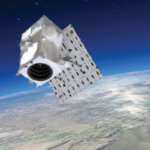
Transaction will support Maxar to accelerate investment in and development of the Company’s next-generation satellite technologies and data insights for its customers
Hexagon invests 100 MUSD in autonomous and sustainable manufacturing through Divergent
Hexagon AB, a global leader in digital reality solutions combining sensor, software and autonomous technologies, today announced a 100 MUSD investment in Divergent Technologies Inc., a pioneer of green manufacturing technologies with the first modular digital factory for the automotive industry.
Thoma Bravo Completes Acquisition of Nearmap Ltd
SAN FRANCISCO and SYDNEY—Thoma Bravo, a leading software investment firm, and Nearmap Ltd (Nearmap), a leading location intelligence and aerial imagery company listed on the Australian Securities Exchange (ASX), today announced the completion of Thoma Bravo’s acquisition of Nearmap in an all-cash scheme of arrangement valued at approximately AUD $1.055 billion.