GIS user technology news

News, Business, AI, Technology, IOS, Android, Google, Mobile, GIS, Crypto Currency, Economics

  • Advertising & Sponsored Posts
    • Advertising & Sponsored Posts
    • Submit Press
  • PRESS
    • Submit PR
    • Top Press
    • Business
    • Software
    • Hardware
    • UAV News
    • Mobile Technology
  • FEATURES
    • Around the Web
    • Social Media Features
    • EXPERTS & Guests
    • Tips
    • Infographics
  • Blog
  • Events
  • Shop
  • Tradepubs
  • CAREERS
You are here: Home / Archives for * PRESS / Earth Imaging - Remote Sensing

Imagery, earth imaging and remote sensing

Satellite Imagery: George Floyd Funeral Service – Houston, TX

June 9, 2020 By GISuser

Satellite Imagery: George Floyd Funeral Service - Houston, TX

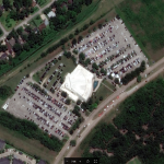
Maxar Technologies collected satellite imagery today over Houston, Texas, that included the Fountain of Praise church, where the funeral service for George Floyd was being held beginning at noon. The satellite imagery was collected at 11:51 AM CDT—approximately 9 minutes before the service began.

Filed Under: Earth Imaging - Remote Sensing Tagged With: Satellite Imagery

Soar.Earth to give away free 50cm high-res SuperView satellite imagery

June 8, 2020 By GISuser

free 50cm high-res SuperView satellite imagery

To celebrate the launch of SuperView on Soar, we’re giving away FREE high-res 50cm satellite imagery (normally $6/sq km) to the first 50 people who place a SuperView archive image order.

Filed Under: Earth Imaging - Remote Sensing Tagged With: Satellite Imagery

Satellite Imagery: Washington, DC and Black Lives Matter Street Mural

June 7, 2020 By GISuser

Satellite Imagery: Washington, DC and Black Lives Matter Street Mural

Maxar collected new satellite imagery this afternoon of Washington D.C. at 12:08 PM EDT that shows people gathered near the entrance to Lafayette Square and at the steps to the Lincoln Memorial.

Filed Under: Earth Imaging - Remote Sensing, Emergency Response, Top Press, Top Text Lead Story Tagged With: maxar, Satellite Imagery

Price break through for new tasked high resolution satellite imagery via the Soar platform

June 5, 2020 By GISuser

SAN FRANCISCO, CALIFORNIA. 5 June 2020 – Earth maps and imagery platform Soar, in partnership with the Chinese Aerospace Science and Technology Corporation (CASC), is excited to announce its latest feature offering high-resolution imagery from the SuperView satellite constellation. 

Filed Under: DATA, Earth Imaging - Remote Sensing

EagleView Hits Key Milestone, Processing 100M Images So Far This Year

June 4, 2020 By GISuser

Company breaks imagery capture record just five months into the year

Filed Under: Earth Imaging - Remote Sensing

Teledyne Lumenera’s new Lt Series USB3 Cameras engineered for modern vision systems

June 3, 2020 By GISuser

The Lt Series USB3 Cameras are designed to meet the challenges of today’s imaging applications

New USB3 cameras engineered to meet the challenges of modern vision systems

Filed Under: Earth Imaging - Remote Sensing, Hardware Tagged With: Teledyne

Satellite Imagery: SpaceX Falcon 9 Crew Dragon Launch

June 2, 2020 By GISuser

Maxar collected new satellite imagery on May 30th of the historic launch of the SpaceX Falcon 9 rocket and Crew Dragon Spacecraft from Launch Pad 39A at the Kennedy Space Center in Florida. Most notably, Maxar collected a dramatic image of the rocket and the astronauts flying toward space and high above the launch pad and […]

Filed Under: Business, Earth Imaging - Remote Sensing, Top Press Tagged With: NASA, SpaceX

Finnish Space Data Company Terramonitor launches a Web Store

May 28, 2020 By GISuser

Finnish Space Data Company Terramonitor launches a Web Store

Terramonitor launches a Web Store that provides easy access to analysis-ready satellite images and up-to-date satellite maps. By processing thousands of satellite images per day with AI and cloud computing, Terramonitor provides revolutionary tools for monitoring and analyzing the globe from space.

Filed Under: Business, DATA, Earth Imaging - Remote Sensing, LiDAR, Maps and Cartography, Top Text Lead Story Tagged With: space data, Terramonitor

Commerce Department Releases New Regulations to Support U.S. Leadership in Commercial Satellite Remote Sensing Industry

May 20, 2020 By GISuser

Today, the U.S. Department of Commerce released new regulations to improve the licensing process for private U.S. satellite remote sensing operations, helping ensure continued U.S. leadership in a critical commercial space industry.

Filed Under: DATA, Earth Imaging - Remote Sensing, Government & OpenGov

Earth Observant Inc. Closes Seed Round

May 18, 2020 By GISuser

SAN FRANCISCO, May 14, 2020 (Newswire.com) – Earth Observant Inc. (EOI) announced the closure of its seed round in the first quarter of this year. Over the past 18 months, the company has been designing a constellation of low-flying satellites that leverage the team’s decades of experience developing propulsion systems and Earth imaging platforms. 

Filed Under: acquisitions and funding, Business, Earth Imaging - Remote Sensing

« Previous Page
Next Page »

Top Press

The Global Expansion of Aueshah: A New Era of High Jewelry

April 11, 2026 By GISuser

KARACHI, PAKISTAN. The international luxury market is experiencing a profound shift. Consumers are increasingly rejecting mass-produced goods in favor of rarity, authenticity, and emotional depth. … [Read More...]

State of Data Science Report – AI and Open Source at Work

September 10, 2025 By GISuser

AI and Open Source at Work … [Read More...]

Topcon Announces Landmark Expansion of Topnet Live Network Across USA

January 26, 2025 By GISuser

LIVERMORE, Calif.---Topcon Positioning Systems has announced a significant expansion of its Topnet Live reference station network, introducing 200 new geodetic stations strategically positioned across … [Read More...]

Space Flight Laboratory (SFL) Announces Launch and Deployment of NorSat-4 Maritime Monitoring Microsatellite

January 19, 2025 By GISuser

Seventh Satellite Developed by SFL for Norway … [Read More...]

HERE and BMW Group extend partnership on AI-powered mapping system

January 8, 2025 By GISuser

HERE and BMW Group extend partnership on AI-powered mapping system for automated driving and enhanced road safety … [Read More...]

Everest Base Camp Helicopter Tour, Helicopter Return Trek, and Manaslu Circuit Trek: Which Nepal Adventure Is Right for You?

November 6, 2026 By GISuser

Almost everyone planning a Nepal trip runs into the same wall. You want the big mountains, you have a fixed number of days, and every itinerary you read seems to promise something … [Read More...]

SFL Missions Inc. Confirms Successful Deployment of Six HawkEye 360 Radio Frequency Detection Satellites with Advanced Capabilities

October 27, 2026 By GISuser

MĀHIA, New Zealand, 26 October 2026 – SFL Missions Inc. today confirmed the successful deployment of six radio frequency (RF) detection and geolocation satellites for HawkEye 360 … [Read More...]

Canadian-Built RoadEng 12 Uses AI to Find the Best Location for New Resource and Rural Roads

October 17, 2026 By GISuser

Vancouver, BC, Canada, October 15, 2026 – North Vancouver-based Softree Technical Systems today released RoadEng Version 12, used in more than 75 countries to locate and design … [Read More...]

Beyond the Map: How AI Image and Video Generation Is Changing Geospatial Communication

October 14, 2026 By GISuser

Ask anyone who has shipped a GIS project what the hardest part was, and the answer is rarely the spatial analysis. It is almost always the communication. A site suitability … [Read More...]

From Maternity to Everyday Wear: Building a Wardrobe That Grows With You

October 14, 2026 By GISuser

When I think about maternity clothing, I feel the biggest mistake is buying too many things at once. During pregnancy, your body keeps changing, and something that fits well today … [Read More...]

Copyright gletham Communications 2015 - 2026

Go to mobile version