GIS user technology news

News, Business, AI, Technology, IOS, Android, Google, Mobile, GIS, Crypto Currency, Economics

  • Advertising & Sponsored Posts
    • Advertising & Sponsored Posts
    • Submit Press
  • PRESS
    • Submit PR
    • Top Press
    • Business
    • Software
    • Hardware
    • UAV News
    • Mobile Technology
  • FEATURES
    • Around the Web
    • Social Media Features
    • EXPERTS & Guests
    • Tips
    • Infographics
  • Blog
  • Events
  • Shop
  • Tradepubs
  • CAREERS
You are here: Home / Archives for * PRESS / Earth Imaging - Remote Sensing

Imagery, earth imaging and remote sensing

Space Flight Laboratory Announces Launch of Atmospheric Monitoring and Earth Observation Microsatellites

September 3, 2020 By GISuser

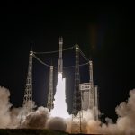
An Arianespace Vega rocket successfully carried two microsatellites built by Space Flight Laboratory into space from the Guiana Space Center in French Guiana, South America. (Credit: Arianespace)

TORONTO, Ontario, Canada, 3 September 2020 – Space Flight Laboratory (SFL), a developer of 52 distinct microspace missions, today announced the successful launch and deployment of the GHGSat-C1 greenhouse gas monitoring microsatellite and the Slovenian NEMO-HD Earth observation microsatellite. SFL developed the small satellites at its facility in Toronto. Both satellites were in contact with ground […]

Filed Under: Business, Earth Imaging - Remote Sensing

Opportunity – AGU Michael H. Freilich Student Visualization Competition Program

September 2, 2020 By GISuser

An opportunity for students in the Earth and space science community Competition overview Powerful visuals can often evoke excitement and emotion, driving a deeper level of engagement with the audience and subject matter being presented. The AGU Michael H. Freilich Student Visualization Competition Program provides an opportunity for students to demonstrate creative ways to use […]

Filed Under: Business, Developer, Earth Imaging - Remote Sensing Tagged With: competition, developer

Satellite Imagery: Before/After Imagery of Hurricane Laura Landfall in Louisiana
August 31, 2020 By GISuser

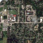
Maxar collected a set of new imagery today (August 27th) of the aftermath of Hurricane Laura as it rapidly moved through Cameron and Lake Charles, Louisiana. Significant damage to homes, buildings and infrastructure can be seen across the region. Satellite image ©2020 Maxar Technologies.

Filed Under: Business, Earth Imaging - Remote Sensing Tagged With: maxar

Atlantic Awarded $16 Million Contract From USACE, St. Louis District
August 27, 2020 By samtheman

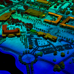
Atlantic announced today that it has been awarded a 5-year, $16 million prime contract by the United States Army Corps of Engineers (USACE), St. Louis District to perform photogrammetric and Lidar surveying and mapping services. Under the Indefinite Delivery Indefinite Quantity (IDIQ), Atlantic will complete task orders nationwide to support geospatial needs of the USACE […]

Filed Under: Business, Earth Imaging - Remote Sensing

Arturo Welcomes Near Space Labs as Stratospheric Imagery Provider

August 22, 2020 By GISuser

Clients will receive high frequency, highly detailed aerial imagery

Filed Under: Earth Imaging - Remote Sensing

Satellite Imagery: LNU Lightning Wildfire in California via Maxar

August 21, 2020 By GISuser

Lnu lightning complex wildfire_healdsburg california_20august2020_wv3 shortwave infrared image

Maxar’s WorldView-3 satellite collected new imagery yesterday afternoon (August 20th) of the LNU Lightning Complex wildfire burning in Sonoma County near Healdsburg, California.

Filed Under: Earth Imaging - Remote Sensing, Emergency Response, Top Text Lead Story Tagged With: California, Imagery, maxar, wildfire

Satellite Imagery: Pine Gulch Wildfire, Colorado (images via @Maxar)

August 10, 2020 By GISuser

Maxar collected new satellite August 8th & 9th of the Pine Gulch wildfire burning north of Grand Junction, Colorado. The fire, which has burned nearly 24,000 acres as of mid-day Sunday, is burning in a remote area approximately 18 miles north of Grand Junction in Mesa and Garfield counties.

Filed Under: Earth Imaging - Remote Sensing, Emergency Response, Environment Tagged With: maxar, wildfire

Beirut Explosion: Maxar Technologies, Before-and-After Satellite Imagery
August 5, 2020 By GISuser

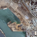
Several of Maxar’s satellites collected new imagery Aug 5, 2020 over Beirut that reveals the aftermath of the massive explosion in the port section of the city.

Filed Under: Earth Imaging - Remote Sensing, Top Text Lead Story Tagged With: Imagery, maxar

Webinar – How to Manage Photogrammetric Production During Peak Season

July 29, 2020 By GISuser

Photogrammetric production during peak season can be challenging. Multiple projects, often comprising tens of thousands of images, need to be processed and delivered in a timely manner.

Filed Under: Business, Earth Imaging - Remote Sensing, Featured TOP PR, GISuse HOT Event, Webinars Tagged With: SimActive, Webinar

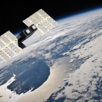
Space Flight Laboratory Announces New Line of Cost-Effective CubeSats to Expand its Current Satellite Offerings
July 27, 2020 By GISuser

Accelerated Development Available

Filed Under: Earth Imaging - Remote Sensing

« Previous Page
Next Page »

Top Press

The Global Expansion of Aueshah: A New Era of High Jewelry

April 11, 2026 By GISuser

KARACHI, PAKISTAN. The international luxury market is experiencing a profound shift. Consumers are increasingly rejecting mass-produced goods in favor of rarity, authenticity, and emotional depth. … [Read More...]

State of Data Science Report – AI and Open Source at Work

September 10, 2025 By GISuser

AI and Open Source at Work … [Read More...]

Topcon Announces Landmark Expansion of Topnet Live Network Across USA

January 26, 2025 By GISuser

LIVERMORE, Calif.---Topcon Positioning Systems has announced a significant expansion of its Topnet Live reference station network, introducing 200 new geodetic stations strategically positioned across … [Read More...]

Space Flight Laboratory (SFL) Announces Launch and Deployment of NorSat-4 Maritime Monitoring Microsatellite

January 19, 2025 By GISuser

Seventh Satellite Developed by SFL for Norway … [Read More...]

HERE and BMW Group extend partnership on AI-powered mapping system

January 8, 2025 By GISuser

HERE and BMW Group extend partnership on AI-powered mapping system for automated driving and enhanced road safety … [Read More...]

Everest Base Camp Helicopter Tour, Helicopter Return Trek, and Manaslu Circuit Trek: Which Nepal Adventure Is Right for You?

November 6, 2026 By GISuser

Almost everyone planning a Nepal trip runs into the same wall. You want the big mountains, you have a fixed number of days, and every itinerary you read seems to promise something … [Read More...]

SFL Missions Inc. Confirms Successful Deployment of Six HawkEye 360 Radio Frequency Detection Satellites with Advanced Capabilities

October 27, 2026 By GISuser

MĀHIA, New Zealand, 26 October 2026 – SFL Missions Inc. today confirmed the successful deployment of six radio frequency (RF) detection and geolocation satellites for HawkEye 360 … [Read More...]

Canadian-Built RoadEng 12 Uses AI to Find the Best Location for New Resource and Rural Roads

October 17, 2026 By GISuser

Vancouver, BC, Canada, October 15, 2026 – North Vancouver-based Softree Technical Systems today released RoadEng Version 12, used in more than 75 countries to locate and design … [Read More...]

Beyond the Map: How AI Image and Video Generation Is Changing Geospatial Communication

October 14, 2026 By GISuser

Ask anyone who has shipped a GIS project what the hardest part was, and the answer is rarely the spatial analysis. It is almost always the communication. A site suitability … [Read More...]

From Maternity to Everyday Wear: Building a Wardrobe That Grows With You

October 14, 2026 By GISuser

When I think about maternity clothing, I feel the biggest mistake is buying too many things at once. During pregnancy, your body keeps changing, and something that fits well today … [Read More...]

Copyright gletham Communications 2015 - 2026

Go to mobile version