GIS user technology news

News, Business, AI, Technology, IOS, Android, Google, Mobile, GIS, Crypto Currency, Economics

  • Advertising & Sponsored Posts
    • Advertising & Sponsored Posts
    • Submit Press
  • PRESS
    • Submit PR
    • Top Press
    • Business
    • Software
    • Hardware
    • UAV News
    • Mobile Technology
  • FEATURES
    • Around the Web
    • Social Media Features
    • EXPERTS & Guests
    • Tips
    • Infographics
  • Blog
  • Events
  • Shop
  • Tradepubs
  • CAREERS
You are here: Home / Archives for * PRESS / Events

GIS industry events

GIS, mapping, and location technology conferences, webinars, and events

New Episode Alert: The Future of Wearable Reality Capture Systems

January 25, 2025 By GISuser

NavVis unveiled its new MLX handheld laser scanner for reality capture at INTERGEO in September 2024.

Filed Under: Around the Web, Business, Events, LiDAR, Top Text Lead Story Tagged With: alert,”, around, business:, capture, episode, events:, future:, lead, LiDAR, New, reality, story, systems, text, the, top, wearable, web

FOSS4G NA 2024: The Premier Open Source Geospatial Conference Returns to St. Louis, September 9-11

August 12, 2024 By GISuser

St. Louis, MO – August 12, 2024 – The Free and Open Source Software for Geospatial (FOSS4G) North America (NA) 2024 conference is set to take place in St. Louis, Missouri, from September 9-11. This premier event brings together a diverse community of geospatial professionals, developers, enthusiasts, and industry leaders for three days of learning, collaboration, […]

Filed Under: Business, Events, GISuse HOT Event, Top Features Tagged With: [2024, 9-11, business:, conference, event, events:, features, FOSS4G, geospatial, gisuse, Hot, louis,, open, premier, returns, september, source, st., the, top

GCPs for Photogrammetry: How Many Do You Need?

March 15, 2024 By GISuser

Surveying and photogrammetry are complementary technologies. While either can be done without the other, they can both benefit from the use of the other.

Filed Under: Business, Events, Top Press Tagged With: Business, events, for, gcps, how, many, need?, photogrammetry, press, top, you

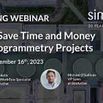
Webinar – How to Save Time and Money on Photogrammetry Projects
November 8, 2023 By GISuser

Webinar on Thursday, November 16th – Hosted by Eric Andelin CP, Senior Workflow Specialist with guest speaker Michael O’Sullivan, VP Sales, SimActive Inc.

Filed Under: Business, Events, Featured TOP PR, Webinars Tagged With: SimActive, Webinar

Webinar Topic: Cameras on Drones and Aircraft: Is Bigger Always Better?

August 8, 2023 By GISuser

Webinar Announcement Hosted by Eric Andelin CP, Senior Workflow Specialist at SimActive and guest speaker, Kevin Graville, System Sales Manager at Phase One. Date: Thursday, August 17th 2023 Register here: https://hubs.ly/Q01ZS6Wz0 Aerial photography continues to thrive as a tool for mapping in spite of alternatives such as Lidar. Pictures can be collected using relatively low-cost cameras and converted to […]

Filed Under: Business, Events, HUGE NEWS Tagged With: SimActive, Webinar

URISA Shares GIS-Pro 2023 Conference Details

June 26, 2023 By GISuser

Des Plaines, IL ( June 14, 2023) – URISA is pleased to share the details for GIS-Pro 2023, its 61st annual conference taking place October 16-19, 2023 in Columbus, Ohio.

Filed Under: Business, Events Tagged With: URISA

TCarta Hosting Coastal and Littoral Zone Mapping Workshop at GEOINT 2023

May 15, 2023 By GISuser

Registration Open Now

Filed Under: Business, Events Tagged With: events, GeoINT, TCarta

Global Marketing Insights Teams with NineTwelve and STEP CG to Present GEOINT Workshop on Moving Data Securely and Quickly across the Battlespace

May 8, 2023 By GISuser

CLEVELAND, Ohio, 8 May 2023 – Dr. Shawana Johnson, GISP, President of Global Marketing Insights, has partnered with fellow subject matter experts on 5G, IoT, and fabric networks for a GEOINT 2023 workshop on assuring the secure and rapid transmission of critical data across the battlespace. The team includes NineTwelve of Indianapolis, Indiana, and STEP CG […]

Filed Under: Business, Events, Top Press Tagged With: events, GeoINT

2023 Terrasolid North American User Conference (June 6-8)

March 9, 2023 By GISuser

Are you interested in learning the latest techniques and workflows for processing Lidar data? Join the largest Terrasolid networking event in North America this June 6 – 8 for the 2023 TERRASOLID NORTH AMERICAN USER CONFERENCE. Level up your skills, increase your productivity, and learn how to create new client deliverables.

Filed Under: Business, Events

TCarta Expands Role in Seabed 2030 Ocean Survey Project

March 8, 2023 By GISuser

Free Workshop at U.S. Hydro 2023

Filed Under: Business, Events

Next Page »

Top Press

The Global Expansion of Aueshah: A New Era of High Jewelry

April 11, 2026 By GISuser

KARACHI, PAKISTAN. The international luxury market is experiencing a profound shift. Consumers are increasingly rejecting mass-produced goods in favor of rarity, authenticity, and emotional depth. … [Read More...]

State of Data Science Report – AI and Open Source at Work

September 10, 2025 By GISuser

AI and Open Source at Work … [Read More...]

Topcon Announces Landmark Expansion of Topnet Live Network Across USA

January 26, 2025 By GISuser

LIVERMORE, Calif.---Topcon Positioning Systems has announced a significant expansion of its Topnet Live reference station network, introducing 200 new geodetic stations strategically positioned across … [Read More...]

Space Flight Laboratory (SFL) Announces Launch and Deployment of NorSat-4 Maritime Monitoring Microsatellite

January 19, 2025 By GISuser

Seventh Satellite Developed by SFL for Norway … [Read More...]

HERE and BMW Group extend partnership on AI-powered mapping system

January 8, 2025 By GISuser

HERE and BMW Group extend partnership on AI-powered mapping system for automated driving and enhanced road safety … [Read More...]

Canadian-Built RoadEng 12 Uses AI to Find the Best Location for New Resource and Rural Roads

October 17, 2026 By GISuser

Vancouver, BC, Canada, October 15, 2026 – North Vancouver-based Softree Technical Systems today released RoadEng Version 12, used in more than 75 countries to locate and design … [Read More...]

Beyond the Map: How AI Image and Video Generation Is Changing Geospatial Communication

October 14, 2026 By GISuser

Ask anyone who has shipped a GIS project what the hardest part was, and the answer is rarely the spatial analysis. It is almost always the communication. A site suitability … [Read More...]

From Maternity to Everyday Wear: Building a Wardrobe That Grows With You

October 14, 2026 By GISuser

When I think about maternity clothing, I feel the biggest mistake is buying too many things at once. During pregnancy, your body keeps changing, and something that fits well today … [Read More...]

eMMC 5.1 Explained: Features, Performance, and Applications in Modern Devices

October 14, 2026 By GISuser

Storage technology is an essential part of modern computing, influencing how devices store information, launch applications, and manage everyday workloads. Although … [Read More...]

SFL Missions Inc. Confirms Successful Deployment of Two GHGSat Greenhouse Gas Monitoring Microsatellites

October 3, 2026 By GISuser

TORONTO, Ontario, Canada, 2 October 2026 – SFL Missions Inc. confirms the successful launch and deployment of the GHGSat-C18 (Eleanor) and GHGSat-C19 (Aidan) commercial greenhouse … [Read More...]

Copyright gletham Communications 2015 - 2026

Go to mobile version