GIS user technology news

News, Business, AI, Technology, IOS, Android, Google, Mobile, GIS, Crypto Currency, Economics

  • Advertising & Sponsored Posts
    • Advertising & Sponsored Posts
    • Submit Press
  • PRESS
    • Submit PR
    • Top Press
    • Business
    • Software
    • Hardware
    • UAV News
    • Mobile Technology
  • FEATURES
    • Around the Web
    • Social Media Features
    • EXPERTS & Guests
    • Tips
    • Infographics
  • Blog
  • Events
  • Shop
  • Tradepubs
  • CAREERS
You are here: Home / Archives for * PRESS / Earth Imaging - Remote Sensing

Imagery, earth imaging and remote sensing

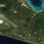
Maxar Releases Satellite Imagery: Vanuatu Before / After Cyclone Harold

April 10, 2020 By GISuser

Maxar collected new imagery today (April 10th) of Vanuatu and the aftermath of the category 5 cyclone (Harold) that recently struck the island nation. Below are before/after images that primarily focus on the island of Espiritu Santo and the main city of Luganville. As you will see in the imagery comparisons, this once lush island […]

Filed Under: Earth Imaging - Remote Sensing, Emergency Response Tagged With: maxar

SimActive Used to Determine Solar Potential from Satellite Imagery

April 7, 2020 By GISuser

SimActive Used to Determine Solar Potential from Satellite Imagery

Montreal, Canada, April 7th, 2020 – SimActive Inc., a world-leading developer of photogrammetry software, announces that his Correlator3D™ product is used by Dutch company NEO B.V. to assess solar potential in multiple cities.  Digital surface models (DSMs) are generated from WorldView and GeoEye satellite stereo images and serve to calculate solar panel capacity.

Filed Under: Business, Earth Imaging - Remote Sensing Tagged With: Imagery, SimActive

Copernicus Masters 2020 Submissions Open 1 April

April 1, 2020 By GISuser

Copernicus Masters 2020 Submissions Open 1 April

The temperature is rising – hottest winter by far

Filed Under: Business, Developer, Earth Imaging - Remote Sensing Tagged With: Copernicus

Successful launch for Airbus’ Bartolomeo

March 14, 2020 By GISuser

Cape Canaveral, 09 March 2020 – The Airbus built Bartolomeo platform has been successfully launched on 06 March from Cape Canaveral, Florida, US. Bartolomeo is now on its journey to the International Space Station (ISS) and will be installed outside of the Columbus Laboratory, the European module of the ISS built by Airbus.

Filed Under: Earth Imaging - Remote Sensing Tagged With: Airbus

Maxar Releases Imagery of Nashville, TN Tornado Damage

March 9, 2020 By GISuser

damage to the Old Tennessee State prison, which was featured in the movies “The Green Mile” and “Walk the Line.”

March 8th, Maxar Technologies collected satellite imagery of Nashville, Tennessee, and the aftermath of the tornado that recently struck the area.

Filed Under: Earth Imaging - Remote Sensing

Satellite Imagery – Locations around the World Affected by #coronavirus COVID-19

March 6, 2020 By GISuser

great mosque and kaaba_mecca_before coronavirus_14feb2020

Maxar Technologies collected new satellite imagery from multiple locations around the world as the novel coronavirus, COVID-19, continues to spread.

Filed Under: Earth Imaging - Remote Sensing, Emergency Response Tagged With: coronavirus, Imagery, maxar

Capella Space Unveils Advanced Satellite Design to Deliver High Resolution On-Demand Earth Observation Data

January 21, 2020 By GISuser

Enhanced technology package meets customer demand for timely, flexible and frequent very high resolution SAR imagery

Filed Under: Earth Imaging - Remote Sensing Tagged With: Capella, Earth Observation

Satellite Imagery: Ukrainian Airlines Crash Location in Iran

January 9, 2020 By GISuser

Satellite Imagery: Ukrainian Airlines Crash Location in Iran

Today (January 9), two of Maxar’s satellites collected new imagery of the crash location of the Ukrainian passenger airplane near Khalaj Abad, Iran. The images were collected first by the WorldView-2 satellite (at approximately 10:34 AM, local) and then again by the WorldView-1 satellite (at approximately 1:47PM local). In the imagery, and particularly the color […]

Filed Under: Earth Imaging - Remote Sensing, Top Press Tagged With: @Road Announces New Mobile Resource Management Solution for BlackBerry Enterprise Customers, iran

Satellite Imagery: Wildfires in New South Wales, Australia

January 5, 2020 By GISuser

Maxar collected new satellite imagery, January 4, 2020, of the wildfires in Victoria and New South Wales, Australia

Filed Under: Earth Imaging - Remote Sensing, Emergency Response, Environment, Top Press Tagged With: maxar, wildfire

Space Economy Report – Commercial Space Revenues to Reach $485 Billion by 2028

December 20, 2019 By GISuser

Satellite operations and services lead growth with five percent annual increase over the next decade Manufacturing, launch and ground segment projected to grow four percent annually

Filed Under: Earth Imaging - Remote Sensing, Research

« Previous Page
Next Page »

Top Press

The Global Expansion of Aueshah: A New Era of High Jewelry

April 11, 2026 By GISuser

KARACHI, PAKISTAN. The international luxury market is experiencing a profound shift. Consumers are increasingly rejecting mass-produced goods in favor of rarity, authenticity, and emotional depth. … [Read More...]

State of Data Science Report – AI and Open Source at Work

September 10, 2025 By GISuser

AI and Open Source at Work … [Read More...]

Topcon Announces Landmark Expansion of Topnet Live Network Across USA

January 26, 2025 By GISuser

LIVERMORE, Calif.---Topcon Positioning Systems has announced a significant expansion of its Topnet Live reference station network, introducing 200 new geodetic stations strategically positioned across … [Read More...]

Space Flight Laboratory (SFL) Announces Launch and Deployment of NorSat-4 Maritime Monitoring Microsatellite

January 19, 2025 By GISuser

Seventh Satellite Developed by SFL for Norway … [Read More...]

HERE and BMW Group extend partnership on AI-powered mapping system

January 8, 2025 By GISuser

HERE and BMW Group extend partnership on AI-powered mapping system for automated driving and enhanced road safety … [Read More...]

Everest Base Camp Helicopter Tour, Helicopter Return Trek, and Manaslu Circuit Trek: Which Nepal Adventure Is Right for You?

November 6, 2026 By GISuser

Almost everyone planning a Nepal trip runs into the same wall. You want the big mountains, you have a fixed number of days, and every itinerary you read seems to promise something … [Read More...]

SFL Missions Inc. Confirms Successful Deployment of Six HawkEye 360 Radio Frequency Detection Satellites with Advanced Capabilities

October 27, 2026 By GISuser

MĀHIA, New Zealand, 26 October 2026 – SFL Missions Inc. today confirmed the successful deployment of six radio frequency (RF) detection and geolocation satellites for HawkEye 360 … [Read More...]

Canadian-Built RoadEng 12 Uses AI to Find the Best Location for New Resource and Rural Roads

October 17, 2026 By GISuser

Vancouver, BC, Canada, October 15, 2026 – North Vancouver-based Softree Technical Systems today released RoadEng Version 12, used in more than 75 countries to locate and design … [Read More...]

Beyond the Map: How AI Image and Video Generation Is Changing Geospatial Communication

October 14, 2026 By GISuser

Ask anyone who has shipped a GIS project what the hardest part was, and the answer is rarely the spatial analysis. It is almost always the communication. A site suitability … [Read More...]

From Maternity to Everyday Wear: Building a Wardrobe That Grows With You

October 14, 2026 By GISuser

When I think about maternity clothing, I feel the biggest mistake is buying too many things at once. During pregnancy, your body keeps changing, and something that fits well today … [Read More...]

Copyright gletham Communications 2015 - 2026

Go to mobile version