GIS user technology news

News, Business, AI, Technology, IOS, Android, Google, Mobile, GIS, Crypto Currency, Economics

  • Advertising & Sponsored Posts
    • Advertising & Sponsored Posts
    • Submit Press
  • PRESS
    • Submit PR
    • Top Press
    • Business
    • Software
    • Hardware
    • UAV News
    • Mobile Technology
  • FEATURES
    • Around the Web
    • Social Media Features
    • EXPERTS & Guests
    • Tips
    • Infographics
  • Blog
  • Events
  • Shop
  • Tradepubs
  • CAREERS
You are here: Home / * PRESS / Business / Satellite Imagery: SpaceX Falcon 9 Crew Dragon Launch

Satellite Imagery: SpaceX Falcon 9 Crew Dragon Launch

June 2, 2020 By GISuser

Maxar collected new satellite imagery on May 30th of the historic launch of the SpaceX Falcon 9 rocket and Crew Dragon Spacecraft from Launch Pad 39A at the Kennedy Space Center in Florida. Most notably, Maxar collected a dramatic image of the rocket and the astronauts flying toward space and high above the launch pad and the clouds at T-plus 120 seconds!

Maxar’s WorldView-1 satellite subsequently collected an image of the launch pad at 3:18PM EDT, four minutes before launch.


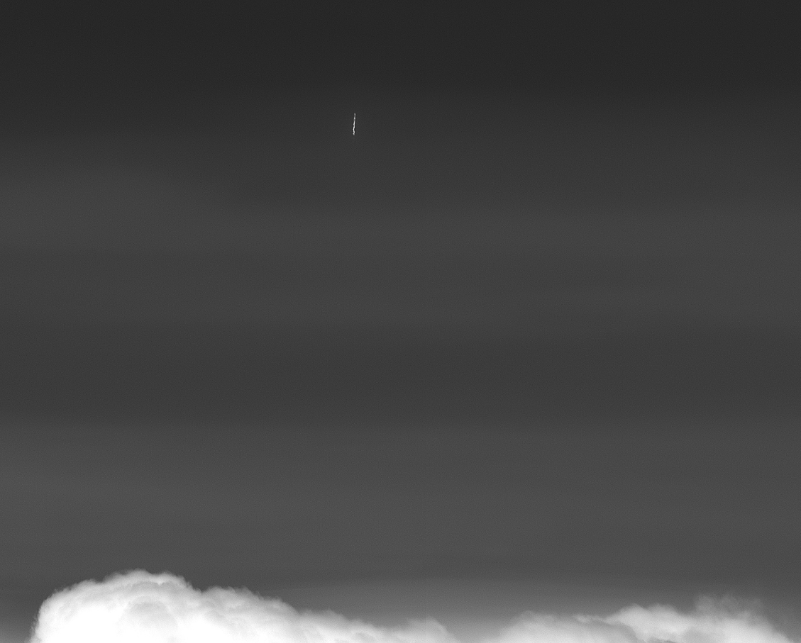
Satellite image ©2020 Maxar Technologies.

Filed Under: Business, Earth Imaging - Remote Sensing, Top Press Tagged With: NASA, SpaceX

Editor’s Picks

Wider Selection of US Topo Maps From USGS Now Available in Avenza’s PDF Maps App

Trimble Unity – Next Generation Suite of Software Applications for Water, Wastewater and Stormwater Utilities

Feature: Social Media Mapping is Crucial for Market Research and your Social Strategy

CoreLogic Data Reveals Wildfires Pose Big Risk to Nearly 900,000 Western US Homes in 2015

See More Editor's Picks...

Recent Industry News

The Drift Between Early Notes and Final Case Files in Abuse-Related Legal Support

April 29, 2026 By GISuser

Aerial Surveys Int’l and Global Marketing Insights to Present GEOINT 2026 Workshop on Multi-Domain Geospatial Fusion for Automated Infrastructure Monitoring

April 24, 2026 By GISuser

Why Timing Matters More Than You Think With Spray Seal (And Why People Often Get It Slightly Wrong)

April 22, 2026 By GISuser

The Quiet Planning Stage Most People Don’t See When Building a Pool in Brisbane

April 22, 2026 By GISuser

Hot News

State of Data Science Report – AI and Open Source at Work

HERE and AWS Collaborate on New HERE AI Mapping Solutions

Virtual Surveyor Adds Productivity Tools to Mid-Level Smart Drone Surveying Software Plan

Categories

Copyright gletham Communications 2015 - 2026

Go to mobile version