GIS user technology news

News, Business, AI, Technology, IOS, Android, Google, Mobile, GIS, Crypto Currency, Economics

  • Advertising & Sponsored Posts
    • Advertising & Sponsored Posts
    • Submit Press
  • PRESS
    • Submit PR
    • Top Press
    • Business
    • Software
    • Hardware
    • UAV News
    • Mobile Technology
  • FEATURES
    • Around the Web
    • Social Media Features
    • EXPERTS & Guests
    • Tips
    • Infographics
  • Blog
  • Events
  • Shop
  • Tradepubs
  • CAREERS
You are here: Home / Archives for * PRESS / Earth Imaging - Remote Sensing

Imagery, earth imaging and remote sensing

UP42 Unveils Very High-Resolution Imagery from Airbus Pléiades Neo Satellites

November 3, 2021 By GISuser

Enhancing Applications in Utilities, Insurance, Agriculture, Government

Filed Under: Business, Earth Imaging - Remote Sensing, Top Press Tagged With: UP42

Enhanced User Experience with New Online Map Service
September 21, 2021 By GISuser

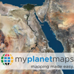
CLERMONT-FERRAND, France – September 21, 2021 – PlanetObserver and Kalisio reveal My Planet  Maps, a new subscription-based online map service that delivers immediate streaming access to  fresh and global data. It includes performant vector and raster georeferenced basemaps. By  accessing data through a reliable web map service, users save the costs of handling, storing and  […]

Filed Under: Business, Earth Imaging - Remote Sensing

Satellogic Joins The International Disasters Charter

September 14, 2021 By GISuser

Through partnership, Satellogic will provide high-resolution, high-frequency satellite data to aid in disaster decision making and management

Filed Under: Business, Earth Imaging - Remote Sensing

Maxar Satellite Imagery: Historic Images of 9/11 and the Upcoming 20th Anniversary

September 10, 2021 By GISuser

As we approach this Saturday’s 20th anniversary of the September 11, 2001 attacks, Maxar is providing a satellite imagery gallery of a number of the most significant sites that were collected shortly after the 2001 attacks, including: the American Airlines Flight 11 and United Airlines Flight 175 crash sites at the World Trade Center in New […]

Filed Under: Earth Imaging - Remote Sensing, Top Text Lead Story Tagged With: 911, Imagery, maxar, NY

ScanWorld and ConstellR join forces towards a comprehensive source of high-value satellite imagery for agriculture and vegetation monitoring

September 7, 2021 By GISuser

Agriculture is both a major contributor to climate change, and one of its first victims. Coincidentally, agriculture is also a key lever to enable a smooth transition to a more sustainable world – but that will require data-driven decisions.

Filed Under: Business, Earth Imaging - Remote Sensing Tagged With: Agriculture

Maxar Satellite Imagery: Flooding in New Jersey
September 4, 2021 By GISuser

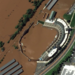
Maxar collected new high resolution satellite imagery yesterday (September 2nd at 11:52 AM, Eastern) that shows historic flooding along the Raritan River in New Jersey. As the remnants of Hurricane Ida moved through the northeast of the United States, the storm dropped record-breaking rainfall causing floods and damage in multiple towns and communities including Somerville, Manville, […]

Filed Under: Earth Imaging - Remote Sensing, Emergency Response, Environment, Top Press Tagged With: flood, hurricane, maxar, New Jersey

Maxar Satellite Imagery: Hurricane Ida Damage, Louisiana

September 2, 2021 By GISuser

Maxar’s satellites collected an extensive amount of new imagery on August 31st over the Gulf Coast and southern Louisiana that help to convey some of the damage caused by Hurricane Ida.

Filed Under: Earth Imaging - Remote Sensing, Emergency Response, Top Press Tagged With: hurricane, Imagery, maxar

Maxar Satellite Imagery: Caldor Fire Approaching Lake Tahoe

September 1, 2021 By GISuser

Maxar continues to monitor the Caldor wildfire as it approaches the southern edge of Lake Tahoe along the California-Nevada border.  Maxar collected yesterday (August 31st) that shows closer views of South Lake Tahoe, the active fire lines and a large pyrocumulus cloud formed by the intense fire.

Filed Under: Earth Imaging - Remote Sensing, Emergency Response, Top Press Tagged With: California, maxar, wildfire

Use Google Maps Satellite Imagery Wisely to Avoid Dangers

September 1, 2021 By GISuser

The U.S. Department of Defense uses a tool called WorldView for military operations in the Middle East. With the advent of newer technology, the military has been able to increase its ability to plan and prepare for future operations. One such tool is the satellite imagery provider WorldView. In this article, we will look at […]

Filed Under: Around the Web, Earth Imaging - Remote Sensing, technology, Tips Tagged With: Google maps, Imagery, Maps

Using UAV LiDAR to obtain and analyse key metrics for operational forest management
August 27, 2021 By GISuser

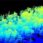
This new case study from Routescene demonstrates the value of UAV LiDAR point cloud data for operational forest management. Traditionally gathering metrics and information for forest management has been undertaken using airborne photogrammetry or by manually walking the site. More recently airborne LiDAR has been recognised as a useful tool and now drone derived LiDAR […]

Filed Under: Business, Earth Imaging - Remote Sensing, LiDAR, Top Press Tagged With: Forest Management, lidar

« Previous Page
Next Page »

Top Press

The Global Expansion of Aueshah: A New Era of High Jewelry

April 11, 2026 By GISuser

KARACHI, PAKISTAN. The international luxury market is experiencing a profound shift. Consumers are increasingly rejecting mass-produced goods in favor of rarity, authenticity, and emotional depth. … [Read More...]

State of Data Science Report – AI and Open Source at Work

September 10, 2025 By GISuser

AI and Open Source at Work … [Read More...]

Topcon Announces Landmark Expansion of Topnet Live Network Across USA

January 26, 2025 By GISuser

LIVERMORE, Calif.---Topcon Positioning Systems has announced a significant expansion of its Topnet Live reference station network, introducing 200 new geodetic stations strategically positioned across … [Read More...]

Space Flight Laboratory (SFL) Announces Launch and Deployment of NorSat-4 Maritime Monitoring Microsatellite

January 19, 2025 By GISuser

Seventh Satellite Developed by SFL for Norway … [Read More...]

HERE and BMW Group extend partnership on AI-powered mapping system

January 8, 2025 By GISuser

HERE and BMW Group extend partnership on AI-powered mapping system for automated driving and enhanced road safety … [Read More...]

Everest Base Camp Helicopter Tour, Helicopter Return Trek, and Manaslu Circuit Trek: Which Nepal Adventure Is Right for You?

November 6, 2026 By GISuser

Almost everyone planning a Nepal trip runs into the same wall. You want the big mountains, you have a fixed number of days, and every itinerary you read seems to promise something … [Read More...]

SFL Missions Inc. Confirms Successful Deployment of Six HawkEye 360 Radio Frequency Detection Satellites with Advanced Capabilities

October 27, 2026 By GISuser

MĀHIA, New Zealand, 26 October 2026 – SFL Missions Inc. today confirmed the successful deployment of six radio frequency (RF) detection and geolocation satellites for HawkEye 360 … [Read More...]

Canadian-Built RoadEng 12 Uses AI to Find the Best Location for New Resource and Rural Roads

October 17, 2026 By GISuser

Vancouver, BC, Canada, October 15, 2026 – North Vancouver-based Softree Technical Systems today released RoadEng Version 12, used in more than 75 countries to locate and design … [Read More...]

Beyond the Map: How AI Image and Video Generation Is Changing Geospatial Communication

October 14, 2026 By GISuser

Ask anyone who has shipped a GIS project what the hardest part was, and the answer is rarely the spatial analysis. It is almost always the communication. A site suitability … [Read More...]

From Maternity to Everyday Wear: Building a Wardrobe That Grows With You

October 14, 2026 By GISuser

When I think about maternity clothing, I feel the biggest mistake is buying too many things at once. During pregnancy, your body keeps changing, and something that fits well today … [Read More...]

Copyright gletham Communications 2015 - 2026

Go to mobile version