
Maxar collected new high-resolution satellite imagery yesterday (23 August) of Kabul that helps to convey visually the ongoing situation in and around Hamid Karzai International Airport. Large crowds of people can be seen at multiple checkpoints and security gates along the perimeter of the airport while several groups of people gather on the tarmac and […]
Imagery, earth imaging and remote sensing
London Borough of Harrow creates digital twin with new street imagery and LiDAR data
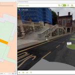
New approach will help improve Planning, Highways and Council Tax operations
Tecta America Zero Uses Aerial Imagery to Innovatively Bring Excellence to America’s Roofs
The Challenge: Facing distant projects and buildings closed due to the pandemic, the Tecta America Zero Company needed a solution for viewing and assessing project sites that was effective and efficient.
Maxar Awarded $26M Contract to Continue Development and Support for NGA’s Open Mapping Platform
WESTMINSTER, Colo.—Maxar Technologies (NYSE:MAXR) (TSX:MAXR), a trusted partner and innovator in Earth Intelligence and Space Infrastructure, today announced it has been awarded a five-year contract worth up to $26.4 million by the U.S. National Geospatial-Intelligence Agency (NGA) to sustain and enhance the National System for Geospatial Intelligence Open Mapping Enclave (NOME). Under the agreement, Maxar […]
IMAGE: Taliban Takeover in Afghanistan

The following satellite image from BlackSky that illustrates the progression of the Taliban takeover in Afghanistan over the last 30 days.
Global Aerial Imaging Market to Reach $6.7 Billion by 2026

SAN FRANCISCO, Aug. 18, 2021 — A new market study published by Global Industry Analysts Inc., (GIA) the premier market research company, today released its report titled “Aerial Imaging – Global Market Trajectory & Analytics”. The report presents fresh perspectives on opportunities and challenges in a significantly transformed post COVID-19 marketplace. Global Aerial Imaging Market
Maxar Satellite Imagery: Kabul Airport, Afghanistan
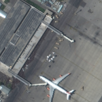
Maxar collected new high-resolution satellite imagery this morning (10:36 AM local time, 16 August) of the chaotic scene underway at Kabul’s Hamid Karzai International Airport in Afghanistan as thousands of people converged on the tarmac and airport runways as countries attempt to evacuate personnel from the city.
Exodus Orbitals graduates from Moonshot space incubator program
Exodus Orbitals, a Canadian startup developing an innovative “satellites-as-a-service” platform, is one of five recent graduates from Australia’s first space-focused incubator program — Moonshot.
Maxar Satellite Imagery: Dixie Fire, California
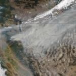
Maxar collected new satellite images on Sunday, August 8th of northern California and the Dixie wildfire that continues to burn and has become the state’s second largest wildfire in history.
Space Flight Laboratory (SFL) Awarded Norwegian Space Agency Contract to Build NorSat-4 Maritime Tracking Microsatellite
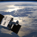
TORONTO, Ontario, Canada, 9 August 2021 – The Norwegian Space Agency (NOSA) has awarded a contract to Space Flight Laboratory (SFL) to build the NorSat-4 maritime tracking microsatellite. NorSat-4 will be the eighth satellite developed by SFL for Norway, including NorSat-3 launched in April 2021 and the NorSat Technology Demonstrator (NorSat-TD) now under construction.