
KARACHI, PAKISTAN. The international luxury market is experiencing a profound shift. Consumers are increasingly rejecting mass-produced goods in favor of rarity, authenticity, and emotional depth. Leading this transformation is Aueshah, a bespoke jewelry house that is actively challenging the European monopoly on high end design. By merging forty years of heritage with advanced authentication technology, […]
State of Data Science Report – AI and Open Source at Work

AI and Open Source at Work
Topcon Announces Landmark Expansion of Topnet Live Network Across USA

LIVERMORE, Calif.—Topcon Positioning Systems has announced a significant expansion of its Topnet Live reference station network, introducing 200 new geodetic stations strategically positioned across the United States. This comprehensive network upgrade expands the availability of advanced centimeter-level accuracy for precision-critical industries, including engineering, surveying, construction, and agricultural sectors.
Space Flight Laboratory (SFL) Announces Launch and Deployment of NorSat-4 Maritime Monitoring Microsatellite

Seventh Satellite Developed by SFL for Norway
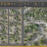
HERE and BMW Group extend partnership on AI-powered mapping system

HERE and BMW Group extend partnership on AI-powered mapping system for automated driving and enhanced road safety
Virtual Surveyor Adds Productivity Tools to Mid-Level Smart Drone Surveying Software Plan

Create Surveys Faster at the Same Cost
GCPs for Photogrammetry: How Many Do You Need?
Surveying and photogrammetry are complementary technologies. While either can be done without the other, they can both benefit from the use of the other.
Norwegian Microsatellite Developed by Space Flight Laboratory (SFL) Achieves Optical Satellite-to-Ground Communications Link

TORONTO, Ontario, Canada, 31 January 2024 – The NorSat-TD demonstration microsatellite developed by Space Flight Laboratory (SFL) for the Norwegian Space Agency (NOSA) has successfully transferred data to a ground station using optical communications technology. The accomplishment is a first for a Dutch-built laser communication device and among the first achieved by a microsatellite.
The Mesa® 4 Rugged Tablet by Juniper® Systems is now available and shipping worldwide.

Experience rugged computing in any environment.
Virtual Surveyor Unveils Photogrammetry App in Major New Release of Smart Drone Survey Software
Seamless Drone Surveying Workflow