GIS user technology news

News, Business, AI, Technology, IOS, Android, Google, Mobile, GIS, Crypto Currency, Economics

  • Advertising & Sponsored Posts
    • Advertising & Sponsored Posts
    • Submit Press
  • PRESS
    • Submit PR
    • Top Press
    • Business
    • Software
    • Hardware
    • UAV News
    • Mobile Technology
  • FEATURES
    • Around the Web
    • Social Media Features
    • EXPERTS & Guests
    • Tips
    • Infographics
  • Blog
  • Events
  • Shop
  • Tradepubs
  • CAREERS
You are here: Home / Archives for Mobile Mapping

Topcon Announces Landmark Expansion of Topnet Live Network Across USA

January 26, 2025 By GISuser

Landmark Expansion of Topnet Live Network

LIVERMORE, Calif.—Topcon Positioning Systems has announced a significant expansion of its Topnet Live reference station network, introducing 200 new geodetic stations strategically positioned across the United States. This comprehensive network upgrade expands the availability of advanced centimeter-level accuracy for precision-critical industries, including engineering, surveying, construction, and agricultural sectors.

Filed Under: Top Press Tagged With: across, announces, expansion, Field GIS, Landmark, live, Mobile Mapping, network, press, top, Topcon, topnet, USA

Mosaic Announces Integration of High Resolution 360º Camera with Laser Scanning Solutions

October 10, 2022 By GISuser

Mosaic Announces Integration of High Resolution 360º Camera with Laser Scanning Solutions

October 10, 2022 – Ready for release – Mosaic X high resolution cameras, enabling customers to gather more valuable data with their mobile mapping solutions, now compatible with RIEGL’s line of Mobile Laser Scanning Systems.   

Filed Under: Business, Featured TOP PR, LiDAR Tagged With: laser scanning, lidar, Mobile Mapping, RIEGL

Few Hidden Features On The Samsung Galaxy S22 Series

March 1, 2022 By GISuser

The Samsung Galaxy S22 series, which includes the S22, S22 Plus, and S22 Ultra, was launched a few days ago and people are loving every features it came with, especially the new S Pen and the amazing zoom. However, there are many features that are usually unnoticed by many people using the series.

Filed Under: Around the Web, Samsung Tagged With: Mobile Mapping

Trimble MX50 LiDAR System Expands Mobile Mapping Portfolio

July 12, 2021 By Editor

trimble mx50

Vehicle-Mounted System Enables Data Capture for Road Agencies and Local Governments 

Filed Under: Business, GPS, Hardware, Mobile Tagged With: Mobile Mapping, Trimble

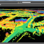
Trimble Revolutionizes Mobile Mapping with MX2 Portable Mobile Mapping System on a Boat

May 25, 2016 By GISuser

AllTerra Deutschland GmbH is the Trimble Center of Competence for Northern and Eastern Germany, and represents Trimble´s Geospatial, Marine and GIS divisions in the region using their mobile mapping solutions as well as all sorts of Geospatial products for several years on various projects all around Germany.

Filed Under: LiDAR, SPATIAL MEDIA AUTHORS, Top Press Tagged With: lidar, Mobile Mapping, Trimble

TerraGo Edge Delivers GeoPackage to Mobile Users

April 8, 2016 By Editor

The latest version of TerraGo Edge provides full “round trip” support for the Open Geospatial Consortium’s GeoPackage, an open, portable format for exchanging geospatial data seamlessly across vendor platforms and mobile devices

Filed Under: Mobile, Software Tagged With: Mobile Mapping, TerraGo Edge

Smart Mobile Solution for Cadastral Mapping, Time to Go International

April 8, 2016 By Editor

It’s time to announce the next huge leap of SuperGIS Mobile Solution!

Filed Under: Mobile, Software Tagged With: android, Mobile Mapping

Orbit GT launches Mobile Mapping Feature Extraction Bundle at SPAR, Houston.

April 4, 2016 By GISuser

Lokeren, Belgium, April 4th, 2016. Orbit GT launches the Mobile Mapping Feature Extraction Bundle at the upcoming SPAR event in Houston, USA.

Filed Under: Mobile, Software Tagged With: Mobile Mapping, Orbit GT

Orbit GT releases update for essential Mobile Mapping Content Manager

March 30, 2016 By Editor

Mobile Mapping Content Manager

Lokeren, Belgium, March 30th, 2016.  Orbit GT releases the 11.2.4 update for the essential Mobile Mapping product “Content Manager”.

Filed Under: Mobile, Software, Top Press Tagged With: Mobile Mapping, Orbit GT

Orbit GT releases update for Mobile Mapping Feature Extraction solutions

March 30, 2016 By GISuser

mobile mapping

Lokeren, Belgium, March 29th, 2016. Orbit GT releases the 11.2.4 update for several products from its Mobile Mapping portfolio.

Filed Under: Mobile, Software Tagged With: Mobile Mapping

Next Page »

Recent Industry News

Best Equipment Labels for Industrial Use: Ranked Systems That Survive Real-World Conditions

April 17, 2026 By GISuser

Building a Global Natural Brand: The Digital Journey of VedaOils

April 15, 2026 By GISuser

DeltaQuad partners with Meridein Group OÜ to strengthen UAS capability in the Baltics

April 15, 2026 By GISuser

The Complete Guide to Improving Home Safety and Efficiency with Dryer Vent Cleaning

April 12, 2026 By GISuser

Hot News

State of Data Science Report – AI and Open Source at Work

HERE and AWS Collaborate on New HERE AI Mapping Solutions

Virtual Surveyor Adds Productivity Tools to Mid-Level Smart Drone Surveying Software Plan

Categories

Copyright gletham Communications 2015 - 2026

Go to mobile version