GIS user technology news

News, Business, AI, Technology, IOS, Android, Google, Mobile, GIS, Crypto Currency, Economics

  • Advertising & Sponsored Posts
    • Advertising & Sponsored Posts
    • Submit Press
  • PRESS
    • Submit PR
    • Top Press
    • Business
    • Software
    • Hardware
    • UAV News
    • Mobile Technology
  • FEATURES
    • Around the Web
    • Social Media Features
    • EXPERTS & Guests
    • Tips
    • Infographics
  • Blog
  • Events
  • Shop
  • Tradepubs
  • CAREERS
You are here: Home / Archives for **Front Page / Featured TOP PR

Bay Park Data Solutions Announces Custom COVID-19 specific health surveys for essential workers and customers

June 8, 2020 By GISuser

Now offering COVID-19 specific health surveys for essential workers and customers – ​We have been working with Southern California remodeling and construction companies to help them provide peace of mind to their customers, employees, and trade workers during this unprecedented Coronavirus pandemic.

Filed Under: Business, Emergency Response, Featured TOP PR, Mobile, Top Text Lead Story Tagged With: arcgis, bay park, coronavirus, ESRI, health survey

Join geospatial experts online as they set out how countries can maximise their data and analysing capabilities

May 21, 2020 By GISuser

Events on United Nations Global Geospatial Information Management

The UN Statistics Division and Ordnance Survey invite you to join a series of three online high-level forum events. 

Filed Under: Around the Web, Business, Events, Featured Event, Featured TOP PR, Webinars

SimActive Announces Webinar: How to Efficiently Process Satellite Imagery

May 11, 2020 By GISuser

Satellite imagery brings several advantages for mapping applications, as it is readily available and covers very large areas.

Filed Under: Business, Featured TOP PR, Webinars Tagged With: SimActive, Webinar

Coast-to-Coast U.S. Coverage Now Deployed for Trimble’s CenterPoint RTX Fast Correction Service

May 7, 2020 By GISuser

Trimble’s CenterPoint RTX U.S. and Canada coverage map

One-Inch GNSS Accuracy in Under a Minute, Delivering Seamless High-Precision Performance Across the U.S. and Southern Canada

Filed Under: DATA, Featured TOP PR, GPS, Software Tagged With: GNSS, Trimble

Trimble Business Center (TBC) v5.30 featuring new CAD Command Line and other enhancements

April 30, 2020 By GISuser

Trimble Business Center (TBC) v5.30

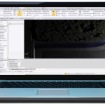
Trimble Business Center v5.30 was released this week featuring a new CAD Command Line, point feature extraction enhancements, new surface tools and updated road and tunnel workflows.

Filed Under: Business, Featured TOP PR, Software Tagged With: Trimble

« Previous Page

Recent Industry News

Why Bathroom Renovation Services Often Change More Than Just the Bathroom

May 20, 2026 By GISuser

The Drift Between Early Notes and Final Case Files in Abuse-Related Legal Support

April 29, 2026 By GISuser

Aerial Surveys Int’l and Global Marketing Insights to Present GEOINT 2026 Workshop on Multi-Domain Geospatial Fusion for Automated Infrastructure Monitoring

April 24, 2026 By GISuser

Why Timing Matters More Than You Think With Spray Seal (And Why People Often Get It Slightly Wrong)

April 22, 2026 By GISuser

Hot News

State of Data Science Report – AI and Open Source at Work

HERE and AWS Collaborate on New HERE AI Mapping Solutions

Virtual Surveyor Adds Productivity Tools to Mid-Level Smart Drone Surveying Software Plan

Categories

Copyright gletham Communications 2015 - 2026

Go to mobile version