GIS user technology news

News, Business, AI, Technology, IOS, Android, Google, Mobile, GIS, Crypto Currency, Economics

  • Advertising & Sponsored Posts
    • Advertising & Sponsored Posts
    • Submit Press
  • PRESS
    • Submit PR
    • Top Press
    • Business
    • Software
    • Hardware
    • UAV News
    • Mobile Technology
  • FEATURES
    • Around the Web
    • Social Media Features
    • EXPERTS & Guests
    • Tips
    • Infographics
  • Blog
  • Events
  • Shop
  • Tradepubs
  • CAREERS
You are here: Home / Archives for wildfire

Satellite Imagery: Wildfires in New South Wales, Australia

January 5, 2020 By GISuser

Maxar collected new satellite imagery, January 4, 2020, of the wildfires in Victoria and New South Wales, Australia

Filed Under: Earth Imaging - Remote Sensing, Emergency Response, Environment, Top Press Tagged With: maxar, wildfire

GIC Collects Imagery over Kincade Fire in Sonoma County

November 1, 2019 By GISuser

38°38'31.6"N 122°45'09.9"W 128, Calistoga, CA 94515 LEAPNOW: Transforming Education

IMAGES AVAILABLE TO EMERGENCY PERSONNEL, GIC MEMBER INSURERS, AND THE MEDIA

Filed Under: Emergency Response, Environment Tagged With: California, Imagery, wildfire

Maxar Collects satellite imagery of the Kincade fire #California #Wildfire

October 31, 2019 By GISuser

Satellite Imagery: New Kincade Fire Images

From Maxar: The Maxar News Bureau has gathered a new set of satellite imagery of the Kincade fire, which continues to burn in northern California near Santa Rosa. The images include sets from October 27th as well as October 30th. As you will see via the imagery, the fire burned very close to the city of […]

Filed Under: Earth Imaging - Remote Sensing, Emergency Response, Environment, Top Press Tagged With: California, maxar, wildfire

Maxar Shares Satellite Imagery of California Wildfires

October 25, 2019 By GISuser

geyserville california and fire_24october2019_swir satellite image

An update via Mxar: Maxar’s WorldView-3 satellite collected a set of new images yesterday, October 24th of the Kincade wildfire near Sonoma, California.

Filed Under: Earth Imaging - Remote Sensing, Top Press Tagged With: California, Imagery, maxar, wildfire

DigitalGlobe Shares Satellite Imagery of California Superbloom
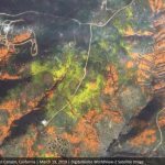
March 20, 2019 By GISuser

DigitalGlobe Satellite Imagery: California Superbloom

DigitalGlobe collected a new set of images yesterday (March 19th) of the “Superbloom” near Lake Elsinore, California. The colorful satellite imagery shows the hillsides along Walker Canyon filled with blooming poppies as well as hundreds of cars parked nearby and people hiking along trails in the area.

Filed Under: Earth Imaging - Remote Sensing, Top Text Lead Story Tagged With: California Superbloom, DigitalGlobe, Imagery, wildfire

ALERTWildfire Partners With GeoLinks to Deploy Fire Detection and Prevention Systems Across California

December 2, 2018 By Editor

The public-private partnership is actively deploying Wildfire Detection, Prevention, and Situational Awareness Systems across a coalition of utility and county assets to enable fire detection and predictive modeling

Filed Under: Emergency Response Tagged With: wildfire

Satellite Imagery: Camp Wildfire – Paradise, California, November 9, 2018

November 10, 2018 By GISuser

Satellite image ©2018 DigitalGlobe, a Maxar company.

DigitalGlobe’s WorldView-3 satellite collected new imagery on November 9 of the deadly Camp Fire near Paradise, California. 

Filed Under: Emergency Response, Environment, Top Press, Top Text Lead Story Tagged With: California, wildfire

Satellites Capture Smoky Skies in North America

August 22, 2018 By GISuser

In mid-August 2018, deadly blazes across the western United States and Canada continued to destroy structures and disrupt the lives of millions of people. But you did not have to be close to the fires to witness its effects. These images show just how far across North America winds have carried the thick plumes of smoke.

Filed Under: Environment Tagged With: wildfire

Esri interactive map of California fires
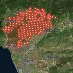
December 5, 2017 By GISuser

california wildfires

Esri has published an interactive map of the California fires

Filed Under: Emergency Response Tagged With: California fires, wildfire

MapThis shares Wildfire Maps – Maps, WebMaps and Resources for #BCwildfire Updates

August 4, 2017 By GISuser

From GEO Jobe GIS – Recall, recently we shared the story of how our friends and colleagues at Esri small business startup, Echosec, supported their lead developer in building a BC wildfire public information ArcGIS online resource in order to help keep the public informed and safe. Building on that and after searching for additional resources, the […]

Filed Under: Around the Web, Emergency Response, EXPERTS, Maps and Cartography, Tips, Top Press Tagged With: canada, Maps, wildfire

« Previous Page
Next Page »

Top Press

The Global Expansion of Aueshah: A New Era of High Jewelry

April 11, 2026 By GISuser

KARACHI, PAKISTAN. The international luxury market is experiencing a profound shift. Consumers are increasingly rejecting mass-produced goods in favor of rarity, authenticity, and emotional depth. … [Read More...]

State of Data Science Report – AI and Open Source at Work

September 10, 2025 By GISuser

AI and Open Source at Work … [Read More...]

Topcon Announces Landmark Expansion of Topnet Live Network Across USA

January 26, 2025 By GISuser

LIVERMORE, Calif.---Topcon Positioning Systems has announced a significant expansion of its Topnet Live reference station network, introducing 200 new geodetic stations strategically positioned across … [Read More...]

Space Flight Laboratory (SFL) Announces Launch and Deployment of NorSat-4 Maritime Monitoring Microsatellite

January 19, 2025 By GISuser

Seventh Satellite Developed by SFL for Norway … [Read More...]

HERE and BMW Group extend partnership on AI-powered mapping system

January 8, 2025 By GISuser

HERE and BMW Group extend partnership on AI-powered mapping system for automated driving and enhanced road safety … [Read More...]

Everest Base Camp Helicopter Tour, Helicopter Return Trek, and Manaslu Circuit Trek: Which Nepal Adventure Is Right for You?

November 6, 2026 By GISuser

Almost everyone planning a Nepal trip runs into the same wall. You want the big mountains, you have a fixed number of days, and every itinerary you read seems to promise something … [Read More...]

SFL Missions Inc. Confirms Successful Deployment of Six HawkEye 360 Radio Frequency Detection Satellites with Advanced Capabilities

October 27, 2026 By GISuser

MĀHIA, New Zealand, 26 October 2026 – SFL Missions Inc. today confirmed the successful deployment of six radio frequency (RF) detection and geolocation satellites for HawkEye 360 … [Read More...]

Canadian-Built RoadEng 12 Uses AI to Find the Best Location for New Resource and Rural Roads

October 17, 2026 By GISuser

Vancouver, BC, Canada, October 15, 2026 – North Vancouver-based Softree Technical Systems today released RoadEng Version 12, used in more than 75 countries to locate and design … [Read More...]

Beyond the Map: How AI Image and Video Generation Is Changing Geospatial Communication

October 14, 2026 By GISuser

Ask anyone who has shipped a GIS project what the hardest part was, and the answer is rarely the spatial analysis. It is almost always the communication. A site suitability … [Read More...]

From Maternity to Everyday Wear: Building a Wardrobe That Grows With You

October 14, 2026 By GISuser

When I think about maternity clothing, I feel the biggest mistake is buying too many things at once. During pregnancy, your body keeps changing, and something that fits well today … [Read More...]

Copyright gletham Communications 2015 - 2026

Go to mobile version