We are living in a world where everything is digital. These days, you can easily earn a college degree, and a good one at that, from the comfort of your couch. Non-traditional higher education alternatives such as for-profit colleges promise far better opportunities when it comes to employment, which is why many IT students are […]
EDU Tip – University of North Alabama offer the UNA Online GIS Analyst Certificate
University of North Alabama Center For Learning & Professional Development is proud to offer the UNA Online GIS Analyst Certificate
Passing Exams Using Practice Tests: Inextricably Intertwined Process of CompTIA A+ Certification Attainment
The CompTIA A+ certification is the industry standard for starting a career in the field of Information Technology. The certified professionals are equipped with the relevant skills to solve business problems and support core technologies in today’s business world. Their skills range from Cloud and security to data management.
The Diploma We Recommend You Take to Advance Your Career

After working in your trade for some time, developing the skills necessary to thrive, you might have tried to progress your career. Even with these skills, it can be quite difficult to move up the ranks – and there’s often a very simple reason for this.
Learning From Home with USGS

The U.S. Geological Survey Youth and Education in Science (YES) Team has revamped their web presence to better assist with online and home learning.
Esri Partners with MCH Strategic Data to Provide School Closure, Reopening, and Instructional Plan Data

Information on US Education Affected by COVID-19 Available on New Dashboard
Esri Offers Students Free Access to Software for Continued Education through Coronavirus Closures

Complimentary Technology and Lessons Support Remote Learning during COVID-19 Outbreak
Blue Marble Geographics to introduce new academic lab for processing drone or UAV-collected imagery with live webinar in January
Hallowell, Maine — December 13, 2019 — Blue Marble Geographics® is hosting a live webinar that will introduce the addition of photogrammetric point cloud processing from drone or UAV-captured images to the GIS software company’s free academic curriculum. The webinar is an online interactive event designed for educators in higher education and begins at 2:00 p.m. EST on Wednesday, January […]
Texas A&M University to Establish Trimble Technology Lab for Geosciences
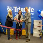
SUNNYVALE, Calif. and COLLEGE STATION, Tex., Nov. 14, 2019—Texas A&M University has received a gift from Trimble (NASDAQ: TRMB) to establish a state-of-the-art Trimble Technology Lab in the College of Geosciences. The Lab will provide an integrated field and classroom experience that will empower geospatial education at the University.
Virginia Tech Uses GeoSLAM Mobile Scanner to Create Physically Immersive VR Experience for Education
NOTTINGHAMSHIRE, U.K., 4 November 2019 – The Creative Technologies Program at Virginia Polytechnic Institute (Virginia Tech) has created an immersive simulation that enables participants to experience a World War I battlefield with their senses of sight, hearing, and touch. The simulation combines a digital Virtual Reality (VR) environment with a life-sized physical model created from 3D […]