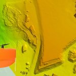
Montreal, Canada, May 14th, 2019 – SimActive Inc., a world-leading developer of photogrammetry software, announces that Correlator3D™ is being used for mapping projects acquired by Wingtra and its high-end vertical take-off and landing drone WingtraOne.
Event Tip – 2019 UAS Roundup and the Top 5 Reasons to Attend!

This full-day event features discussions about the use of drones to support public safety operations in Colorado.
RDO becomes first WingtraOne drone Certified Repair Center

RDO Integrated Controls and Wingtra to Provide Enhanced Services and Support for the WingtraOne VTOL Survey Drone
FAA Makes Major Drone ID Marking Change
The Federal Aviation Administration (FAA) has posted a rule in the Federal Register requiring small drone owners to display the FAA-issued registration number on an outside surface of the aircraft.
STRABAG Deploys the Phantom 4 RTK for Construction Surveying to Create Precise 3D Models

NEXT GENERATION MAPPING – SAVING TIME IN CONSTRUCTION SURVEYING WITH DRONES
senseFly inaugural user conference aims to optimize drone operations for customers

Cheseaux-Lausanne, Switzerland, May 14, 2018—senseFly, the industry’s leading provider of professional mapping drones, and a commercial drone subsidiary of Parrot Group, is hosting its first-ever user conference June 14-15 at the Omni Interlocken Hotel in Colorado.
Announcing the Global Availability of the Delair UX11 fixed-wing drone
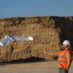
DELAIR ANNOUNCES GLOBAL AVAILABILITY OF MOST ADVANCED & COST EFFECTIVE LARGE AREA MAPPING UAV FOR GEOSPATIAL PROFESSIONALS
Cansel to Distribute Microdrones Fully Integrated Drone Systems Throughout Canada
VAUDREUIL-DORION, Quebec, March 28, 2018 — Leading geospatial solutions provider, Cansel, signed an agreement to distribute Microdrones integrated systems. With 23 locations and a strong reputation dating back to 1966, Cansel is firmly positioned to help customers adopt drone technology for geospatial applications.
UAV and Commercial Drone Industry Outlook & Predictions for 2018

GEO Jobe, a leading GIS software and solution provider offering UAV mapping services, is pleased to announce projections for the Commercial Drone industry in 2018.
Feature – Benefits & Cost Savings of UAV for GIS Mapping and Data Collection

Local government, utilities, College Campus and facility managers have a new resource at their disposal to help reduce costs associated with GIS mapping efforts and to keep their GIS land base current and up to date while also saving money.