GIS user technology news

News, Business, AI, Technology, IOS, Android, Google, Mobile, GIS, Crypto Currency, Economics

  • Advertising & Sponsored Posts
    • Advertising & Sponsored Posts
    • Submit Press
  • PRESS
    • Submit PR
    • Top Press
    • Business
    • Software
    • Hardware
    • UAV News
    • Mobile Technology
  • FEATURES
    • Around the Web
    • Social Media Features
    • EXPERTS & Guests
    • Tips
    • Infographics
  • Blog
  • Events
  • Shop
  • Tradepubs
  • CAREERS
You are here: Home / Archives for DJI

DJI Matrice 4 Series Brings Intelligence to Aerial Operations

January 8, 2025 By GISuser

New Matrice 4T and Matrice 4E enterprise drones feature smart detection for Smarter Operations and Laser Range Finder for Real-Time Precise Measurement

Filed Under: Around the Web, Business, UAV/UAS Tagged With: aerial, around, brings, business:, DJI, Intelligence, matrice, Operations, series, the, uav/uas, web

DJI Mini 2 is the Newest and Best Drone in the World, Elite Consulting Says

November 5, 2020 By Editor

Fly in almost all of Europe without asking permission or getting authorization

Filed Under: UAV/UAS Tagged With: DJI, UAV

DJI Unveils First Integrated Lidar Drone Solution and A Powerful Full-Frame Camera Payload For Aerial Surveying at INTERGEO Digital

October 14, 2020 By Editor

New DJI Zenmuse P1 And DJI Zenmuse L1 Payloads Become The Drone Industry’s Most Capable Solutions For Geospatial, Surveying And Construction Professionals

Filed Under: UAV/UAS Tagged With: DJI, intergeo, UAV

DJI Drives The Future Of Commercial Drones At AirWorks 2020

September 13, 2020 By GISuser

New Sensors And Systems Enable Drone Solutions For The Coronavirus Era SHENZHEN, China, Aug. 25, 2020  — DJI, the world’s leader in civilian drones and aerial imaging technology, today revealed new sensor systems and data integrations for its professional drone platforms at the fifth annual AirWorks conference, as the global coronavirus pandemic spurs massive adoption […]

Filed Under: Business, UAV/UAS Tagged With: DJI, UAS, UAV

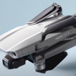
DJI Announces Mavic Air 2 with 4K60 Camera

May 8, 2020 By GISuser

DJI Announces Mavic Air 2

NEW YORK–(B&H is excited to announce the release of the Mavic Air 2 from DJI. This long-awaited follow-up to the immensely popular Mavic Air ships with a better camera, more shooting modes, new tracking features, and a longer battery life. Plus, it’s every bit as portable as the first. The Mavic Air 2 Fly More Combo variation provides additional […]

Filed Under: Hardware, Top Text Lead Story, UAV/UAS Tagged With: DJI, UAV

Get Ready To Up Your Creative Game With The New DJI Mavic Air 2

May 7, 2020 By GISuser

New DJI Mavic Air 2

Reimagining The Experience Of Aerial Creativity, Mavic Air 2 Is The Smartest, Safest And Easiest-To-Fly Consumer Drone to Date

Filed Under: Hardware, UAV/UAS Tagged With: DJI, mavic, UAV

SkyPixel And DJI Launch Aerial Photo & Video Contest Celebrating 5th Anniversary

December 30, 2019 By GISuser

SkyPixel And DJI Launch Aerial Photo & Video Contest

Introducing New Special Category To Call For Memorable Aerial Stories Beyond The Sky, With Prizes Totaling To $117,000 USD

Filed Under: Business, Top Text Lead Story, UAV/UAS Tagged With: contest, DJI, UAV

DJI Is Reviewing FAA Proposal To Identify Drones In American Skies

December 30, 2019 By GISuser

DJI

FAA Rule For Remote Identification Intends To Bolster Safety, Security And Accountability

Filed Under: UAV/UAS Tagged With: DJI

STRABAG Deploys the Phantom 4 RTK for Construction Surveying to Create Precise 3D Models

October 15, 2018 By GISuser

NEXT GENERATION MAPPING – SAVING TIME IN CONSTRUCTION SURVEYING WITH DRONES

Filed Under: UAV/UAS Tagged With: DJI, drone

DJI Introduces Mavic Air For Limitless Exploration Wherever Adventure Takes You

January 23, 2018 By GISuser

dji air

The Most Portable 3-Axis Gimbal 4K Camera Drone Features SmartCapture, FlightAutonomy 2.0 and Advanced Pilot Assistance System

Filed Under: Hardware, Mobile, Top Press, UAV/UAS Tagged With: DJI

Recent Industry News

The Drift Between Early Notes and Final Case Files in Abuse-Related Legal Support

April 29, 2026 By GISuser

Aerial Surveys Int’l and Global Marketing Insights to Present GEOINT 2026 Workshop on Multi-Domain Geospatial Fusion for Automated Infrastructure Monitoring

April 24, 2026 By GISuser

Why Timing Matters More Than You Think With Spray Seal (And Why People Often Get It Slightly Wrong)

April 22, 2026 By GISuser

The Quiet Planning Stage Most People Don’t See When Building a Pool in Brisbane

April 22, 2026 By GISuser

Hot News

State of Data Science Report – AI and Open Source at Work

HERE and AWS Collaborate on New HERE AI Mapping Solutions

Virtual Surveyor Adds Productivity Tools to Mid-Level Smart Drone Surveying Software Plan

Categories

Copyright gletham Communications 2015 - 2026

Go to mobile version