GIS user technology news

News, Business, AI, Technology, IOS, Android, Google, Mobile, GIS, Crypto Currency, Economics

  • Advertising & Sponsored Posts
    • Advertising & Sponsored Posts
    • Submit Press
  • PRESS
    • Submit PR
    • Top Press
    • Business
    • Software
    • Hardware
    • UAV News
    • Mobile Technology
  • FEATURES
    • Around the Web
    • Social Media Features
    • EXPERTS & Guests
    • Tips
    • Infographics
  • Blog
  • Events
  • Shop
  • Tradepubs
  • CAREERS
You are here: Home / Archives for **Front Page / GISuse HOT Event

FOSS4G NA 2024: The Premier Open Source Geospatial Conference Returns to St. Louis, September 9-11

August 12, 2024 By GISuser

St. Louis, MO – August 12, 2024 – The Free and Open Source Software for Geospatial (FOSS4G) North America (NA) 2024 conference is set to take place in St. Louis, Missouri, from September 9-11. This premier event brings together a diverse community of geospatial professionals, developers, enthusiasts, and industry leaders for three days of learning, collaboration, […]

Filed Under: Business, Events, GISuse HOT Event, Top Features Tagged With: [2024, 9-11, business:, conference, event, events:, features, FOSS4G, geospatial, gisuse, Hot, louis,, open, premier, returns, september, source, st., the, top

Esri Federal GIS Conference Showcases How GIS Interconnects National Government

February 19, 2021 By Editor

Esri Federal GIS Conference

Annual Event Spotlights How Technology Empowers Staff and Collaboration Across Agencies

Filed Under: Business, Events, GISuse HOT Event, Top Text Lead Story Tagged With: ESRI, Government

Enter the LIDAR Drone Mapping Arena at Minimal Risk

December 8, 2020 By Editor

When: Wednesday, December 9, 2020 – Time: 10AM – 11AM CDT

Filed Under: Events, Featured Webinar, GISuse HOT Event, LiDAR, Webinars Tagged With: lidar, Webinar

UP42 Hosts Webinar on Fusion of Satellite Imagery, AIS Data, Machine Learning for Maritime Surveillance

November 30, 2020 By Editor

APIs connect UP42, geospatial data and processing capabilities, and the applications built with those

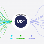
BERLIN, Germany, 30 November 2020 – UP42, creator of the leading developer platform for Earth observation data and analytics, will host a free webinar on maritime monitoring and surveillance on Dec. 9, 2020. Presentations will discuss the integration of optical and radar satellite imagery with Automatic Identification System (AIS) ship tracking data for analysis using machine […]

Filed Under: Earth Imaging - Remote Sensing, Featured Event, GISuse HOT Event, Webinars Tagged With: UP42

Webinar – How to Manage Photogrammetric Production During Peak Season

July 29, 2020 By GISuser

Photogrammetric production during peak season can be challenging. Multiple projects, often comprising tens of thousands of images, need to be processed and delivered in a timely manner.

Filed Under: Business, Earth Imaging - Remote Sensing, Featured TOP PR, GISuse HOT Event, Webinars Tagged With: SimActive, Webinar

More than 100 UAS Exhibitors Onboard for Commercial UAV Expo Americas 2019

July 15, 2019 By GISuser

uav expo

Record early commitments dwarf those of any other commercial drone event in the Americas

Filed Under: Events, Featured Event, GISuse HOT Event, UAV/UAS Tagged With: UAS, UAV

MUST See Technology at the 2019 ESRIUC

June 10, 2019 By Editor

The 2019 International Esri User Conference (#ESRIUC) takes place July 8-12, 2019 in beautiful San Diego, CA. We are pleased to feature updates and tips from some of the exhibiting companies (Esri partners). Below you’ll find details of their latest “Must See” technologies!

Filed Under: Events, GISuse HOT Event, SPOTLIGHTS, Top Press, Top Text Lead Story Tagged With: conference, esriuc, event

Event Tip – Esri Canada User Conference – Victoria 2019 #EsriCanadaUC

May 10, 2019 By GISuser

Our annual User Conferences continue to be the best place to learn, ask questions and get answers about all things GIS. They also provide a great opportunity to network with your peers and industry experts.

Filed Under: Events, GISuse HOT Event, Top Press

Images from #FOSS4GNA, San Diego and a Tip About FOSS4G2020

April 18, 2019 By Editor

foss4gna san diego

FOSS4G North America is the premier open geospatial technology and business conference where technologists, end-users and decision makers convene to share how open source software is becoming a part of their business and their geospatial stack. 

Filed Under: Events, Featured Event, GISuse HOT Event, Top Text Lead Story Tagged With: event, FOSS4G, Open Source

GeoIgnite – A New Event and Agenda for Canada’s Geospatial Sector

March 25, 2019 By GISuser

GeoIgnite - A New Event and Agenda for Canada’s Geospatial Sector

Canada has a proud history in the realm of geospatial and location technology.  In fact, an Ottawa-based geographer, the late Dr. Roger Tomlinson, is universally recognized as the “father” of what is now known as geospatial information services, or GIS.  Despite Canada’s prominence in the history of GIS, the country has lacked a vendor-neutral annual […]

Filed Under: Around the Web, Events, Featured Event, GISuse HOT Event Tagged With: canada, event

Next Page »

Recent Industry News

Best Equipment Labels for Industrial Use: Ranked Systems That Survive Real-World Conditions

April 17, 2026 By GISuser

Building a Global Natural Brand: The Digital Journey of VedaOils

April 15, 2026 By GISuser

DeltaQuad partners with Meridein Group OÜ to strengthen UAS capability in the Baltics

April 15, 2026 By GISuser

The Complete Guide to Improving Home Safety and Efficiency with Dryer Vent Cleaning

April 12, 2026 By GISuser

Hot News

State of Data Science Report – AI and Open Source at Work

HERE and AWS Collaborate on New HERE AI Mapping Solutions

Virtual Surveyor Adds Productivity Tools to Mid-Level Smart Drone Surveying Software Plan

Categories

Copyright gletham Communications 2015 - 2026

Go to mobile version