The CZMIL SuperNova combines the deep bathymetric lidar experience of Teledyne Optech with comprehensive processing software from Teledyne CARIS to provide the best geospatial solution
Teledyne to lead GeoAI discussion at Canadian Symposium on Remote Sensing
Vaughan, CANADA, June 17, 2021 ─ Teledyne Optech and Teledyne CARIS, both Teledyne Technologies [NYSE:TDY] companies and global leaders in advanced lidar sensors and marine mapping software, will join a panel discussion at the 42nd Canadian Symposium on Remote Sensing. The virtual event runs from June 21-24.
Teledyne Optech launches CZMIL SuperNova, a full geospatial bathymetric lidar solution with industry-leading depth penetration

The CZMIL SuperNova is powered by Teledyne CARIS processing software for creation of seamless topo/bathy data products
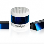
Seabed Selects Velodyne Lidar Sensors for Mobile Mapping System
Equipped with Velodyne Puck™ Sensors, Seabed Mobile Mapping Systems Support Marine Environment Protection and Sustainability
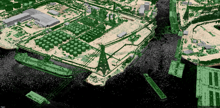
VeriDaaS Initiates California Statewide LiDAR Collection Project
DENVER, Colorado — June 1, 2021 — VeriDaaS today announced that it has completed test flights necessary to begin its statewide California mapping project by acquiring high-density LiDAR elevation data on multiple areas of interest (AOIs). This data will be used for evaluation purposes by various state, federal and commercial stakeholders.
Quanergy and Digital Mortar’s Partnership Brings Advanced LiDAR-based Retail Analytics Covering the Entire Shoppers’ Journey for Retail and Smart Spaces
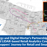
SUNNYVALE, Calif.– May 4, 2021 – Quanergy Systems, Inc., a leading provider of LiDAR (Light Detection and Ranging) sensors and smart 3D perception solutions, today announced a technology partnership with Digital Mortar to provide advanced LiDAR-based people tracking and analytics for retail and other smart spaces.
GeoCue Upgrades Survey-Grade UAS LIDAR/Imaging Systems with True View® 635/640
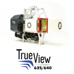
HUNTSVILLE, AL – GeoCue Group Inc. has updated its RIEGL-based True View® 3D Imaging Systems (3DIS®) with the launch of the new True View 635/640 3DIS. GeoCue’s True View 3DIS family brings a unique combination of fused LIDAR sensors and photogrammetric cameras in a fully calibrated platform, allowing direct generation of high accuracy, colorized LIDAR […]
Velodyne Showcases Advanced Lidar Solutions at Auto Shanghai 2021
Velodyne’s Lidar Sensors Deliver Real-Time 3D Vision for Safer Mobility and Smarter Communities
Fugro wins repeat Geo-data solutions contract with State of Texas
Fugro has been awarded its second-consecutive Geo-data solutions contract by the Texas Department of Information Resources (DIR) to support the state’s Strategic Mapping Program (StratMap). The new contract will run up to 5 years, providing opportunities for the state and its local government, public utility and academia partners to contract with Fugro for comprehensive GIS, geospatial and geotechnical offerings. Projects completed under the StratMap contract will help DIR meet its goal of developing consistent digital Geo-data layers across the state […]
Velodyne Lidar Announces Multi-Year Agreement With AGM Systems LLC

AGM Systems Launches New Velodyne Lidar-Based UAV Mapping Solution for Leading Energy Companies Worldwide