GIS user technology news

News, Business, AI, Technology, IOS, Android, Google, Mobile, GIS, Crypto Currency, Economics

  • Advertising & Sponsored Posts
    • Advertising & Sponsored Posts
    • Submit Press
  • PRESS
    • Submit PR
    • Top Press
    • Business
    • Software
    • Hardware
    • UAV News
    • Mobile Technology
  • FEATURES
    • Around the Web
    • Social Media Features
    • EXPERTS & Guests
    • Tips
    • Infographics
  • Blog
  • Events
  • Shop
  • Tradepubs
  • CAREERS
You are here: Home / Archives for Velodyne

Velodyne Lidar Signs Multi-Year Agreement with GreenValley International

November 18, 2022 By GISuser

GreenValley International's LiBackpack DGC50 mobile backpack 3D mapping system equipped with Velodyne Lidar's Puck lidar sensors. Photo credit: GreenValley International

Lidar-Powered Mapping Systems for Any 3D Environment

Filed Under: Business, LiDAR, Top Press Tagged With: lidar, Velodyne

Seabed Selects Velodyne Lidar Sensors for Mobile Mapping System

June 11, 2021 By Editor

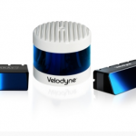
Equipped with Velodyne Puck™ Sensors, Seabed Mobile Mapping Systems Support Marine Environment Protection and Sustainability

Filed Under: Business, LiDAR Tagged With: lidar, Velodyne

Velodyne Showcases Advanced Lidar Solutions at Auto Shanghai 2021

April 17, 2021 By Editor

Lidar Solutions at Auto Shanghai 2021

Velodyne’s Lidar Sensors Deliver Real-Time 3D Vision for Safer Mobility and Smarter Communities

Filed Under: Business, LiDAR, Top Press Tagged With: lidar, Velodyne

Velodyne Lidar Announces Multi-Year Agreement With AGM Systems LLC

April 1, 2021 By Editor

Velodyne Lidar Announces Multi-Year Agreement With AGM Systems LLC

AGM Systems Launches New Velodyne Lidar-Based UAV Mapping Solution for Leading Energy Companies Worldwide

Filed Under: Business, LiDAR, Top Text Lead Story Tagged With: lidar, Velodyne

Velodyne Lidar Signs Multi-Year Sales Agreement with Emesent

January 27, 2021 By GISuser

Equipped with Velodyne Sensors, Emesent Autonomous Scanning System Makes Data Capture Fast and Simple for Forestry, Infrastructure, Mapping and Film Industries

Filed Under: LiDAR Tagged With: lidar, Velodyne

Velodyne Lidar Launches Ecosystem Partner Program

April 16, 2020 By GISuser

“Automated with Velodyne” Aims to Propel Customer Success

Filed Under: LiDAR Tagged With: lidar, Velodyne

Velodyne Lidar Acquires Mapper.ai for ADAS Launch

July 23, 2019 By GISuser

Velodyne Lidar Acquires Mapper.ai for ADAS Launch

Velodyne adds Mapper’s mapping and localization software to advance revolutionary lidar-centric ADAS

Filed Under: acquisitions and funding, LiDAR Tagged With: acquisition, lidar, Velodyne

Idriverplus Building Smart Autonomous Vehicles With Velodyne Lidar Technology

July 9, 2019 By GISuser

Velodyne Sensors Deliver Industry-Leading Range and Resolution to Idriverplus Autonomous Driving Products

Filed Under: LiDAR Tagged With: lidar, Velodyne

Real Earth™ Wins Microsoft Competition for 3D Mapping and Localization

April 28, 2016 By GISuser

Velodyne LiDAR Performance Excels

Filed Under: Earth Imaging - Remote Sensing, FrontPage Leader, LiDAR Tagged With: lidar, Velodyne

At UAS/UAV Mapping Forum, Velodyne Previews UAV Remote Sensing Using Multi-Beam 3D LiDAR

October 14, 2015 By GISuser

On First Anniversary of Its Unveiling, VLP-16 LiDAR Puck Surpasses 1,000 Unit Sales Milestone

Filed Under: Earth Imaging - Remote Sensing, LiDAR, UAV/UAS Tagged With: 3D LiDAR, Velodyne

Next Page »

Recent Industry News

The Drift Between Early Notes and Final Case Files in Abuse-Related Legal Support

April 29, 2026 By GISuser

Aerial Surveys Int’l and Global Marketing Insights to Present GEOINT 2026 Workshop on Multi-Domain Geospatial Fusion for Automated Infrastructure Monitoring

April 24, 2026 By GISuser

Why Timing Matters More Than You Think With Spray Seal (And Why People Often Get It Slightly Wrong)

April 22, 2026 By GISuser

The Quiet Planning Stage Most People Don’t See When Building a Pool in Brisbane

April 22, 2026 By GISuser

Hot News

State of Data Science Report – AI and Open Source at Work

HERE and AWS Collaborate on New HERE AI Mapping Solutions

Virtual Surveyor Adds Productivity Tools to Mid-Level Smart Drone Surveying Software Plan

Categories

Copyright gletham Communications 2015 - 2026

Go to mobile version