
Maxar collected new satellite imagery this morning (11:40 AM, Eastern; June 25th) of the collapsed Champlain Towers South condo complex in Surfside, Florida. Dozens of rescue vehicles can be seen around the collapsed building as search and recovery efforts continue throughout the day.
Imagery, earth imaging and remote sensing
SBG Systems to host a webinar entitled “PPK for UAV Photogrammetry, THE optimal workflow to reduce GCP and maximize ROI – featuring DJI Phantom 4 RTK”

Carrières-sur-Seine, France, June 17th 2021 – SBG Systems organizes a webinar as they announce new features dedicated to UAV photogrammetry for its popular INS/GNSS PPK software called Qinertia. The webinar will explain how Qinertia can dramatically reduce GCP need and maximize ROI with an optimal workflow demonstrated with a DJI Phantom 4 RTK.
Public Comment Requested on revision to OGC 3D streaming community standard, I3S
New version of the I3S Community Standard, used for streaming large 3D datasets to desktop and mobile devices, improves performance and scalability with enhancements to 3D Object and Integrated Mesh layers
Orbital Sidekick Announces Upcoming Launch of its Most Powerful Satellite: Aurora, to Advance Damage Prevention Efforts for Facility Owners and Operators
Hyperspectral monitoring delivers precise and hyper-focused data to detect small hydrocarbon leaks and physical threats to pipeline rights of way, in addition to other sustainability-focused applications
Pylon uses hi-res aerial imagery and 3D solar shading simulation to accurately predict solar output

While many solar installations require a site visit, Pylon is pleased to announce the launch of its new 3D-shading simulation tool which can accurately predict solar energy output. Pylon does this using high-resolution aerial imagery and 3D shade modelling.
@Maxar Satellite Imagery: Falcon 9 Rocket with Cargo Dragon Capsule, Kennedy Space Center

Maxar collected new satellite images yesterday and today of the SpaceX Falcon 9 rocket with its Cargo Dragon capsule at SLC 39A in the Kennedy Space Center. Today’s WorldView-3 high resolution view shows the rocket at the launch pad approximately 70 minutes before its successful launch today (3 June).
CARMERA Launches Inventory Map, Provides Live Look at Road Changes for Autonomous Driving and More

CARMERA’s new Inventory Map helps consumer and HD maps stay up-to-date by providing a live feed of road changes. Part of CARMERA’s Change-as-a-Service suite, Inventory Map helps make navigation safer for autonomous and human drivers.
CATALYST Collaborates with Amazon Web Services to Deliver Geospatial Insights to Decision Makers

MARKHAM, Ontario, Canada, June 01, 2021 – CATALYST, a PCI Geomatics brand, is collaborating with Amazon Web Services (AWS) to take satellite-based earth observation intelligence to the mainstream business community via AWS Cloud. The CATALYST-AWS collaboration will deliver actionable geoscience analytics to users with any level of technical expertise.
Virtual Surveyor Introduces Enhanced Stockpile Reporting in Drone Surveying Software
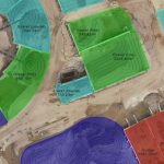
AARSCHOT, Belgium, 1 June 2021 – Calculating and reporting stockpile inventories are now easier and faster in the latest version of the Virtual Surveyor drone surveying software. Virtual Surveyor Version 8.2 allows users to accurately calculate stockpile volumes in drone imagery with just a few mouse clicks and then generate a professional PDF report detailing material […]
UP42 Announces Copernicus Masters Challenge to Augment Earth Observation Data with Generative Adversarial Networks
The global innovation competition will award the best algorithms that address challenges in EO analytics