Fintech has expanded at an astonishing rate in recent years. The value of financial services is predicted to exceed $305 billion by 2025 as a result of automation and other technological advances. In the United States, there are over 10,000 fintech companies. This contributes to maintaining a healthy level of competitiveness.
Esri Announces Winners of the 2022 ArcGIS Online Competition
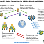
US High School and Middle School Students Used GIS Technology to Map Home State Issues
Opportunity – GEOINT 2021 Tradecraft Competition

USGIF and OGC bring you this second annual opportunity for USGIF and OGC members to demonstrate innovative and useful GEOINT solutions addressing mission problems through visualization, discovering needles in needle stacks, data sharing, and interoperability.
Opportunity – AGU Michael H. Freilich Student Visualization Competition Program

An opportunity for students in the Earth and space science community Competition overview Powerful visuals can often evoke excitement and emotion, driving a deeper level of engagement with the audience and subject matter being presented. The AGU Michael H. Freilich Student Visualization Competition Program provides an opportunity for students to demonstrate creative ways to use […]
Tell your StoryMaps Story! #YourSDGstory

Are you a Story Mapper who loves to tell multi-media, feature-rich stories using the ArcGIS Online Story Maps tools? Well, here’s your opportunity to be recognized by sharing a story of your sustainable development goals. From Esri… Are you ready to join storytellers worldwide in a competition for positive change? For this year’s annual StoryMaps […]
The 1st ATLAS call for innovative solutions is now open!

ATLAS is looking for innovative ideas and solutions via an open call for the development of new services that will make use of the ATLAS platform technical foundation.
NGA contest created to uncover innovative ways of retrieving and analyzing data in different locations, formats, schemas and interfaces
NGA contest created to uncover innovative ways of retrieving and analyzing data in different locations, formats, schemas and interfaces
Esri Partners with XPRIZE Foundation to Map the Ocean
New Partnership to Advance Exploration of the Mysterious Ocean Floor
European Satellite Navigation Competition – Extended Submission Phase
The submission phase for the ESNC 2016 is going into extra time. Interested participants have the chance to submit, complete or improve their ideas until 09:00 am (CEST) Monday, 11 July 2016 at www.esnc.eu.
Calling All Innovators: Competition Seeks Applications Leveraging Data from Space
T-SYSTEMS OPEN TELEKOM CLOUD CHALLENGE – Handling Big Data with Cloud Computing