Toronto, Ontario & Toulouse, France, 04 March 2021 – Today, Ecopia AI (“Ecopia”) announced a partnership with Airbus to produce next-generation digital maps on a global scale—including land use/land cover, roads, and building footprint data. This digital mapping solution will provide commercial and government users with an accurate and up-to-date digital representation of their areas of interest, driving better decision […]
Imagery, earth imaging and remote sensing
SimActive Software Used with Drones for Monitoring Construction in Texas

Montreal, Canada, February 23rd, 2021 – SimActive Inc., a world-leading developer of photogrammetry software, announces the use of its Correlator3D product by Chasco Constructors in Texas for monitoring construction. The project was performed by the Virtual Design Construction (VDC) group for Round Rock Public Safety over a land area of more than 50 acres.
Satellite Imagery: Protests In Yangon, Myanmar – @MaxarTechnologies

Maxar Technologies collected new satellite imagery this morning (at 10:52 AM local time, February 22nd) of the widespread protests that formed today across Yangon, Myanmar.
CATALYST Announces Cost-Effective, Fully Scalable Processing of Earth Observation Imagery on the Cloud

Process Petabytes in Minutes
Hiber successfully launches second generation satellite via SpaceX’s Transporter-1

Hiber brings technical assembly in-house increasing efficiency & affordability of go-to-market solutions
Satellite Imagery: Myanmar Protests and “We Want Democracy” mural
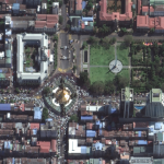
Maxar Technologies recently collected new satellite images of four cities in Myanmar where protests have been seen (and continue) including: Yangon, Mandalay, Myitkyina and Naypyitaw
Satellite Imagery: Earthquake Damage, Soma City, Japan

Maxar Technologies’ WorldView-3 satellite collected new imagery on Sunday, February 14, of the Fukushima prefecture in Japan and the aftermath of the recent magnitude 7.1 earthquake that struck offshore on February 13. Sunday’s imagery revealed efforts in progress to clear a landslide along the Joban Expressway near Soma City. The link below contains imagery of […]
Norway Selects Space Flight Laboratory (SFL) to Develop Technology Demonstrator Microsatellite
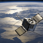
Advanced AIS and Laser Communications Onboard
Satellite Imagery of SuperBowl LV at Raymond James Stadium, Tampa Bay

Maxar Technologies’ GeoEye-1 satellite collected new imagery yesterday (February 7, 2021) at 11:39 AM EST of the Raymond James stadium in Tampa Bay, Florida—site of last night’s SuperBowl LV football game between the Kansas City Chiefs and the Tampa Bay Buccaneers.
LiveEO Performs Satellite-Based Vegetation Risk Analysis of Entire U.S. Electric Transmission Grid

Results reveal exciting insights about the vegetation condition alongside nearly 574,000 miles of overhead lines. LiveEO’s further analysis helps utilities to improve management processes and to decrease wildfire and storm damage risks