GIS user technology news

News, Business, AI, Technology, IOS, Android, Google, Mobile, GIS, Crypto Currency, Economics

  • Advertising & Sponsored Posts
    • Advertising & Sponsored Posts
    • Submit Press
  • PRESS
    • Submit PR
    • Top Press
    • Business
    • Software
    • Hardware
    • UAV News
    • Mobile Technology
  • FEATURES
    • Around the Web
    • Social Media Features
    • EXPERTS & Guests
    • Tips
    • Infographics
  • Blog
  • Events
  • Shop
  • Tradepubs
  • CAREERS
You are here: Home / Archives for PCI

CATALYST Develops Automated Workflow for South African National Space Agency to Convert SPOT Archive to Analysis Ready Data

May 10, 2021 By Editor

Analysis Ready Data unlocks the power of satellite imagery by turning pixels into interoperable measurements.

MARKHAM, Ontario, Canada and Cape Town, South Africa, 10 May 2021 – CATALYST, a PCI Geomatics brand, has delivered an automated workflow for the South African National Space Agency’s (SANSA) Earth Observation Department to convert decades of SPOT satellite imagery to CARD4L Analysis Ready Data (ARD). The scalable workflow enables SANSA to prepare its entire SPOT […]

Filed Under: Business, Earth Imaging - Remote Sensing, Top Press Tagged With: PCI

CATALYST Announces Cost-Effective, Fully Scalable Processing of Earth Observation Imagery on the Cloud

February 22, 2021 By Editor

CATALYST Announces Cost-Effective, Fully Scalable Processing of Earth Observation Imagery on the Cloud

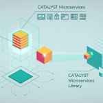
Process Petabytes in Minutes

Filed Under: Business, Earth Imaging - Remote Sensing, Software, Top Text Lead Story Tagged With: cloud, Data, PCI

PCI Geomatics Extends and Expands its Exclusive Agreement with China’s Beijing Space Eye Innovation Technology Co., Ltd. (BSEI)

October 14, 2015 By GISuser

MARKHAM, Ontario, Canada—October 14, 2015: PCI Geomatics, a world leading developer of remote sensing and photogrammetric software and systems, is pleased to announce that it has extended and expanded its exclusive distribution agreement with Beijing Space Eye Innovation Technology Co., Ltd. (BSEI) of China for an additional five years.

Filed Under: Earth Imaging - Remote Sensing Tagged With: China, PCI

PCI Geomatics announces strategic partnership with MDA for Accessing RADARSAT-2 Imagery

January 13, 2015 By GISuser

MARKHAM, Ontario, Canada—January 13, 2014: PCI Geomatics, a world leading developer of remote sensing and photogrammetric software and systems, announced today a strategic partnership with McDonald, Dettwiler and Associated Ltd. (MDA).

Filed Under: Earth Imaging - Remote Sensing Tagged With: PCI, radarsat

Recent Industry News

Aerial Surveys Int’l and Global Marketing Insights to Present GEOINT 2026 Workshop on Multi-Domain Geospatial Fusion for Automated Infrastructure Monitoring

April 24, 2026 By GISuser

Why Timing Matters More Than You Think With Spray Seal (And Why People Often Get It Slightly Wrong)

April 22, 2026 By GISuser

The Quiet Planning Stage Most People Don’t See When Building a Pool in Brisbane

April 22, 2026 By GISuser

Best Equipment Labels for Industrial Use: Ranked Systems That Survive Real-World Conditions

April 17, 2026 By GISuser

Hot News

State of Data Science Report – AI and Open Source at Work

HERE and AWS Collaborate on New HERE AI Mapping Solutions

Virtual Surveyor Adds Productivity Tools to Mid-Level Smart Drone Surveying Software Plan

Categories

Copyright gletham Communications 2015 - 2026

Go to mobile version