GIS user technology news

News, Business, AI, Technology, IOS, Android, Google, Mobile, GIS, Crypto Currency, Economics

  • Advertising & Sponsored Posts
    • Advertising & Sponsored Posts
    • Submit Press
  • PRESS
    • Submit PR
    • Top Press
    • Business
    • Software
    • Hardware
    • UAV News
    • Mobile Technology
  • FEATURES
    • Around the Web
    • Social Media Features
    • EXPERTS & Guests
    • Tips
    • Infographics
  • Blog
  • Events
  • Shop
  • Tradepubs
  • CAREERS
You are here: Home / Archives for Open Source

CodeSee Launches Open Source Hub

June 29, 2022 By GISuser

CodeSee Launches Open Source Hub – A Next Generation Community for Developers to Learn, Connect, and Meaningfully Contribute to Open Source – First-of-its-Kind Community Brings Developers and Open Source Projects Together

Filed Under: Developer Tagged With: code, developer, Open Source

Cesium Releases Free ‘Cesium for Unreal’ for All Creators

April 6, 2021 By Editor

Open source plugin unlocks global 3D data and geospatial technology for Unreal Engine and is now available for free on Epic Games’ Unreal Engine Marketplace

Filed Under: Business, Software Tagged With: cesium, Open Source

Everything You Need to Know About Kubernetes Security Best Practices

January 21, 2021 By GISuser

Are you an entrepreneur who’s looking to give your business a complete digital makeover? Or perhaps you’re a software developer who’s looking for a more efficient way to deploy cloud-native applications? In either case, chances are Kubernetes has already caught your attention.

Filed Under: Developer, EXPERTS, Tips Tagged With: developer, Open Source, Security

Mapbox once touted as the opensource competitor to Google Maps is no longer free

December 11, 2020 By Editor

Mapbox once touted as the opensource competitor to Google Maps is no longer free

Mapbox GL JS is no longer free, as of December 8th, 2020. Yesterday, Mapbox announced that they were moving their Mapbox GL JS library from a BSD license to a new more commercial license.

Filed Under: Business, open source, Software, Top Text Lead Story Tagged With: mapbox, Open Source

Defense Strategies Institute is proud to announce the 4th annual GEOINT & Open Source Analytics Summit

August 12, 2019 By GISuser

GEOINT & Open Source Analytics Summit

Creating Trusted Geospatial Intelligence Partnerships in a Rapidly Evolving World at Defense Strategies Institute’s GEOINT & Open Source Analytics Summit

Filed Under: Events, open source Tagged With: event, GeoINT, Open Source, osint

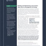
Building a Successful Open Source Management Strategy
July 28, 2019 By GISuser

Building a Successful Open Source Management Strategy

Are you contemplating a switch to open source technology? Perhaps you’re a consultant and want to expand your expertise and solution offerings to include Open Source solutions. This resource may be worth a read then.

Filed Under: Government & OpenGov, Research Tagged With: Open Source, research

Images from #FOSS4GNA, San Diego and a Tip About FOSS4G2020

April 18, 2019 By Editor

foss4gna san diego

FOSS4G North America is the premier open geospatial technology and business conference where technologists, end-users and decision makers convene to share how open source software is becoming a part of their business and their geospatial stack. 

Filed Under: Events, Featured Event, GISuse HOT Event, Top Text Lead Story Tagged With: event, FOSS4G, Open Source

Putting Open Source GIS to Use

February 9, 2018 By Guest

The global GIS market is expected to reach $14.6 billion by 2020, presenting massive opportunities for growth. At the same time, organizations are moving away from proprietary software and the burden of single-vendor lock-in towards more flexible and budget-friendly open source solutions. The concurrent rise in GIS and open source is creating new ways for […]

Filed Under: Business, EXPERTS, Top Features, Top Press Tagged With: Boundless, Open Source

Open Source Big Data Projects – Emergence of the Converged Data Platform

November 29, 2017 By GISuser

Open Source Big Data Projects

Discover the business value of a converged data platformin this executive guide.

Filed Under: Research, Top Press Tagged With: Big Data, Open Source

When is Free not Free: The True Costs of Open Source

November 18, 2017 By GISuser

When something goes wrong in your software, you fix it. When something is wrong in an OSS package you’re beholden to community fixes and web search – neither cares about your needs or your timeline.

Filed Under: Business, Research Tagged With: Open Source

Next Page »

Top Press

The Global Expansion of Aueshah: A New Era of High Jewelry

April 11, 2026 By GISuser

KARACHI, PAKISTAN. The international luxury market is experiencing a profound shift. Consumers are increasingly rejecting mass-produced goods in favor of rarity, authenticity, and emotional depth. … [Read More...]

State of Data Science Report – AI and Open Source at Work

September 10, 2025 By GISuser

AI and Open Source at Work … [Read More...]

Topcon Announces Landmark Expansion of Topnet Live Network Across USA

January 26, 2025 By GISuser

LIVERMORE, Calif.---Topcon Positioning Systems has announced a significant expansion of its Topnet Live reference station network, introducing 200 new geodetic stations strategically positioned across … [Read More...]

Space Flight Laboratory (SFL) Announces Launch and Deployment of NorSat-4 Maritime Monitoring Microsatellite

January 19, 2025 By GISuser

Seventh Satellite Developed by SFL for Norway … [Read More...]

HERE and BMW Group extend partnership on AI-powered mapping system

January 8, 2025 By GISuser

HERE and BMW Group extend partnership on AI-powered mapping system for automated driving and enhanced road safety … [Read More...]

Everest Base Camp Helicopter Tour, Helicopter Return Trek, and Manaslu Circuit Trek: Which Nepal Adventure Is Right for You?

November 6, 2026 By GISuser

Almost everyone planning a Nepal trip runs into the same wall. You want the big mountains, you have a fixed number of days, and every itinerary you read seems to promise something … [Read More...]

SFL Missions Inc. Confirms Successful Deployment of Six HawkEye 360 Radio Frequency Detection Satellites with Advanced Capabilities

October 27, 2026 By GISuser

MĀHIA, New Zealand, 26 October 2026 – SFL Missions Inc. today confirmed the successful deployment of six radio frequency (RF) detection and geolocation satellites for HawkEye 360 … [Read More...]

Canadian-Built RoadEng 12 Uses AI to Find the Best Location for New Resource and Rural Roads

October 17, 2026 By GISuser

Vancouver, BC, Canada, October 15, 2026 – North Vancouver-based Softree Technical Systems today released RoadEng Version 12, used in more than 75 countries to locate and design … [Read More...]

Beyond the Map: How AI Image and Video Generation Is Changing Geospatial Communication

October 14, 2026 By GISuser

Ask anyone who has shipped a GIS project what the hardest part was, and the answer is rarely the spatial analysis. It is almost always the communication. A site suitability … [Read More...]

From Maternity to Everyday Wear: Building a Wardrobe That Grows With You

October 14, 2026 By GISuser

When I think about maternity clothing, I feel the biggest mistake is buying too many things at once. During pregnancy, your body keeps changing, and something that fits well today … [Read More...]

Copyright gletham Communications 2015 - 2026

Go to mobile version