GIS user technology news

News, Business, AI, Technology, IOS, Android, Google, Mobile, GIS, Crypto Currency, Economics

  • Advertising & Sponsored Posts
    • Advertising & Sponsored Posts
    • Submit Press
  • PRESS
    • Submit PR
    • Top Press
    • Business
    • Software
    • Hardware
    • UAV News
    • Mobile Technology
  • FEATURES
    • Around the Web
    • Social Media Features
    • EXPERTS & Guests
    • Tips
    • Infographics
  • Blog
  • Events
  • Shop
  • Tradepubs
  • CAREERS
You are here: Home / Archives for **Front Page / Features of the Month

The #GeoGeeksAtHome Podcast – Listen and Learn from GeoGeeks at Home during the #Coronavirus

March 27, 2020 By GISuser

Geogeeks at home podcast

GISuser founder, Glenn Letham (@gletham) has started a new Podcast, GeoGeeksatHome. Enjoy discussions with GIS, surveying, and mapping industry professionals while they continue with their jobs working at home. 

Filed Under: Around the Web, Business, Featured Webinar, Features of the Month, Top Press, video, VIDEOS, Webinars Tagged With: geogeek, Podcast

Learn Python with this Free Guide – Python 3 Object-Oriented Programming

August 1, 2019 By GISuser

Python 3 Object-Oriented Programming

Uncover modern Python with this guide to Python data structures, design patterns, and effective object-oriented techniques.

Filed Under: Developer, Features of the Month, Research Tagged With: developer, python

Where are You Running Off To? Open Source GIS and Fitness Route Tracking

August 16, 2017 By Troy Lambert

ArcGIS Editor for OpenStreetMap

Mapping is becoming more relevant to the average person’s every day activities than ever before. From fitness trackers like Fitbit to the Apple Watch and the activity and workout apps available for iOS to cycling and running apps like Strava and Map my Run, people are using maps to visualize their fitness, and share those […]

Filed Under: Business, Features of the Month, Top Features, Top Press Tagged With: Fitness Route Tracking, Open Source GIS

Business Location Challenges: How GIS Can Help

June 8, 2017 By GISuser

Selecting the right location is a challenge for all kinds of businesses, not just those that serve customers directly. Things like the demographics and education level of the surrounding population who will be potential employees, schools in the area who train workers for particular professions, and the availability and quality of either affordable family housing […]

Filed Under: Business, EXPERTS, Features of the Month, Top Features, Top Text Lead Story Tagged With: Business Location

Vault 7: Security and Location Data

March 15, 2017 By Troy Lambert

Not long ago, I talked here about UAV Cloud Data: we are generating a ton of location data, and need some effective way to store it on the cloud. Two things have to be considered: it needs to be secure, so it cannot be accessed by just anyone, but it also needs to be available […]

Filed Under: Around the Web, Business, EXPERTS, Features of the Month, FrontPage Leader, Top Text Lead Story Tagged With: location data, Security

Feature – Partly Cloudy: The UAV Data Concern

December 14, 2016 By GISuser

Unmanned Aerial Vehicles (UAV) that can film extended flights and gather data in 4K Video, LiDAR, or using other sensors create a huge cloud data storage issue. Since the data may reveal sensitive information about key property, progress, or infrastructure, how will you ensure data security and integrity? One of the key components of any […]

Filed Under: Around the Web, EXPERTS, Features of the Month, Top Features, Top Press, Top Text Lead Story, UAV/UAS Tagged With: cloud, drones, UAV, UAV data

Mapping Reform: Where are Things Likely to Change?

December 6, 2016 By Troy Lambert

In the uncertain times following this election, one thing is for sure. Things will change over the next few years with a Republican president bent on change and a congress likely to cooperate with him.

Filed Under: Around the Web, Business, EXPERTS, Features of the Month, FrontPage Leader, Top Features, Top Press Tagged With: lambert, Mapping Reform

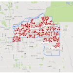
City of Covington Finds Success Using Elements XS3 for GIS Based Asset Management

August 18, 2016 By Editor

The City of Covington, WA has successfully implemented GIS based asset management for streets, parks, and stormwater assets in their Public Works Department.  The City has integrated their ArcGIS platform with Elements XS3 to track and coordinate efforts in Public Works and maximize their GIS investment.

Filed Under: Business, EXPERTS, Features of the Month, Top Features, Top Press, UTILITIES Tagged With: GIS Based Asset Management

In Time for #ESRIUC – Echosec Social Media Mapping Contest: #FoundOnEchosec

June 23, 2016 By Editor

Some cool, ESRIUC news from the Esri Startup Program team… Exciting news, Esri Startup Program Partner, Echosec has launched their ArcGIS Marketplace listing,http://arcg.is/28QSiDb!

Filed Under: 2016 ESRIUC, Features of the Month, Software Tagged With: echosec, esriuc, Social Media Mapping Contest:

5 Must Have Mobile Apps While You visit San Diego for #esriuc

June 22, 2016 By Editor

Here we are once again on the heels of another International Esri User Conference #esriuc. This means that geeks and GeoGeeks from all over the World (over 150 countries I’m guessing) will be converging on the city for the annual Geo Luv-fest. 

Filed Under: *FEATURES, 2016 ESRIUC, Business, Features of the Month, Mobile, THE EDITOR, Tips, Top Press Tagged With: esriuc, mobile apps, mobile maps

Next Page »

Recent Industry News

Building a Global Natural Brand: The Digital Journey of VedaOils

April 15, 2026 By GISuser

DeltaQuad partners with Meridein Group OÜ to strengthen UAS capability in the Baltics

April 15, 2026 By GISuser

The Complete Guide to Improving Home Safety and Efficiency with Dryer Vent Cleaning

April 12, 2026 By GISuser

The First 90 Days Tell the Truth: What Hospitality Fitouts Reveal After Opening

March 27, 2026 By GISuser

Hot News

State of Data Science Report – AI and Open Source at Work

HERE and AWS Collaborate on New HERE AI Mapping Solutions

Virtual Surveyor Adds Productivity Tools to Mid-Level Smart Drone Surveying Software Plan

Categories

Copyright gletham Communications 2015 - 2026

Go to mobile version