Selecting the right location is a challenge for all kinds of businesses, not just those that serve customers directly. Things like the demographics and education level of the surrounding population who will be potential employees, schools in the area who train workers for particular professions, and the availability and quality of either affordable family housing or viable public transit all affect how effective a business will be in any given area.
Even more complex are tax laws, potential municipal and state tax breaks, the living wage required for employees in a given area, and the availability of benefits, health care, and recreation.
So how can GIS help inform businesses who are making these decisions? It comes down to some basic elements, but creating a meaningful map containing all of this data can make choosing an ideal location easier.
State Level Information
The first place to start is at the state level. This is where a business looks at things like median wages, cost of living, and taxes.
Median wages give businesses a general idea about varying labor costs. However, wage data is not enough by itself.
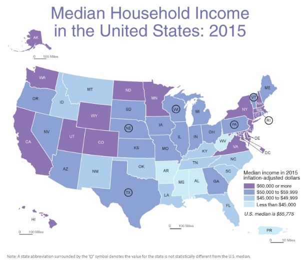
While median wage data can say something about average wages in an area, it does not reveal the cost of living.
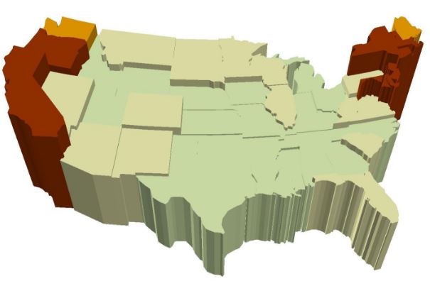 US Cost of Living Map
Adding this data gives the business an idea of what kind of living wage they will need to offer workers for them to be viable in the employment marketplace. It is also helpful for them to know unemployment numbers, to inform them how competitive the marketplace is currently.
The state tax situation is another consideration. Some states have personal income tax and certain business tax differences that set them apart.
Nevada and Texas both have unusual property tax laws, so much so that they have spawned a new, private lending property tax funding industry. These taxation issues affect businesses and individuals alike.
Mapping Income tax rates and other tax issues gives the business another piece of the picture. However, state information is simply the place to start.
Local Information
It’s necessary to next drill down to the local level, and look at municipal demographics, regulations, and services.
For instance, in a large municipal areal like Los Angeles or Phoenix, there are several smaller municipalities located in the area referred to by the name of the city. These municipalities are large in and of themselves, and can be diverse in their regulation, population, available housing, and other benefits.
The Phoenix area consists of Glendale, Chandler, Mesa, Tempe, and many other large suburbs. Each has their own unique governing body, tax structure, and demographics.
In the City of Phoenix, there are few family homes close to the downtown area, as is the case with many large cities, so public transportation and commuting options are really important for companies to consider. However, the outlying areas of Chandler and Mesa, south of the city proper, have a number of single family homes, apartments, and many housing options.
 Single Family Homes for Sale in Mesa, Arizona. Courtesy of Zillow.
The suburbs also offer residents access to excellent healthcare, and there are recreational and other opportunities close by. The entertainment offered in a larger area offers better lifestyle choices than some areas.
Overlaying this information with other business data fleshes out the picture even more. The cost of health care at clinics, hospitals, doctors, and the emerging nurse practitioner clinics, along with the cost of health insurance, is driven down somewhat by competition and the abundance of these in the area.
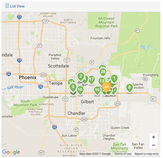 Hospitals in Mesa, Arizona
The Neighborhood
Once a business has narrowed prospects down to the city level, they need to begin to look at specific locations, which introduces new factors into the equation. Beyond wages, demographics, and available services, they need to look at more detailed factors, like parking and public transportation for employees and customers alike.
Using our example, in downtown Phoenix, parking is a premium, and is priced accordingly. As a result, public transportation options become much more important. However, Mesa also has a robust transit system for those who choose not to drive for environmental or other reasons.
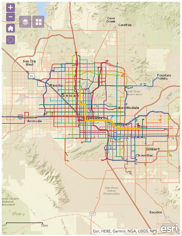 Phoenix area public transit map
This is where things like competitors come in. Where are they located? Is the business setting itself up in a good location to compete?
All of these factors and more can be mapped, layered, and then analyzed. The advantage of big data is that it can help business form a more complete picture than ever before. The advantage of GIS is that we help them visualize that data, which leads to greater profits, more visibility, and an engaged workforce.
Author:
Troy Lambert is a freelance writer, editor, and non-profit consultant by day, and a suspense thriller author by night. He learned about the power of GIS while working as a researcher at a museum, and is always looking for ways to apply this technology and big data in new and innovative ways. Troy is an avid cyclist, skier, and hiker. He lives, works, and plays in Boise, Idaho. His work can be found at troylambertwrites.com, and you can connect with him on Twitter @tlambertwrites.