GISuser.com

GIS and Technology news for mapping professionals

  • PRESS
    • Submit PR
    • Top Press
    • Business
    • GIS, Geo Tech Software
    • Hardware
    • UAV News
    • Mobile Technology
    • Editor’s Top Picks
    • Get TOP Listing!
  • FEATURES
    • GeoGeeksinCars
    • 10 Question Q&A
    • FROM THE EDITOR
    • SPATIAL MEDIA AUTHORS
    • Social Media Features
    • EXPERTS & Guests
    • Listicles and Top 10 Lists
    • Infographics
    • VIDEOS
  • Events
    • Webinars
    • Submit event
    • Event Media Partner
  • CAREERS
    • Career Help Articles
    • People and Career News
    • Work from Home
    • About GeoJobs.BIZ
  • About
    • Advertise
      • Advertise wth GISuser
      • Media Kit Request Form
      • Directory
      • Submit Press
    • Contact GISuser
    • Meet the Editor
    • Social Media
      • AnyGeo Blog
      • GeoGeeks Podcast
      • Social Media Features
      • Like Us
    • SpatialMedia
      • LBSzone
      • LiDAR Magazine
      • Amerisurv
      • SymbianOne
    • RSS feed
  • Blog
  • Shop
  • Cloud Hosting
    • Amazon Cloud Hosting
    • WordPress cloud hosting
    • Dedicated servers USA
    • Linux Shared Hosting
    • Windows Shared Hosting
    • Web Development
    • SSL Certificate
  • Tradepubs
You are here: Home / * PRESS / 2016 ESRIUC / In Time for #ESRIUC – Echosec Social Media Mapping Contest: #FoundOnEchosec

In Time for #ESRIUC – Echosec Social Media Mapping Contest: #FoundOnEchosec

June 23, 2016 By Editor

Some cool, ESRIUC news from the Esri Startup Program team… Exciting news, Esri Startup Program Partner, Echosec has launched their ArcGIS Marketplace listing,http://arcg.is/28QSiDb!

Echosec ArcGIS Marketplace Listing & Social Media Mapping Contest: #FoundOnEchosec

To support the announcement their team has organized a Social Media Mapping Contest: #FoundOnEchosec,http://bit.ly/28QTd6A, for you to try out their product in preparation for Esri UC. Want to follow up with them onsite? Visit them in the Startup Zone, booth Z6 in the expo. This competition is open to anyone with an ArcGIS Online account. Participate in the fun!

About Echosec:

For those of you unfamiliar with Echosec, the software is a social media mapping platform that provides intelligence to law enforcement, security, marketing, and journalism professionals. Echosec can take you anywhere in the world, any time. Combining social media posts with Esri geographic data, Echosec delivers a unique way of displaying real-time, user driven information about natural disasters, wars, and other global events.

Echosec’s integration into ArcGIS Online with the Echosec web client allows for visualization and data sources alongside the social media search. This means that Echosec and ArcGIS users are able to display their feature and tile layers within Echosec, query for social media related to their layers and data then export the social media search results directly to their ArcGIS Online account as a Feature Layer. This integration between Echosec and ArcGIS Online allows Esri users to inject another dimension to their existing workflow.

Echosec Social Media Mapping Contest: #FoundOnEchosec

 Objective: Share the best photos that you found using Echosec OR share screenshots of the best ArcGIS Online map that you created with Echosec as a data layer

 Get Started: Learn more about the contest:  www.echosec.net/found-on-echosec

Contest Dates:

  • Start Date: Thursday, June 23rd, 2016
  • End Date: Thursday, June 30th, 2016 11:59pm PST

Prize: An Echosec Swag Box and a map themed surprise that fits on your desk to display your dominance for all things GIS!

How to Enter:

  • Go to https://esri.echosec.net/login and click the ‘SIGN IN WITH ESRI’ button.
  • Login using your ArcGIS Online credentials. You’ll be redirected to the Echosec app. Start searching! (Don’t have an ArcGIS account, sign up here)
  • Here is a walk through video showing how to use the integration: https://youtu.be/_FECHT9gvI0
  • Find great posts using Echosec and screenshot the search you’ve done within Echosec. (Bonus points for adding your ArcGIS Online content into Echosec as a data layer)
  • Share your screenshots on Social Media. Twitter, Facebook, Instagram, Pinterest or Google+ work and tag Echosec (Twitter: @echosec_search Instagram: @echosec.search)
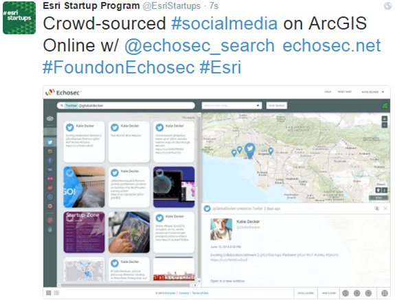
  • Example Tweet (remember to turn on location!):

Crowd-sourced #socialmedia on ArcGIS Online w/ @echosec_search location-based platform! #FoundOnEchosec

Analyzing @EsriStartups #socialmedia posts on location-based platform @echosec_search http://bit.ly/28QTd6A  @Esri

Limit of 1 entry/person/platform

Follow Echosec

  • Facebook:www.facebook.com/echosec
  • Twitter: @echosec_search or @echosec_uk
  • Instagram: echosec.search
  • Pinterest: www.pinterest.com/echosec
  • Google+: plus.google.com/+EchosecNetSystems


Rules: more information can be found here: www.echosec.net/found-on-echosec

Related Articles on GISuser:

  • ArcGIS Gets More Social at #esriuc – Echosec Pro for Social Search Now Available in the ArcGIS MarketplaceArcGIS Gets More Social at #esriuc – Echosec Pro for Social Search Now Available in the ArcGIS Marketplace
  • Echosec to Showcase Location-Based Geospatial Social Search Solution at 2016 #ESRIUCEchosec to Showcase Location-Based Geospatial Social Search Solution at 2016 #ESRIUC
  • [WOW Tech] Seen and Heard at #ESRIUC – the new Echosec ArcGIS Integration[WOW Tech] Seen and Heard at #ESRIUC – the new Echosec ArcGIS Integration
  • 5 Must Have Mobile Apps While You visit San Diego for #esriuc5 Must Have Mobile Apps While You visit San Diego for #esriuc
  • Storytelling with Maps Contest Winners Announced at Esri UCStorytelling with Maps Contest Winners Announced at Esri UC
  • Voyager Search Improves Search Capabilities and Overall Usability With More Than 150 Updates to its Version 1.9.8Voyager Search Improves Search Capabilities and Overall Usability With More Than 150 Updates to its Version 1.9.8

Filed Under: 2016 ESRIUC, Features of the Month, Software Tagged With: echosec, esriuc, Social Media Mapping Contest:


Editor’s Picks

ArcGIS Online Updates Include Smart Mapping and More

ArcGIS Online Updates Include Smart Mapping and More

Geospago and what3words partner to provide a mobile mapping solution with 3-word addressing throughout the globe

Tripomatic – Custom Maps Built entirely with OpenSource Mapping Tools

Juniper Systems’ New Rugged Handheld Offers Unparalleled Efficiency for Data-Intensive Application

See More Editor's Picks...

About Editor

Glenn is a geographer and a GIS professional with over 20 years experience in the industry. He's the co-founder of GISuser and several other technology web publications.

Connect with GISuser

  • Facebook
  • Google+
  • LinkedIn
  • RSS
  • Twitter


GIS jobs

Recent Features

Digitalization and Simulation at the North Pole

Natural Gas District & GIS-Centric Asset Management

5 Ways Technology Is Affecting The Sharing Economy

Spotlight – Township Canada: Explore Canadian Legal Land Descriptions on a Map

GeoGeeksinCars – The one in “Tippy” the right-hand drive Mitsubishi, at DevSummit

More Posts from this Category

Categories


Recent Posts

  • Suffolk Launches International Women’s Month With Pledge to Increase Career Opportunities for Women in Construction and STEM
  • DeVry University Helps Close Opportunity Gap for Women in Technology
  • Commercial UAV Expo Americas Advisory Board Announced
  • TCarta Awarded NOAA Grant to Enhance Satellite Derived Bathymetry Technology in Alaskan Waters
  • Five Indispensable Skills For The Future of Work

RSS Career Tips

  • Four Characteristics of the Best Virtual Employees
  • Jobcase Launches Free Unemployment Resource Center for Workers Impacted by COVID-19
  • 8 Questions Employers Should Ask About Coronavirus
  • Must-Have Gadgets and Technology for the Remote Office Worker
  • Must-Have Gadgets and Technology for the Remote Office Worker


shop for geogeek swag

RSS Tech pubs

  • The Controller's Guide to Payables Automation
  • Accounts Payable: Embracing the Strategic Evolution
  • Avoiding the Risks of Financial Fraud

RSS Computers

  • iPad CTO Kit - including the iPad Tips and Tricks Guide for IT Executives and Managers
  • The Essentials of Information Security Kit: Includes a Free PC Security Handbook - 2nd Edition eBook
  • Windows... On Speed

RSS HR Tips

  • Post-Coronavirus Office Checklist
  • Fiduciary of the Future
  • Creating A Secure Remote Work Environment eBook

RSS Gov Tech

  • Next-generation Situational Awareness - How Skydio's autonomous drone solutions protect first responders
  • AI Meets Inspection: How Autonomous Drones are Changing the Game in Enterprise
  • Cyberwarfare Requires Speed, Adaptability and Visibility to Win: Enterprises Must Close the IT Operations and Security Gap

RSS UAV news

  • Global Commercial Drone Market Expected to Exceed $8.5 Billion By 2027
  • Down to Earth – Drone Lidar Surveying Reality Series Returns
  • Florida Signs Participating Addendum with DroneUp Providing Public Sector Agencies Access to Drone Services

RSS Geojobs

  • An error has occurred, which probably means the feed is down. Try again later.
Copyright Spatial Media LLC 2003 - 2015