GIS user technology news

News, Business, AI, Technology, IOS, Android, Google, Mobile, GIS, Crypto Currency, Economics

  • Advertising & Sponsored Posts
    • Advertising & Sponsored Posts
    • Submit Press
  • PRESS
    • Submit PR
    • Top Press
    • Business
    • Software
    • Hardware
    • UAV News
    • Mobile Technology
  • FEATURES
    • Around the Web
    • Social Media Features
    • EXPERTS & Guests
    • Tips
    • Infographics
  • Blog
  • Events
  • Shop
  • Tradepubs
  • CAREERS
You are here: Home / Archives for plotting

Golden Software Enhances Box Plots Functions in Grapher Package for Faster Data Importing and Plotting

March 13, 2024 By GISuser

No more wrestling with pivot tables or manual data layout adjustments. Use your data as is to clearly visualize all data in one easy to create graph.

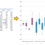
OLDEN, Colorado, 12 March 2024 – Golden Software, a leading developer of scientific graphing and visualization software, has added Grouped Box Plot functionality to make sensor data easier to import and plot in the latest version of its Grapher scientific graphing package. In addition, new Beta capabilities being tested in the release make the software more […]

Filed Under: Software Tagged With: AND, box, Data, enhances, Faster, for, functions, golden, grapher, importing, package, plots, plotting, software

Feature – HP Adds to Large Format Plotting Portfolio With PageWide Technology and the T3500, T7200

June 14, 2014 By Editor

GIS imaging has evolved greatly in a short time and continues to evolve at a rapid pace. File sizes are growing and images have become more intricate and rich in color. HP is keeping pace with these technological developments and the increased demand placed on the GIS/Geo professional to produce amazing output at a faster […]

Filed Under: Hardware Tagged With: Articles, Feature - HP Adds to Large Format Plotting Portfolio With PageWide Technology and the T3500, hardware, HP, plotting, T7200

Recent Industry News

The Drift Between Early Notes and Final Case Files in Abuse-Related Legal Support

April 29, 2026 By GISuser

Aerial Surveys Int’l and Global Marketing Insights to Present GEOINT 2026 Workshop on Multi-Domain Geospatial Fusion for Automated Infrastructure Monitoring

April 24, 2026 By GISuser

Why Timing Matters More Than You Think With Spray Seal (And Why People Often Get It Slightly Wrong)

April 22, 2026 By GISuser

The Quiet Planning Stage Most People Don’t See When Building a Pool in Brisbane

April 22, 2026 By GISuser

Hot News

State of Data Science Report – AI and Open Source at Work

HERE and AWS Collaborate on New HERE AI Mapping Solutions

Virtual Surveyor Adds Productivity Tools to Mid-Level Smart Drone Surveying Software Plan

Categories

Copyright gletham Communications 2015 - 2026

Go to mobile version