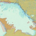
Fugro is mobilising its Rapid Airborne Multibeam Mapping System (RAMMS) to Ontario, Canada, to acquire 3147 km2 of high-resolution bathymetry data over Lake Huron for the Canadian Hydrographic Service (CHS). The survey is expected to last 6 months from data collection to data delivery and will support the agency’s ongoing nautical charting updates in the country’s Great Lakes region.
Teledyne CARIS delivers depth management system to the Danish Hydrographic Office

Fredericton, NB, CANADA, April 28, 2020 — Teledyne CARIS, a Teledyne Technologies [NYSE:TDY] company, and the Danish Geodata Agency (DGA) are pleased to announce the successful completion of the project to implement a new depth data management system. The scope of the project program included delivery of CARIS Bathy DataBASE, migration tools, system configuration and implementation. The project also […]
Okeanus Enhances Hydrographic Survey Equipment Offering

Okeanus invests in Geometrics G-882 marine magnetometer and transverse gradiometer (TVG) array
DelNorte and OceanWise deliver Tidal Level System to RNLI
DelNorte in conjunction with OceanWise has delivered a new on-line tidal level system to the Royal National Lifeboat Institution (RNLI) to assist its crews to safely launch its rescue craft from its new Lifeboat station at Portishead, Avon, UK.
S-100 support in CARIS S-57 Composer 3.0
Fredericton, NB, Canada – March 16, 2015 – CARIS is pleased to announce the release of CARIS S-57 Composer 3.0, a desktop application for the production of electronic navigational products, including Electronic Navigational Charts (ENC), Additional Military Layers (AML), Inland Electronic Navigational Charts (IENC) and Digital Nautical Charts (DNC).
OceanWise supports 2nd Mexican Hydrographic Convention, 15th Meso-American and Caribbean Hydrographic Commission
OceanWise actively participated in both the 2nd Mexican Hydrographic Convention and 15th meeting of the Meso-American and Caribbean Hydrographic Commission (MACHC) of the International Hydrographic Organisation (IHO) hosted by the Mexican Navy Hydrographic Department at its Oceanographic Institute for the Pacific Region in Manzanillo, Colima, Mexico from 8 – 13 December 2015.