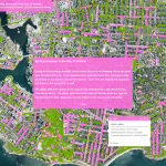
The City of Victoria has rolled out its annual map of blooming cherry and plum trees throughout the region. The interactive map pinpoints different types of blossoming trees across the city depending on the time of year. (Source: CFAX1070)
Southern States Most at Risk for Coronavirus Peak?
BestPlaces.net, a small firm in Portland Oregon, has released several data sets to help health professionals and policymakers gain insights into how severely COVID-19 might impact counties, metro areas and states. BestPlaces has amassed an unparalleled collection of data on every city, town, state, metro area, county and zip code in the U.S. and is […]
COVID-19 Lost Loved Ones and Recovery Stories Project from GISCorps

A message from the GIScorps volunteers:
New USGS map can help Puerto Rico deal with risk of landslides after hurricanes
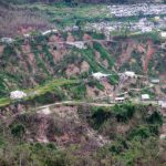
March 19, 2020 – A new U.S. Geological Survey map of Puerto Rico shows the relative risks of landslides due to the kind of intense rainfall brought on by hurricanes. It identifies 20% of the island as at high risk, 9% at very high risk, and 1% at extremely high risk of landslides under those conditions.
10 Different Types of World Maps

A person who makes maps is called a cartographer. The Greeks are known to be the pioneers of map making with proper mathematical footing.
Esri Announces StoryMapper of the Year Contest Winners

Contestants Use Esri Technology to Tell Their Stories and Win Cash, Tech Donations
Squirl, Inc. Launches Mapping Platform for Books

Connecting stories with their real-world settings
Mapillary launches a mapping dashcam solution to help logistics companies cut delivery delays by improving maps en-route

New York, October 17—Mapillary, the street-level imagery platform that uses computer vision to scale and automate mapping, just launched a dashcam that’s been customized for mapping purposes.
Google Maps Now Rolling Out Incognito mode
Something of interest shared today via Engadget… Google Maps’ Incognito mode is now making its way to all users, just a couple of weeks after it arrived to the app’s preview group for testing.
“Streets of Gold” map wins two British Cartographic Society Awards
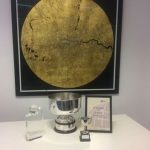
Following success at this year’s Esri User Conference, “Streets of Gold” has won two prestigious accolades at the British Cartographic Society Awards.