NavVis VLX is a first-of-its-kind wearable mapping system designed for hands-free, all-in-one reality capture, including survey-grade point clouds, in even the most complex environments such as construction sites, staircases and technical rooms
RedTail LiDAR Systems supports wounded veterans through stream restoration
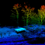
Nestled in the mountains of Tucker County, WV, the Patriots4 (P4) Outdoor Resort is a respite for wounded veterans and their families, service members, and civilians. The non-profit organization’s mission is to give back to those who have given so much through their service to our country by providing a means to enjoy outdoor activities […]
Velodyne Lidar Launches Ecosystem Partner Program

“Automated with Velodyne” Aims to Propel Customer Success
The GeoGeeks at Home Podcast #6 -The One with Bill Emison

Recorded on March 26, 2020. Glenn has a talk with a long time colleague, Bill Emison of Diversified Communications (www.divcom.com).
2 more days to register for the first episode of Straight to the point #Webinar
WEBINAR: Capture, process and finetune your LiDAR data
LIDARUSA Completes Integration of Optech CL-360
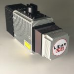
Somerville, AL – February 2017. As a new decade breaks upon us, LIDARUSA is pleased to announce that the Optech CL-360 has joined the ranks of our LIDARUSA Snoopy systems. The Snoopy CL-360 has been meticulously designed for integration on backpack, vehicle, and UAV applications.
International Lidar Mapping Forum Announces New Keynotes: Jack Dangermond and Geospatial Executives Panel
Jack Dangermond, Founder & President of Esri, to keynote before joining Joe Astroth, CEO of Cyclomedia USA; Robert Mankowski, VP of Digital Cities at Bentley Systems; Michel Stanier, EVP of Teledyne Geospatial; and Jim Van Rens, Senior Vice President at RIEGL USA for Geospatial Executives Panel
Blue Marble Geographics releases version 21.1 of Global Mapper and the Lidar Module
Blue Marble Geographics — February 19, 2020 — Blue Marble Geographics® released version 21.1 of its all-in-one GIS software, Global Mapper®, and its advanced point cloud processing add-on, the Lidar Module®, today.
Atlantic enhances its airborne capability with Teledyne Optech’s new Galaxy T2000 and G2 sensor system
Vaughan, Ontario, January 21, 2020 — Teledyne Optech, a Teledyne Technologies [NYSE:TDY] company and global leader in lidar sensing, is pleased to announce that Atlantic is first to take possession of the new Optech G2 sensor system, which will accommodate their two Optech Galaxy Prime airborne lidar sensors.
International Lidar Mapping Forum Announces First Keynote of 2020 Conference Program
Tara O’Shea, Director of Forest Programs at Planet, to Present on Combining Lidar & Earth Observation Satellite Data