CAMBRIDGE, Ontario, Nov. 09, 2022 (GLOBE NEWSWIRE) — This week, Extract Energy launched a pilot project with Hamilton Community Enterprises (HCE) to demonstrate new technology designed to harvest a vast, untapped source of clean electricity.
Bentley Systems Explores Decarbonization and Climate-Resilient Pathways with Digital Solutions at COP27
Will Present in Sustainable Innovation Forum and Partner with Microsoft in the Green Zone
Esri Partners with Digital Earth Africa to Support Sustainable Growth
Agreement Will Expand Access to Satellite Imagery Analysis for Environmental Monitoring and Risk Reduction
Geospatial solutions for climate change explored at Geo-Resolution 2022 in St. Louis
Experts in geospatial information, public health, human migration and water, energy and food systems gathered at the Geo-Resolution conference at Saint Louis University in St. Louis, Sept. 28, to talk about the impacts of climate change and how geospatial technology can be used to better understand and mitigate climate change impacts.
Esri Partners with Federal Government and State of California to Tackle Climate Change, Improve Resilience

Map-Based Dashboards Help Communities Assess Exposure to Climate Hazards and Conservation Opportunities
NOAA still expects above-normal Atlantic hurricane season
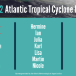
Preparedness is key during the peak months of hurricane season
NOAA predicts above-normal 2022 Atlantic Hurricane Season

Ongoing La Niña, above-average Atlantic temperatures set the stage for busy season ahead
NASA, Partners Offer Global View of Environmental Changes
WASHINGTON, May 19, 2022 /PRNewswire/ — Continuing the collaboration that produced the COVID-19 Earth Observing Dashboard in 2020, NASA and its international partners in Europe and Japan have combined the collective scientific power of their Earth-observing satellite data in expanding the online resource to document a broad array of planet-wide changes in the environment and human society.
World-Renowned Oceanographer and “Hero Of The Planet” Dr. Sylvia A. Earle Joins Ecuador President For Signing Of Expanded Marine Protected Area In Galápagos Islands Hope Spot
PUERTO AYORA, Ecuador–(BUSINESS WIRE)–Amid news that the Earth’s oceans warmed at a rate eight times faster than in the preceding decades, the protection of marine life has never been more critical. Mission Blue Founder and National Geographic Explorer in Residence, Dr. Sylvia A. Earle is joining Ecuador President Guillermo Lasso on the signing of an official decree enhancing the marine protected […]
Sparkgeo partners on a 2.0 solution to track and monitor the effects of climate change

MERMAID: new advancements in monitoring coral reef health — There’s a common misperception that nature got a break from humans during the pandemic. In fact, it has been quite the opposite. Coral reefs continue to suffer dramatically due to climate change; specifically coral bleaching, spiked by extreme ocean heat waves, ocean acidification and the rise […]