Valencia, Spain, Centennial CO, – DIELMO 3D S.L., (www.dielmousa.com) Dielmo 3D is pleased to announce the launching of the Web Portal of OHIO, a 100% CUSTOMIZABLE LiDAR/GIS WEB-PORTAL for the State of Ohio. The demonstrative online GIS web-portal for Ohio is derived from publicly available LiDAR and GIS datasets, providing easy access to the data, […]
Imagery, earth imaging and remote sensing
Rocket Lab Announces World’s First Commercial Launch Site
Announcement makes Rocket Lab world’s first commercial company to build and operate an orbital launch range
Leica Geosystems Gives Customers Access to Intelligent Imagery

New program gives Leica Geosystems customers easy and free access through the cloud to intelligent imagery with the newest generation of robotic total stations and GNSS/GPS handhelds.
Countdown to submit innovative ideas to High-Res Urban Challenge
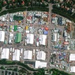
14 days left to enter the European Space Imaging High-Res Urban Challenge
Spatial Media Acquires UAV News Publication; Recruits Industry Veteran Roland Mangold to head LIDAR Magazine

Frederick, Maryland & Midland, Ontario – July 1st, 2015 – Spatial Media LLC (www.spatialmedia.us) is pleased to announce the acquisition of UAV Business and Technology Report, recruiting long-time GeoTech publishing industry veteran Roland Mangold to its editorial team. The UAVBTR archive and readership will integrate with LIDAR Magazine, now in its fifth year as a […]
NASA Administrator Statement on the Loss of SpaceX CRS-7
WASHINGTON, June 28, 2015 — The following is a statement from NASA Administrator Charles Bolden on the loss Sunday of the SpaceX Commercial Resupply Services 7 (CRS-7) mission.
XV Pacific Games in Port Moresby – Sports Facilities Mapped by Pléiades Satellites
Port Moresby, the capital of Papua New Guinea, is hosting the XV Pacific Games from 4th to 18th July, 2015.
Aireon and Isavia Sign Agreement to Investigate Expanding Surveillance Over North Atlantic and Polar Regions
Iceland’s Air Navigation Service Provider and Aireon Sign MOU to Improve Airspace Efficiency in more Than 5.4 Million Square Kilometers of Airspace
Copernicus Masters: CLOUDEO – THE GOING LIVE CHALLENGE
Test and realise your EO service – The CloudEO Going Live Challenge awards proposals for EO-related products and services that are ready to be tested and implemented with a prize package worth EUR 10,000
NGA and DigitalGlobe Open Source Toolkit to Harness the Power of Collaborative Mapping
LONGMONT, Colo.–The National Geospatial-Intelligence Agency and DigitalGlobe (NYSE: DGI) have partnered to release an open source software toolkit designed to harness the power of crowdsourced mapping for Geospatial Big Data Analytics. The open source project Hootenanny provides a scalable processing engine and interactive editing interface to enable rapid conflation of map features generated from satellite […]