GIS user technology news

News, Business, AI, Technology, IOS, Android, Google, Mobile, GIS, Crypto Currency, Economics

  • Advertising & Sponsored Posts
    • Advertising & Sponsored Posts
    • Submit Press
  • PRESS
    • Submit PR
    • Top Press
    • Business
    • Software
    • Hardware
    • UAV News
    • Mobile Technology
  • FEATURES
    • Around the Web
    • Social Media Features
    • EXPERTS & Guests
    • Tips
    • Infographics
  • Blog
  • Events
  • Shop
  • Tradepubs
  • CAREERS
You are here: Home / * PRESS / Earth Imaging - Remote Sensing / Countdown to submit innovative ideas to High-Res Urban Challenge

Countdown to submit innovative ideas to High-Res Urban Challenge

July 2, 2015 By GISuser

14 days left to enter the European Space Imaging High-Res Urban Challenge

Win very high-resolution satellite data to use in your solution.

We know you have winning ideas!

But the hardest thing with entering any competition is getting all the ‘stuff’ together to get your proposal over the line. We know what it’s like. But we encourage all of you who have begun the journey to complete.

And those who are still thinking about it, register now and get rolling.

European Space Imaging believes in your ground-breaking urban innovations and is looking forward to the chance to select this year’s winner.

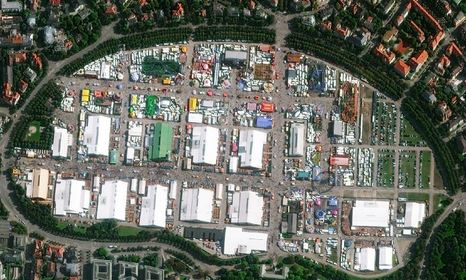
“The Winner will have access to a valuable commercial data package of very high-resolution satellite imagery that could become the basis of the success of their solution, and give them the opportunity to work at the forefront of technology.“ says Michaela Neumann, Director Sales and Marketing at European Space Imaging.

Sign up now and complete by 13 July 2015!

For more info and to sign up for the challenge visit: http://eusi.copernicus-masters.com/

About European Space Imaging 
European Space Imaging is the leading supplier of very high-resolution (VHR) satellite imagery across Europe and North Africa. They operate a multi-mission capable ground station, enabling optimised collection strategies, flexibility and real-time weather assessments. Since 2002 European Space Imaging has continued to provide imagery from the most advanced VHR satellites available and services to customers throughout their region.

Filed Under: Earth Imaging - Remote Sensing, Top Press Tagged With: European Space Imaging, Urban Challenge

Editor’s Picks

Using Lidar to Classify Landslides

Now Available: Explorer for ArcGIS on Android #mobiletip

A New, Official Arkansas GIS Web Portal

Blue Marble Announces Advanced LiDAR Option for the Global Mapper SDK

See More Editor's Picks...

Recent Industry News

Milwaukee M18FHZ-0 Hackzall Reciprocating Saw – For hardcore cutting in a compact size

June 19, 2026 By GISuser

How Enterprises Are Using AI to Automate 80% of Customer Interactions With Voice Agents

June 16, 2026 By GISuser

Why On Cloud Shoes Are Worth the Price in Mexico

June 16, 2026 By GISuser

Jinghong vs XAG Agricultural Drones: A Comprehensive Comparison Guide

June 16, 2026 By GISuser

Hot News

State of Data Science Report – AI and Open Source at Work

HERE and AWS Collaborate on New HERE AI Mapping Solutions

Virtual Surveyor Adds Productivity Tools to Mid-Level Smart Drone Surveying Software Plan

Categories

Copyright gletham Communications 2015 - 2026

Go to mobile version