GIS user technology news

News, Business, AI, Technology, IOS, Android, Google, Mobile, GIS, Crypto Currency, Economics

  • Advertising & Sponsored Posts
    • Advertising & Sponsored Posts
    • Submit Press
  • PRESS
    • Submit PR
    • Top Press
    • Business
    • Software
    • Hardware
    • UAV News
    • Mobile Technology
  • FEATURES
    • Around the Web
    • Social Media Features
    • EXPERTS & Guests
    • Tips
    • Infographics
  • Blog
  • Events
  • Shop
  • Tradepubs
  • CAREERS
You are here: Home / Archives for * PRESS / Earth Imaging - Remote Sensing

Imagery, earth imaging and remote sensing

Nearmap unveils game-changing streaming 3-D online and previews AI technology at Navig8

June 8, 2019 By GISuser

nearmap

South Jordan, Utah, June 6, 2019 — Aerial imagery business, Nearmap, today launched its new 3-D product in a move that will revolutionize the way industries such as urban planning, architecture, construction, government and councils view and shape cities across Australia and the U.S. The company is also previewing its groundbreaking AI technology at its customer event, […]

Filed Under: Business, Earth Imaging - Remote Sensing, Top Text Lead Story Tagged With: 3D, Imagery

Satellite Imagery: Omaha Beach and Normandy American Cemetery: 75th Anniversary of D-Day

June 6, 2019 By GISuser

Omaha Beach and Normandy American Cemetery:

One of Maxar’s satellites collected new imagery this morning associated with the 75th Anniversary of D-Day. Fortunately, between a hole in the clouds along the French coastline, Maxar collected imagery at 11:36 AM local time in which you can see Omaha Beach and the ceremony in progress at the Normandy American Cemetery and Memorial.

Filed Under: Earth Imaging - Remote Sensing, Top Press

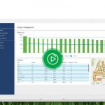
Satellite Data Analytics Saving Dairy Farmers Valuable Time with New Grass Management Service
June 5, 2019 By GISuser

Satellite Data Analytics Saving Dairy Farmers

Wednesday 5th June, 2019, Harwell, UK – Grass SAT, an innovative, new grass management service is launched today by Rezatec, the geospatial data analytics company, to provide dairy farmers with automated daily updates of grass cover per paddock, and other features, to optimise grazing management decisions throughout the year.

Filed Under: Earth Imaging - Remote Sensing, Environment, UAV/UAS

SimActive Releases Version 8.2 for Processing of Multispectral Imagery

June 4, 2019 By GISuser

SimActive Releases Version 8.2 for Processing of Multispectral Imagery

Montreal, Canada, June 4th, 2019 – SimActive Inc., a world-leading developer of photogrammetry software, announces the release of Correlator3D™ version 8.2 with advanced processing capabilities of multispectral imagery.   Supported sensors include the MicaSense RedEdge / Altum and the Parrot Sequoia.

Filed Under: Earth Imaging - Remote Sensing, Top Press Tagged With: Multispectral Imagery

Satellite Imagery: Midwest Flooding and Tornado Damage
June 3, 2019 By GISuser

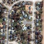
Midwest Flooding and Tornado Damage

Maxar Technologies collected recent satellite imagery of the flooding seen in the Midwest (Kansas, Oklahoma) and tornado damage in Ohio (near Clayton).

Filed Under: Earth Imaging - Remote Sensing, Emergency Response Tagged With: sattelite, tornado

Airbus wins three satellite deal from Inmarsat for revolutionary spacecraft

May 30, 2019 By GISuser

Inmarsat GX7, 8 & 9 will be based on Airbus’ new standard and fully reconfigurable satellite product line OneSat –  OneSat brings best value for money, reducing cost and time to orbit thanks to a highly innovative approach

Filed Under: Earth Imaging - Remote Sensing

Solv3D Releases New Features and Pricing Model

May 28, 2019 By GISuser

CALGARY – April 24, 2019  – Solv3D, a leading provider of 3D processing, geospatial data visualization and collaboration tools announced that a number of new features have recently been released within SiteVisit360™ and 3DPointLogic™ along with a newly developed pricing model for the latter. 

Filed Under: Earth Imaging - Remote Sensing, Software Tagged With: 3D

Bluesky and Skyline Create Dynamic 3D City Models

May 18, 2019 By GISuser

Bluesky and Skyline Create Dynamic 3D City Models

Ashby-De-La-Zouch, UK – May 13, 2019 – Aerial mapping company Bluesky is working with SkylineGlobe UK on a project to provide high accuracy, photorealistic 3D City Models that will be available as off the shelf datasets and via an internet streaming service.The new, dynamic 3D models will provide a visualisation and analytical platform for smart city […]

Filed Under: Business, Earth Imaging - Remote Sensing Tagged With: 3D

East View Geospatial: Image Cleaning and Pre-Processing Services for VDBs

May 9, 2019 By GISuser

Minneapolis, MN USA. May 7, 2019 — East View Geospatial (EVG), a provider of content-rich geospatial products, is now offering high-quality image cleaning and pre-processing services for visual databases (VDBs).

Filed Under: Earth Imaging - Remote Sensing

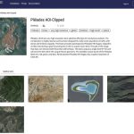
Airbus launches UP42, a space tech startup democratising access to geospatial data
May 7, 2019 By GISuser

Berlin, 7 May 2019 – UP42 , a subsidiary of Airbus Defence and Space, today launches an open platform and marketplace dedicated to helping developers and startups build, run, and scale geospatial products. UP42 opens up access to geospatial data, imagery, and processing algorithms — allowing users to develop, launch, and monetise game-changing new products.

Filed Under: DATA, Earth Imaging - Remote Sensing, Top Press

« Previous Page
Next Page »

Top Press

The Global Expansion of Aueshah: A New Era of High Jewelry

April 11, 2026 By GISuser

KARACHI, PAKISTAN. The international luxury market is experiencing a profound shift. Consumers are increasingly rejecting mass-produced goods in favor of rarity, authenticity, and emotional depth. … [Read More...]

State of Data Science Report – AI and Open Source at Work

September 10, 2025 By GISuser

AI and Open Source at Work … [Read More...]

Topcon Announces Landmark Expansion of Topnet Live Network Across USA

January 26, 2025 By GISuser

LIVERMORE, Calif.---Topcon Positioning Systems has announced a significant expansion of its Topnet Live reference station network, introducing 200 new geodetic stations strategically positioned across … [Read More...]

Space Flight Laboratory (SFL) Announces Launch and Deployment of NorSat-4 Maritime Monitoring Microsatellite

January 19, 2025 By GISuser

Seventh Satellite Developed by SFL for Norway … [Read More...]

HERE and BMW Group extend partnership on AI-powered mapping system

January 8, 2025 By GISuser

HERE and BMW Group extend partnership on AI-powered mapping system for automated driving and enhanced road safety … [Read More...]

Everest Base Camp Helicopter Tour, Helicopter Return Trek, and Manaslu Circuit Trek: Which Nepal Adventure Is Right for You?

November 6, 2026 By GISuser

Almost everyone planning a Nepal trip runs into the same wall. You want the big mountains, you have a fixed number of days, and every itinerary you read seems to promise something … [Read More...]

SFL Missions Inc. Confirms Successful Deployment of Six HawkEye 360 Radio Frequency Detection Satellites with Advanced Capabilities

October 27, 2026 By GISuser

MĀHIA, New Zealand, 26 October 2026 – SFL Missions Inc. today confirmed the successful deployment of six radio frequency (RF) detection and geolocation satellites for HawkEye 360 … [Read More...]

Canadian-Built RoadEng 12 Uses AI to Find the Best Location for New Resource and Rural Roads

October 17, 2026 By GISuser

Vancouver, BC, Canada, October 15, 2026 – North Vancouver-based Softree Technical Systems today released RoadEng Version 12, used in more than 75 countries to locate and design … [Read More...]

Beyond the Map: How AI Image and Video Generation Is Changing Geospatial Communication

October 14, 2026 By GISuser

Ask anyone who has shipped a GIS project what the hardest part was, and the answer is rarely the spatial analysis. It is almost always the communication. A site suitability … [Read More...]

From Maternity to Everyday Wear: Building a Wardrobe That Grows With You

October 14, 2026 By GISuser

When I think about maternity clothing, I feel the biggest mistake is buying too many things at once. During pregnancy, your body keeps changing, and something that fits well today … [Read More...]

Copyright gletham Communications 2015 - 2026

Go to mobile version