GISuser.com

GIS and Technology news for mapping professionals

  • PRESS
    • Submit PR
    • Top Press
    • Business
    • Software
    • Hardware
    • UAV News
    • Mobile Technology
  • FEATURES
    • Around the Web
    • Social Media Features
    • EXPERTS & Guests
    • Tips
    • Infographics
  • Events
  • CAREERS
  • Advertise
    • Advertise
  • Blog
  • Shop
  • Tradepubs
You are here: Home / Archives for tornado

Satellite Imagery: Midwest Flooding and Tornado Damage

June 3, 2019 By GISuser

Midwest Flooding and Tornado Damage

Maxar Technologies collected recent satellite imagery of the flooding seen in the Midwest (Kansas, Oklahoma) and tornado damage in Ohio (near Clayton).

Filed Under: Earth Imaging - Remote Sensing, Emergency Response Tagged With: sattelite, tornado

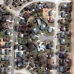
Missouri’s Geospatial Community Reacts with Emergency Tornado Mapping of Jefferson City, MO

May 31, 2019 By GISuser

To initiate emergency response protocol in response to the Jefferson City tornado, the State and local geospatial community sprang into action as soon as the tornado hit.

Filed Under: Emergency Response, LiDAR, Maps and Cartography Tagged With: Missouri, tornado

WOAH… amazing photo of tornado touching down on ground in Colorado at DIA #COwx

May 21, 2014 By Editor

Woah, my friend  @Spinneyo just arrived back in Denver at DIA and snapped this pic and shared on Instagram as a tornado is touching down very close to DIA.. stay safe Colorado! Hope you don’t mind me sharing Jon… For more amazing, real time COWX photos see this stream on the Echsoec social map search

Filed Under: instagram, weather Tagged With: Colorado, tornado, Weather

Feed

  • RSS


GIS jobs


Recent Features

Digitalization and Simulation at the North Pole

Natural Gas District & GIS-Centric Asset Management

5 Ways Technology Is Affecting The Sharing Economy

Spotlight – Township Canada: Explore Canadian Legal Land Descriptions on a Map

GeoGeeksinCars – The one in “Tippy” the right-hand drive Mitsubishi, at DevSummit

More Posts from this Category

Categories

Recent Posts

  • A treadmill is one of the most popular fitness equipment
  • 3 Things to Help You Become a Software Engineer
  • Esri Announces Winners of the 2022 ArcGIS Online Competition
  • KBC WhatsApp Lottery Winner 2022 List – KBC Head Office Number +19188444477 – KBC Sim Card Lucky Draw 2022
  • Animation explainer for a trading application

RSS Career Tips

  • Four Characteristics of the Best Virtual Employees
  • 8 Questions Employers Should Ask About Coronavirus
  • Jobcase Launches Free Unemployment Resource Center for Workers Impacted by COVID-19
  • Must-Have Gadgets and Technology for the Remote Office Worker
  • Must-Have Gadgets and Technology for the Remote Office Worker


shop for geogeek swag

RSS Tech pubs

  • Why data democratisation defines the workplace of the future
  • Breaking the Code: How Low Code Is Changing Development
  • The Essentials of IT Management - 2022 Kit

RSS Computers

  • The Essentials of Information Security Kit: Includes a Free PC Security Handbook - 2nd Edition eBook
  • The Idiot's Ultimate Guide to Build Your Own PC
  • Windows... On Speed

RSS HR Tips

  • At Work: The 2022 Workplace Trends Report
  • The 2022 Guide To Creating A Great Visitor Experience
  • Enterprise Executives Say Hybrid Work is Here to Stay

RSS Gov Tech

  • The Bipartisan Infrastructure Bill: How you can win more bids
  • How Connected Vehicle Data Can Transform Public Sector Decision-Making
  • Getting started with personalization at scale

RSS UAV news

  • Draganfly Deploys Versatile Situational Assessment Drones to Ukraine
  • Ocean Specialists Inc. Launches “USVs as a Service” Business Line
  • UAS Drone Subsidiary, Duke Robotics’, Sniper Drone showcased at a leading International Airshow in the Asia Pacific Region

RSS Geojobs

  • IT Endpoint Lead
Copyright Spatial Media LLC 2003 - 2015