
An update via Mxar: Maxar’s WorldView-3 satellite collected a set of new images yesterday, October 24th of the Kincade wildfire near Sonoma, California.
Imagery, earth imaging and remote sensing
We can all now see real-time, high definition aerial images of anywhere on earth thanks to Soar
Oct 25th, 2019 – Satellite imagery company Soar has today announced it is now allowing public access to its satellites which provide near-real time imagery all across Earth at 10m resolution per pixel.
Airbus built Solar Orbiter heads for the Sun in Florida
Spacecraft completed all tests and ready for fiery mission
Mapillary launches a mapping dashcam solution to help logistics companies cut delivery delays by improving maps en-route

New York, October 17—Mapillary, the street-level imagery platform that uses computer vision to scale and automate mapping, just launched a dashcam that’s been customized for mapping purposes.
DEFRA use satellite technology to monitor disease in key species throughout England
DEFRA (the Department for Environment Food & Rural Affairs) has begun a nationwide project with geospatial data analytics company, Rezatec, to map the key species of ash and oak and monitor for diseases such as ash dieback.
NexTech Launches ARitize The World’s First Self-Serve, Augmented Reality (AR) Platform
NEW YORK and TORONTO, Sept. 24, 2019 — NexTech AR Solutions (the “Company” or “NexTech”)(OTCQB: NEXCF)(CSE: NTAR)(FSE: N29), a leader in the rapidly growing AR industry providing full-funnel Augmented Reality (AR), is proud to announce the launch of the world’s first self service 3D AR publishing platform called ARitize™. Now it’s possible to optimize conversions, reduce returns, […]
Space tech startup UP42 comes out of beta; launches marketplace dedicated to Earth observation
UP42 is a new platform and marketplace for developers and startups, offering customers access to high-resolution satellite imagery, geospatial data and ready-to-use algorithms From today, SMBs and independent developers will have easy access to a wide range of geospatial data and analytics, which have traditionally been restricted to large corporates and governments The space tech […]
Delair offers unlimited photogrammetry plan to enable more flexible model for digital mapping

Plan offers unlimited use of the delair.ai cloud platform for maps and 3D models, collaboration, data storage, photogrammetry, and manual analysis at a fixed low monthly rate.
Maxar Satellite Imagery shows Golden Ray Carrier Ship Capsizing
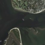
Maxar’s WorldView-2 satellite collected a new image (September 10th) of the Golden Ray—the car carrier ship that capsized on Sunday in the middle of Saint Simons Sound, near Brunswick, Georgia. The ship was reportedly carrying thousands of vehicles and overturned early on Sunday morning after departing from the nearby port of Brunswick.
Satellite Imagery: Hurricane Dorian Damage in the Bahamas
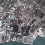
Maxar collected new satellite imagery this morning (September 5th) over the northern Bahamas that provide our first clear view of the extensive damage caused by Hurricane Dorian to Marsh Harbour, Great Abaco Island and a number of the villages on nearby cays.