GIS user technology news

News, Business, AI, Technology, IOS, Android, Google, Mobile, GIS, Crypto Currency, Economics

  • Advertising & Sponsored Posts
    • Advertising & Sponsored Posts
    • Submit Press
  • PRESS
    • Submit PR
    • Top Press
    • Business
    • Software
    • Hardware
    • UAV News
    • Mobile Technology
  • FEATURES
    • Around the Web
    • Social Media Features
    • EXPERTS & Guests
    • Tips
    • Infographics
  • Blog
  • Events
  • Shop
  • Tradepubs
  • CAREERS
You are here: Home / Archives for **Front Page / Top Text Lead Story

Census Bureau Hosts Virtual Summit to Highlight Data Innovations

November 24, 2020 By Editor

The U.S. Census Bureau is celebrating the fifth anniversary of The Opportunity Project (TOP) at its first-ever three day virtual conference, featuring more than 35 new products from the Census Bureau and industry collaborators. There will be 24 sessions at this year’s conference including keynotes, lightning talks and discussions on government innovation, open data strategy and technology for good. […]

Filed Under: Business, Top Text Lead Story Tagged With: Census

NavVis Introduces Processing in the Cloud for Even Faster Laser Scanning Workflows

November 17, 2020 By Editor

The Cloud Processing Add-on for NavVis IndoorViewer processes multiple datasets in parallel.

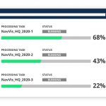
From processing to viewing, with NavVis it can now be done entirely in the cloud.

Filed Under: Business, Top Text Lead Story

Illinois Institute of Technology to Establish Trimble Technology Lab for Civil, Architectural, and Environmental Engineering

November 13, 2020 By Editor

SUNNYVALE, Calif., and CHICAGO, Nov. 12, 2020 — Illinois Institute of Technology has received a gift from Trimble (NASDAQ: TRMB) to establish a state-of-the-art Technology Lab for the Department of Civil, Architectural and Environmental Engineering’s (CAEE) Construction Engineering and Management Program. 

Filed Under: Business, Top Text Lead Story Tagged With: EDU, Trimble

SimActive Releases Version 8.6 of Correlator3D™

November 10, 2020 By Editor

SimActive Releases Version 8.6

Montreal, Canada, November 9th, 2020 – SimActive Inc., a world-leading developer of photogrammetry software, announces the release of Correlator3D™ version 8.6. 

Filed Under: Business, LiDAR, Software, Top Text Lead Story Tagged With: SimActive

USGS Unveils Mobile Flood Tool for the Nation

November 5, 2020 By Editor

USGS Unveils Mobile Flood Tool for the Nation

The U.S. Geological Survey announced Friday the completion of a new mobile tool that provides real-time information on water levels, weather and flood forecasts all in one place on a computer, smartphone or other mobile device.

Filed Under: Business, Mobile, Top Text Lead Story Tagged With: mobile, USGS

Webinar – Improving your Photogrammetric Workflow with New Version 8.6

November 2, 2020 By Editor

Improving your Photogrammetric Workflow with New Version 8.6

SimActive will release a new version of its photogrammetry software Correlator3D. The new version includes multiple new features, such as the use of intensity data from LAS files for image registration, the ability to improve mosaic seamlines with a DSM and the support of  DJI sun sensors.

Filed Under: Top Text Lead Story, Webinars Tagged With: SimActive, Webinar

Lincoln Institute of Land Policy Launches Center for Geospatial Solutions @landpolicy

October 29, 2020 By Editor

Lincoln Institute of Land Policy

New technology hub will open access to valuable geospatial data and analysis

Filed Under: Business, Environment, Government & OpenGov, Top Text Lead Story Tagged With: lincoln institute

Augusta-Richmond County Board of Assessors Shares Impressive Statistics Related to its Use of MobileAssessor

October 27, 2020 By Editor

The consolidated government of Augusta-Richmond, the second largest city in Georgia with a population of over 200,000, has realized a 216 to 1 return on investment (ROI) after implementing MobileAssessor by Data Cloud Solutions.

Filed Under: Business, Hardware, Mobile, Top Text Lead Story Tagged With: mobile

Satellite Imagery: East Troublesome Wildfire Near Rocky Mountain National Park, Colorado

October 23, 2020 By Editor

East Troublesome Wildfire Near Rocky Mountain National Park, Colorado

Maxar Technologies collected new satellite imagery (October 22nd)  of the East Troublesome Wildfire burning out of control near Rocky Mountain National Park (RMNP) in northern Colorado.

Filed Under: Earth Imaging - Remote Sensing, Emergency Response, Top Text Lead Story Tagged With: Colorado, Imagery, maxar, wildfire

Esri UK signs partnership with drone hardware specialist Heliguy to create end-to-end drone solution for AEC

October 21, 2020 By Editor

Hardware and software combination gives organisations one-stop drone solution

Filed Under: Business, Top Text Lead Story, UAV/UAS Tagged With: construction, UAV

« Previous Page
Next Page »

Recent Industry News

Why Adults Are Trimming Their Routines for Travel and Busy Weeks

June 10, 2026 By GISuser

Top Benefits of AI Video Surveillance for Businesses and Public Spaces

June 5, 2026 By GISuser

How to Choose the Best Office Interior Designers in Delhi for End-to-End Projects

June 3, 2026 By GISuser

Why Bathroom Renovation Services Often Change More Than Just the Bathroom

May 20, 2026 By GISuser

Hot News

State of Data Science Report – AI and Open Source at Work

HERE and AWS Collaborate on New HERE AI Mapping Solutions

Virtual Surveyor Adds Productivity Tools to Mid-Level Smart Drone Surveying Software Plan

Categories

Copyright gletham Communications 2015 - 2026

Go to mobile version