GIS user technology news

News, Business, AI, Technology, IOS, Android, Google, Mobile, GIS, Crypto Currency, Economics

  • Advertising & Sponsored Posts
    • Advertising & Sponsored Posts
    • Submit Press
  • PRESS
    • Submit PR
    • Top Press
    • Business
    • Software
    • Hardware
    • UAV News
    • Mobile Technology
  • FEATURES
    • Around the Web
    • Social Media Features
    • EXPERTS & Guests
    • Tips
    • Infographics
  • Blog
  • Events
  • Shop
  • Tradepubs
  • CAREERS
You are here: Home / Archives for *FEATURES / EXPERTS

Expert articles and Guest contributions

Feature articles and special editorial contributions from friends of GISuser and guest writers

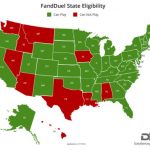
Feature – States’ Rights: A Sure Bet on Location

August 8, 2017 By Troy Lambert

This October, the Supreme Court will hear a landmark case on the repeal of the Professional and Amateur Sports Protection Act (PASPA) passed by Congress in 1992. The act prohibits sports betting in all states except Nevada, Oregon, Montana, and Delaware. These states were grandfathered in, and therefore exempt to the law.

Filed Under: Business, EXPERTS, Maps and Cartography, Top Features, Top Press Tagged With: lambert, location, Maps

MapThis shares Wildfire Maps – Maps, WebMaps and Resources for #BCwildfire Updates

August 4, 2017 By GISuser

From GEO Jobe GIS – Recall, recently we shared the story of how our friends and colleagues at Esri small business startup, Echosec, supported their lead developer in building a BC wildfire public information ArcGIS online resource in order to help keep the public informed and safe. Building on that and after searching for additional resources, the […]

Filed Under: Around the Web, Emergency Response, EXPERTS, Maps and Cartography, Tips, Top Press Tagged With: canada, Maps, wildfire

Mapping Forest disturbance across Canada over a 25-year study period

June 30, 2017 By GISuser

forest disturbance in canada

How do you keep track of changing forest cover when nearly a tenth of the world’s forests are located within your borders? It’s a big question in Canada, where forests are a key economic resource.

Filed Under: Around the Web, Earth Imaging - Remote Sensing, Environment, EXPERTS

How Maps Are Making Us Smarter

June 28, 2017 By GISuser

The evolution of aerial maps is, in many respects, a story of the development of technology. It’s also a narrative about human ambition: maps have always been important aids in making key decisions about commercial, military, and imperial goals. Once rare artifacts, they are now increasingly vital and available tools in the hands of multitudes—a […]

Filed Under: Business, EXPERTS

Business Location Challenges: How GIS Can Help
June 8, 2017 By GISuser

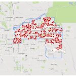
Selecting the right location is a challenge for all kinds of businesses, not just those that serve customers directly. Things like the demographics and education level of the surrounding population who will be potential employees, schools in the area who train workers for particular professions, and the availability and quality of either affordable family housing […]

Filed Under: Business, EXPERTS, Features of the Month, Top Features, Top Text Lead Story Tagged With: Business Location

Engaging Missouri Constituents Through Mobile Technology

May 11, 2017 By GISuser

Imagine planning a fishing trip with family or friends and knowing exactly where to find the hot fishing spots and having the exact driving directions on how to get there.  Imagine being able to purchase your hunting and fishing license right from your phone and store them offline. 

Filed Under: EXPERTS, Mobile, Top Features, Top Press Tagged With: Mobile Technology

Feature – A Vision for the GEOPowered Cloud

April 7, 2017 By GISuser

Esri Silver Business Partner GEO Jobe GIS shares with us their vision for the GEO Powered Cloud, an enterprise deployment platform for the ArcGIS enterprise ecosystem.

Filed Under: Business, developer, EXPERTS, Top Features, Top Text Lead Story, Web Services Tagged With: arcgis online, cloud, geo jobe

Tackling the GEOINT Big Data Mess

March 28, 2017 By GISuser

According to the PBS documentary, “The Human Face of Big Data,” we now create as much data every two days as the world generated from its inception through 2003

Filed Under: Business, EXPERTS, Top Features, Top Press Tagged With: Big Data

Vault 7: Security and Location Data

March 15, 2017 By Troy Lambert

Not long ago, I talked here about UAV Cloud Data: we are generating a ton of location data, and need some effective way to store it on the cloud. Two things have to be considered: it needs to be secure, so it cannot be accessed by just anyone, but it also needs to be available […]

Filed Under: Around the Web, Business, EXPERTS, Features of the Month, FrontPage Leader, Top Text Lead Story Tagged With: location data, Security

Feature – Finding Jesus Using GIS and GPR

January 17, 2017 By Troy Lambert

As GIS Users we know GIS has amazing power. I have written about how it has the ability to enhance marketing efforts, do good things for the environment by helping us track light pollution, and even use the past to inform the present.

Filed Under: *FEATURES, Around the Web, Business, EXPERTS, Top Press Tagged With: lambert

« Previous Page
Next Page »

Top Press

The Global Expansion of Aueshah: A New Era of High Jewelry

April 11, 2026 By GISuser

KARACHI, PAKISTAN. The international luxury market is experiencing a profound shift. Consumers are increasingly rejecting mass-produced goods in favor of rarity, authenticity, and emotional depth. … [Read More...]

State of Data Science Report – AI and Open Source at Work

September 10, 2025 By GISuser

AI and Open Source at Work … [Read More...]

Topcon Announces Landmark Expansion of Topnet Live Network Across USA

January 26, 2025 By GISuser

LIVERMORE, Calif.---Topcon Positioning Systems has announced a significant expansion of its Topnet Live reference station network, introducing 200 new geodetic stations strategically positioned across … [Read More...]

Space Flight Laboratory (SFL) Announces Launch and Deployment of NorSat-4 Maritime Monitoring Microsatellite

January 19, 2025 By GISuser

Seventh Satellite Developed by SFL for Norway … [Read More...]

HERE and BMW Group extend partnership on AI-powered mapping system

January 8, 2025 By GISuser

HERE and BMW Group extend partnership on AI-powered mapping system for automated driving and enhanced road safety … [Read More...]

Everest Base Camp Helicopter Tour, Helicopter Return Trek, and Manaslu Circuit Trek: Which Nepal Adventure Is Right for You?

November 6, 2026 By GISuser

Almost everyone planning a Nepal trip runs into the same wall. You want the big mountains, you have a fixed number of days, and every itinerary you read seems to promise something … [Read More...]

SFL Missions Inc. Confirms Successful Deployment of Six HawkEye 360 Radio Frequency Detection Satellites with Advanced Capabilities

October 27, 2026 By GISuser

MĀHIA, New Zealand, 26 October 2026 – SFL Missions Inc. today confirmed the successful deployment of six radio frequency (RF) detection and geolocation satellites for HawkEye 360 … [Read More...]

Canadian-Built RoadEng 12 Uses AI to Find the Best Location for New Resource and Rural Roads

October 17, 2026 By GISuser

Vancouver, BC, Canada, October 15, 2026 – North Vancouver-based Softree Technical Systems today released RoadEng Version 12, used in more than 75 countries to locate and design … [Read More...]

Beyond the Map: How AI Image and Video Generation Is Changing Geospatial Communication

October 14, 2026 By GISuser

Ask anyone who has shipped a GIS project what the hardest part was, and the answer is rarely the spatial analysis. It is almost always the communication. A site suitability … [Read More...]

From Maternity to Everyday Wear: Building a Wardrobe That Grows With You

October 14, 2026 By GISuser

When I think about maternity clothing, I feel the biggest mistake is buying too many things at once. During pregnancy, your body keeps changing, and something that fits well today … [Read More...]

Copyright gletham Communications 2015 - 2026

Go to mobile version