GIS user technology news

News, Business, AI, Technology, IOS, Android, Google, Mobile, GIS, Crypto Currency, Economics

  • Advertising & Sponsored Posts
    • Advertising & Sponsored Posts
    • Submit Press
  • PRESS
    • Submit PR
    • Top Press
    • Business
    • Software
    • Hardware
    • UAV News
    • Mobile Technology
  • FEATURES
    • Around the Web
    • Social Media Features
    • EXPERTS & Guests
    • Tips
    • Infographics
  • Blog
  • Events
  • Shop
  • Tradepubs
  • CAREERS
You are here: Home / * PRESS / DATA / Satellite Imagery: US Capitol, January 7th via @Maxar

Satellite Imagery: US Capitol, January 7th via @Maxar

January 8, 2021 By GISuser

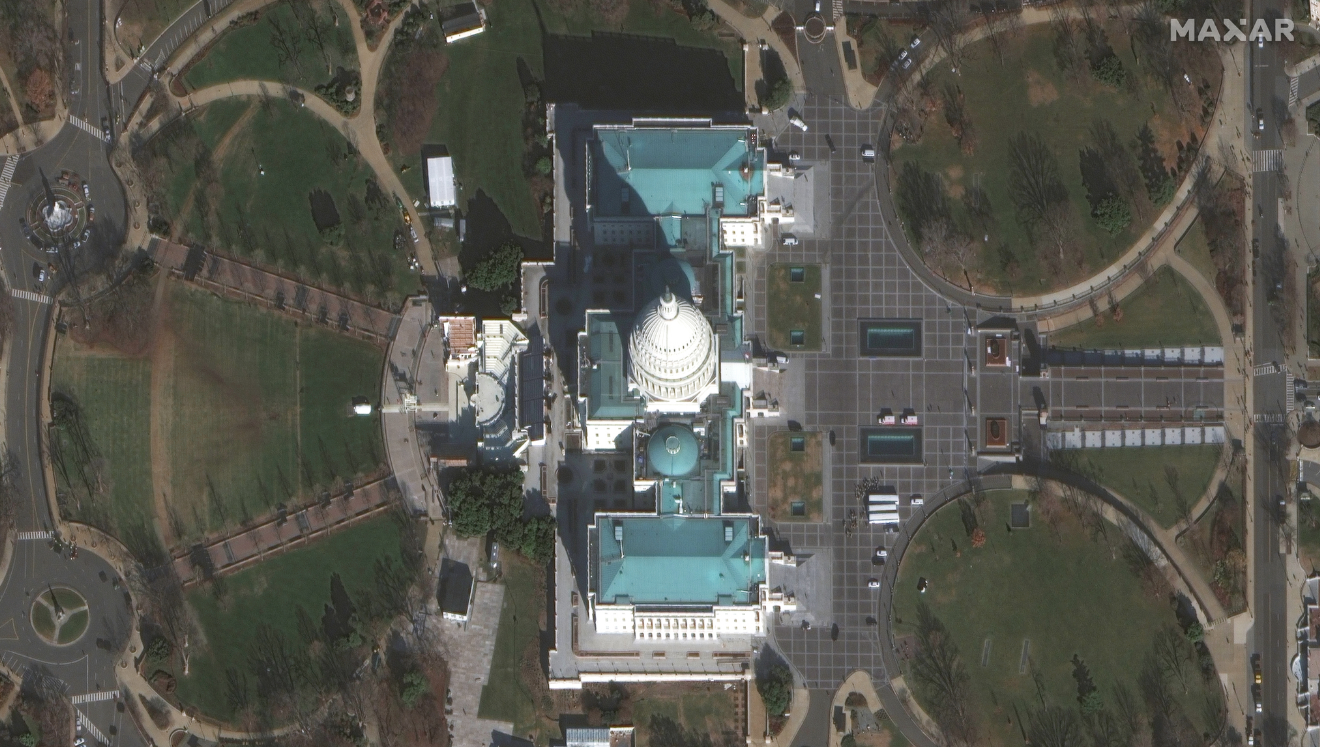
Yesterday (January 7th at 10:59 a.m. and 11:02 a.m. EST), two of Maxar Technologies’ high-resolution satellites collected new imagery of Washington D.C., including the U.S. Capitol and surrounding area. The imagery provides an excellent view of the inauguration stands/seats along the west side of the Capitol as well as an overview of the Capitol grounds.

Satellite image ©2020 Maxar Technologies

Filed Under: DATA, Earth Imaging - Remote Sensing Tagged With: maxar

Editor’s Picks

ArcGIS Online Updates Include Smart Mapping and More

Geospago and what3words partner to provide a mobile mapping solution with 3-word addressing throughout the globe

Event Review, Commercial Drone Expo

Esri Helps Developers Add Geo to Apps at TechCrunch Disrupt NY 2016

See More Editor's Picks...

Recent Industry News

The Future of Competitive Gaming: Why DMA Technology is the Ultimate Performance Edge

June 24, 2026 By GISuser

Milwaukee M18FHZ-0 Hackzall Reciprocating Saw – For hardcore cutting in a compact size

June 19, 2026 By GISuser

How Enterprises Are Using AI to Automate 80% of Customer Interactions With Voice Agents

June 16, 2026 By GISuser

Why On Cloud Shoes Are Worth the Price in Mexico

June 16, 2026 By GISuser

Hot News

State of Data Science Report – AI and Open Source at Work

HERE and AWS Collaborate on New HERE AI Mapping Solutions

Virtual Surveyor Adds Productivity Tools to Mid-Level Smart Drone Surveying Software Plan

Categories

Copyright gletham Communications 2015 - 2026

Go to mobile version