GISuser.com

GIS and Technology news for mapping professionals

  • PRESS
    • Submit PR
    • Top Press
    • Business
    • GIS, Geo Tech Software
    • Hardware
    • UAV News
    • Mobile Technology
    • Editor’s Top Picks
    • Get TOP Listing!
  • FEATURES
    • GeoGeeksinCars
    • 10 Question Q&A
    • FROM THE EDITOR
    • SPATIAL MEDIA AUTHORS
    • Social Media Features
    • EXPERTS & Guests
    • Listicles and Top 10 Lists
    • Infographics
    • VIDEOS
  • Events
    • Webinars
    • Submit event
    • Event Media Partner
  • CAREERS
    • Career Help Articles
    • People and Career News
    • Work from Home
    • About GeoJobs.BIZ
  • About
    • Advertise
      • Advertise wth GISuser
      • Media Kit Request Form
      • Directory
      • Submit Press
    • Contact GISuser
    • Meet the Editor
    • Social Media
      • AnyGeo Blog
      • GeoGeeks Podcast
      • Social Media Features
      • Like Us
    • SpatialMedia
      • LBSzone
      • LiDAR Magazine
      • Amerisurv
      • SymbianOne
    • RSS feed
  • Blog
  • Shop
  • Cloud Hosting
    • Amazon Cloud Hosting
    • WordPress cloud hosting
    • Dedicated servers USA
  • Tradepubs
You are here: Home / *BLOG / Around the Web / ArcGIS Online Updates Include Smart Mapping and More

ArcGIS Online Updates Include Smart Mapping and More

December 14, 2015 By GISuser

In case you missed it, Esri announced a number of updates to ArcGIS Online (OGO) late in November

ArcGIS Online Updates Include Smart Mapping and More

ArcGIS Online Updates Include Smart Mapping and More (Image Credit: Esri)


The company has stated that this release includes updates and new capabilities for organization administration, smart mapping, configurable apps, content, and more. For additional details see the What’s new help topic.

A few of the noteworthy enhancements for AGO users include:

  • Smart Mapping – Smart mapping provides data-driven tools that enable you to explore your data to unlock information and easily author visually appealing web maps
  • New map styles have been added that enable you to visualize and explore multiple attributes in your data.
  • Map & Scene Viewer – new map styles have been added that enable you to visualize and explore multiple attributes in your data.
  • You can now choose to display your data within two different scene environments
  • Story Maps – Create Story is the quickest and easiest way to author your story. Pick an App from the list, or Ask the Pros for a suggestion to meet your story needs

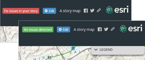
Create Story can be found in several places; on the main Story Maps home, on the Apps page, and also on My Stories. Open any of those locations and look for the Create Story button. See Using Create Story to choose a story map for more information.

Read More on the ArcGIS Resources Blog

Related Articles on GISuser:

  • Esri Business Partner, GEO Jobe, Announces Release of Admin Tools V 1.0.12 in the ArcGIS MarketplaceEsri Business Partner, GEO Jobe, Announces Release of Admin Tools V 1.0.12 in the ArcGIS Marketplace
  • Creating Story Maps Just Got Easier with the New Look, ArcGIS StoryMaps BetaCreating Story Maps Just Got Easier with the New Look, ArcGIS StoryMaps Beta
  • Admin Tools for ArcGIS Online – now availableAdmin Tools for ArcGIS Online – now available
  • Developer of popular ArcGIS Marketplace app, reveals Top 10 Tools used by GIS professionalsDeveloper of popular ArcGIS Marketplace app, reveals Top 10 Tools used by GIS professionals
  • What’s New In ArcGIS OnlineWhat’s New In ArcGIS Online
  • Announcing Mapfolio V 2.0 – Leading free ArcGIS Online Application Gets New FunctionalityAnnouncing Mapfolio V 2.0 – Leading free ArcGIS Online Application Gets New Functionality

Filed Under: Around the Web, GISuser Promotion, Software, THE EDITOR, Top Press Tagged With: arcgis online, ESRI, what's new


Editor’s Picks

How Safe is Google Wallet?

How Safe is Google Wallet?

3D Printed Parts for Drones

Microsoft unveils the future of Windows

Social Guide – The Definitive Starting Point for Mastering your Twitter Analytics

See More Editor's Picks...

Connect with GISuser

  • Facebook
  • Google+
  • LinkedIn
  • RSS
  • Twitter


GIS jobs

Recent Features

Digitalization and Simulation at the North Pole

Natural Gas District & GIS-Centric Asset Management

5 Ways Technology Is Affecting The Sharing Economy

Spotlight – Township Canada: Explore Canadian Legal Land Descriptions on a Map

GeoGeeksinCars – The one in “Tippy” the right-hand drive Mitsubishi, at DevSummit

More Posts from this Category

Categories


Recent Posts

  • Address Points & Building Footprints as KML, GeoJSON, Shapefile
  • OceanWise – Delivering site surveys and installations remotely
  • OGC Members propose update to work of Features API Standards Working Group; public comment sought
  • Indian Army signs a $20 million contract with ideaForge to procure SWITCH UAV
  • OGC seeks public comment on proposal to revise Indexed 3D Scene Layers (I3S) Community Standard

RSS Career Tips

  • Four Characteristics of the Best Virtual Employees
  • Jobcase Launches Free Unemployment Resource Center for Workers Impacted by COVID-19
  • 8 Questions Employers Should Ask About Coronavirus
  • Must-Have Gadgets and Technology for the Remote Office Worker
  • Must-Have Gadgets and Technology for the Remote Office Worker


shop for geogeek swag

RSS Tech pubs

  • Empowering Your Network Operations Team in the Hybrid Infrastructure Era
  • Gartner Peer Insights 'Voice of the Customer': Network Performance Monitoring and Diagnostics, 2020
  • Gartner Market Guide for Digital Experience Monitoring, 2020

RSS Computers

  • iPad CTO Kit - including the iPad Tips and Tricks Guide for IT Executives and Managers
  • The Essentials of Information Security Kit: Includes a Free PC Security Handbook - 2nd Edition eBook
  • Windows... On Speed

RSS HR Tips

  • Considerations for Safely Returning Employees to the Workplace
  • How Successful Organizations are Addressing Cost Issues with Data
  • Unlearning Your Organizational Culture: A Playbook for Leading in an Unpredictable, Virtual World

RSS Gov Tech

  • Why Smart Cities Need an Event-Driven Architecture
  • What's New for Interactive Electronic Signing in 2021?
  • COVID-19, Remote Work and Cybersecurity Threats: 7 Pointers for In-House Counsel

RSS UAV news

  • Indian Army signs a $20 million contract with ideaForge to procure SWITCH UAV
  • senseFly launches eBee e-learning platform and operator certification program to advance drone knowledge
  • Commentary from senseFly on the the impact of the new EU drone regulation

RSS Geojobs

  • An error has occurred, which probably means the feed is down. Try again later.
Copyright Spatial Media LLC 2003 - 2015