GISuser.com

GIS and Technology news for mapping professionals

  • PRESS
    • Submit PR
    • Top Press
    • Business
    • GIS, Geo Tech Software
    • Hardware
    • UAV News
    • Mobile Technology
    • Editor’s Top Picks
    • Get TOP Listing!
  • FEATURES
    • GeoGeeksinCars
    • 10 Question Q&A
    • FROM THE EDITOR
    • SPATIAL MEDIA AUTHORS
    • Social Media Features
    • EXPERTS & Guests
    • Listicles and Top 10 Lists
    • Infographics
    • VIDEOS
  • Events
    • Webinars
    • Submit event
    • Event Media Partner
  • CAREERS
    • Career Help Articles
    • People and Career News
    • Work from Home
    • About GeoJobs.BIZ
  • About
    • Advertise
      • Advertise wth GISuser
      • Media Kit Request Form
      • Directory
      • Submit Press
    • Contact GISuser
    • Meet the Editor
    • Social Media
      • AnyGeo Blog
      • GeoGeeks Podcast
      • Social Media Features
      • Like Us
    • SpatialMedia
      • LBSzone
      • LiDAR Magazine
      • Amerisurv
      • SymbianOne
    • RSS feed
  • Blog
  • Shop
  • Cloud Hosting
    • Amazon Cloud Hosting
    • WordPress cloud hosting
    • Dedicated servers USA
  • Tradepubs
You are here: Home / * PRESS / Business / Esri Helps Developers Add Geo to Apps at TechCrunch Disrupt NY 2016

Esri Helps Developers Add Geo to Apps at TechCrunch Disrupt NY 2016

May 6, 2016 By GISuser

Online services, APIs, SDKs, and ready-to-use content available through the Esri Startup Program

Esri Helps Developers Add Geo to Apps at TechCrunch Disrupt NY 2016

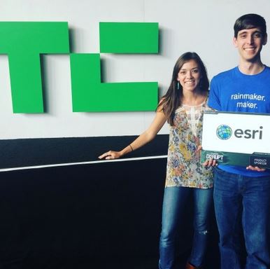
REDLANDS, Calif.–Today, Esri announced it will be a sponsor and exhibitor at the TechCrunch Disrupt NY 2016 and Hackathon conference to be held in Brooklyn, New York, May 7 to 11, 2016. Esri staff will be on hand to provide information on the free, global Esri Startup Program, which helps qualifying developers, emerging businesses, and tech entrepreneurs build mapping and location analytics capabilities into their products.

Esri is pleased to partner with @TechCrunch and provide game-changing mapping and spatial analytics #tcdisruptny

Developers attending the conference will explore the ways that using geographic information system (GIS) technology can provide a competitive advantage. Those joining the weekend hackathon can take advantage of free Esri ArcGIS developer accounts to create apps that are deployable on any device, using the latest spatial software for geofencing, directions and routing, spatial analysis, geocoding, imagery and visualization, and more.

“Esri is pleased to partner with TechCrunch and provide game-changing mapping and spatial analytics to fast-evolving technology,” said Kurt Daradics, Esri Startup Program manager. “Partnering with TechCrunch has been a great way for us to help the developer community.”

  • Who
    • Kurt Daradics, Esri Startup Program Manager
    • Katie Decker, Esri Startup Program Marketing Manager
  • What: TechCrunch Disrupt NY 2016 and Hackathon
  • Where: Brooklyn, New York
  • When: Hackathon: May 7–8, 2016; Conference: May 9–11, 2016
  • Activities
    • Hackathon, including a $5,000 prize for best use of Esri technology
    • Exhibit Expo

About Esri

Since 1969, Esri has been giving customers around the world the power to think and plan geographically. The market leader in GIS technology, Esri software is used in more than 350,000 organizations worldwide including each of the 200 largest cities in the United States, most national governments, more than two-thirds of Fortune 500 companies, and more than 7,000 colleges and universities. Esri applications, running on more than one million desktops and thousands of web and enterprise servers, provide the backbone for the world’s mapping and spatial analysis. Esri is the only vendor that provides complete technical solutions for desktop, mobile, server, and Internet platforms. Visit us at esri.com/news.

Copyright © 2016 Esri. All rights reserved. Esri, the Esri globe logo, GIS by Esri, ArcGIS, @esri.com, and esri.com are trademarks, service marks, or registered marks of Esri in the United States, the European Community, or certain other jurisdictions. Other companies and products or services mentioned herein may be trademarks, service marks, or registered marks of their respective mark owners.

Related Articles on GISuser:

  • Esri to Showcase Advanced Developer Tools at TechCrunch Disrupt NYEsri to Showcase Advanced Developer Tools at TechCrunch Disrupt NY
  • How APIs Connect Applications to Enable More Powerful Geospatial AnalysisHow APIs Connect Applications to Enable More Powerful Geospatial Analysis
  • GeoGeeks in Cars Going For Coffee at #DevSummit – Episode #14 with Will Cadell of MaptiksGeoGeeks in Cars Going For Coffee at #DevSummit – Episode #14 with Will Cadell of Maptiks
  • Canadian Students Win Big at Esri’s First Global Content ChallengeCanadian Students Win Big at Esri’s First Global Content Challenge
  • Esri and UN Launch Global Storytelling CompetitionEsri and UN Launch Global Storytelling Competition
  • Esri Relaunches ArcGIS For DevelopersEsri Relaunches ArcGIS For Developers

Filed Under: Business, Developer, FrontPage Leader, Top Text Lead Story Tagged With: api, developer, ESRI, New York, tcdisrupt


Editor’s Picks

geojobs

GeoJobs.BIZ Employment and Career Resource for GIS, Surveying, and Mapping Professionals

Social Media is an Increasingly Important Part of Webmaps, Data Analysis, Analytics and Visualizations

Esri Indonesia Story Map Explores Missing AirAsia Flight 8501

Infographic – What’s New in iOS 8?

See More Editor's Picks...

Connect with GISuser

  • Facebook
  • Google+
  • LinkedIn
  • RSS
  • Twitter


GIS jobs

Recent Features

Digitalization and Simulation at the North Pole

Natural Gas District & GIS-Centric Asset Management

5 Ways Technology Is Affecting The Sharing Economy

Spotlight – Township Canada: Explore Canadian Legal Land Descriptions on a Map

GeoGeeksinCars – The one in “Tippy” the right-hand drive Mitsubishi, at DevSummit

More Posts from this Category

Categories


Recent Posts

  • LiDAR Can Create Richer Contextually-Aware User Experiences, Finds Strategy Analytics
  • Done With Mundane Work-from-home? Here’s How Online Team Building Activities Could Help
  • How to track a cell phone location online
  • How to Digitalize Every Aspect of Your Business
  • Webinar Tip – Getting Started with D3.js for Data Visualization

RSS Career Tips

  • Four Characteristics of the Best Virtual Employees
  • Jobcase Launches Free Unemployment Resource Center for Workers Impacted by COVID-19
  • 8 Questions Employers Should Ask About Coronavirus
  • Must-Have Gadgets and Technology for the Remote Office Worker
  • Must-Have Gadgets and Technology for the Remote Office Worker


shop for geogeek swag

RSS Tech pubs

  • Buyer's Guide to Voluntary Benefits -- A Simple Guide for HR Professionals
  • Leaning into Benefits Enrollment in the COVID Era
  • Sitecore Personalization Quick Start

RSS Computers

  • The Essentials of Information Security Kit: Includes a Free PC Security Handbook - 2nd Edition eBook
  • iPad CTO Kit - including the iPad Tips and Tricks Guide for IT Executives and Managers
  • Windows... On Speed

RSS HR Tips

  • Buyer's Guide to Voluntary Benefits -- A Simple Guide for HR Professionals
  • 2021 Regulatory & Legislative Update Handbook
  • Regulatory & Legislative Update: What Employers Need to Know in 2021

RSS Gov Tech

  • 11 Habits of Successful Law Firms - Updated for the Digital Age
  • How Legal Teams Renew Their Focus on Cost Savings
  • Whitepaper | What 300 L&D Leaders Have Learned About Building Data Fluency

RSS UAV news

  • Cobra AntiDrones is developing the concept of a interceptor drone, killer of a loitering munition and strike UAVs similar to the Turkish Bayraktar TB2
  • Webinar – Processing Large Drone Projects Webinar
  • NOAA Awards Black Swift Technologies Contract to Develop GPS-Denied Navigation

RSS Geojobs

  • An error has occurred, which probably means the feed is down. Try again later.
Copyright Spatial Media LLC 2003 - 2015