GIS user technology news

News, Business, AI, Technology, IOS, Android, Google, Mobile, GIS, Crypto Currency, Economics

  • Advertising & Sponsored Posts
    • Advertising & Sponsored Posts
    • Submit Press
  • PRESS
    • Submit PR
    • Top Press
    • Business
    • Software
    • Hardware
    • UAV News
    • Mobile Technology
  • FEATURES
    • Around the Web
    • Social Media Features
    • EXPERTS & Guests
    • Tips
    • Infographics
  • Blog
  • Events
  • Shop
  • Tradepubs
  • CAREERS
You are here: Home / Archives for UP42

UP42 and Planet team up to expand the availability of frequent-revisit, very high resolution satellite data

August 29, 2024 By GISuser

BERLIN, August 27, 2024 – UP42, the leading Earth observation platform, announced a partnership with Planet Labs PBC (NYSE: PL), a global provider of daily satellite imagery and solutions. This collaboration significantly expands UP42’s optical data portfolio with the integration of Planet SkySat, the world’s largest constellation of high resolution Earth observation satellites. With 15 […]

Filed Under: Business, Featured TOP PR Tagged With: AND, availability, business:, data:, expand, featured, frequent-revisit,, high, planet, resolution, satellite, team, the, top, UP42, very

UP42 and Planet team up to expand the availability of frequent-revisit, very high resolution satellite data

August 27, 2024 By GISuser

BERLIN, August 27, 2024 – UP42, the leading Earth observation platform, announced a partnership with Planet Labs PBC (NYSE: PL), a global provider of daily satellite imagery and solutions. This collaboration significantly expands UP42’s optical data portfolio with the integration of Planet SkySat, the world’s largest constellation of high resolution Earth observation satellites. With 15 […]

Filed Under: * PRESS Tagged With: AND, availability, data:, expand, frequent-revisit,, high, planet, press, resolution, satellite, team, the, UP42, very

UP42 and Geoawesomeness Unveil 2024 Report on the Adoption of Earth Observation

March 13, 2024 By GISuser

Berlin, March 13, 2024 – UP42, a leading geospatial developer platform and marketplace, together with Geoawesomeness, a long-established community about geospatial technologies, have released a special report unveiling insights into the adoption of Earth observation in 2024. This report, unveiled during an event on March 12th, is part of the EO Hub initiative, a journalistic collaboration between UP42 […]

Filed Under: Business Tagged With: [2024, adoption, AND, Business, earth, geoawesomeness, observation, report, the, unveil, UP42

UP42 and GLOBHE Sign Partnership to Bring Drone Data to Geospatial Marketplace

November 8, 2023 By GISuser

GLOBHE's breadth of sensor availability, ranging from RGB, LiDAR, Multispectral and Thermal. (Image Credit: Isabelle Nyroth)

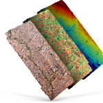
Customers can now task drones and browse drone data next to other types of imagery, all in one place.

Filed Under: Business, DATA Tagged With: UP42

UP42 and Umbra Unveil Partnership at World Satellite Business Week, Enhancing Environmental, Asset, and Land Monitoring

September 15, 2023 By GISuser

Geospatial leaders release a special video to explain the benefits of easier access to high resolution SAR data.

Filed Under: Business, DATA Tagged With: SAR, UP42

UP42 and ImageSat International (ISI) Partner to Unlock Critical Applications of Geospatial Data

September 5, 2023 By GISuser

From disaster response to environmental monitoring, operators in essential sectors will have direct access to high-resolution optical imagery.

Filed Under: Business, Earth Imaging - Remote Sensing Tagged With: UP42

UP42 and Vexcel Team Up to Expand Aerial Imagery and Geospatial Data Portfolio on the Marketplace

March 28, 2023 By GISuser

High-resolution and Accuracy in 30+ Countries for Utility, AEC, Energy, Insurance, and Telecoms Applications

Filed Under: Business, Earth Imaging - Remote Sensing, Top Text Lead Story Tagged With: UP42

UP42 Launches ArcGIS Pro Add-in as Part of Esri Partner Network

October 18, 2022 By GISuser

ArcGIS users have direct access to the UP42 platform for easier data visualization and analysis

Filed Under: Business, DATA Tagged With: arcgis, UP42

UP42 Achieves Sustainability Partner Designation in the Google Cloud Partner Advantage Program

September 20, 2022 By GISuser

Google Cloud Recognizes UP42 as Part of Google Cloud Ready – Sustainability Program

Filed Under: Business Tagged With: cloud, UP42

UP42 Adds BlackSky Dynamic Monitoring to Marketplace

September 8, 2022 By GISuser

UP42 Adds BlackSky Dynamic Monitoring to Marketplace

On-demand access to low-latency dawn-to-dusk imagery

Filed Under: Earth Imaging - Remote Sensing, Featured TOP PR Tagged With: Imagery, UP42

Next Page »

Recent Industry News

The Drift Between Early Notes and Final Case Files in Abuse-Related Legal Support

April 29, 2026 By GISuser

Aerial Surveys Int’l and Global Marketing Insights to Present GEOINT 2026 Workshop on Multi-Domain Geospatial Fusion for Automated Infrastructure Monitoring

April 24, 2026 By GISuser

Why Timing Matters More Than You Think With Spray Seal (And Why People Often Get It Slightly Wrong)

April 22, 2026 By GISuser

The Quiet Planning Stage Most People Don’t See When Building a Pool in Brisbane

April 22, 2026 By GISuser

Hot News

State of Data Science Report – AI and Open Source at Work

HERE and AWS Collaborate on New HERE AI Mapping Solutions

Virtual Surveyor Adds Productivity Tools to Mid-Level Smart Drone Surveying Software Plan

Categories

Copyright gletham Communications 2015 - 2026

Go to mobile version