
SAVANNAH, Ga. (Feb. 12, 2018) — Savannah/Hilton Head International Airport (SAV) is partnering with Woolpert to integrate unmanned aircraft system (UAS) technologies into airport and airfield operations.
UAV and Commercial Drone Industry Outlook & Predictions for 2018

GEO Jobe, a leading GIS software and solution provider offering UAV mapping services, is pleased to announce projections for the Commercial Drone industry in 2018.
Pix4D Recognizes GEO Jobe GIS & UAV Services for 3D Drone Mapping for Smart Cities

GEO Jobe UAV Mapping Services has been recognized by UAV software industry leader, Pix4D having a recent 3D model derived from UAV data featured in their weekly #3DMonday community spotlight
FAA Restricts Drones over Statue of Liberty, Other Landmarks
At the request of U.S. national security and law enforcement agencies, the Federal Aviation Administration (FAA) is using its existing authority under Title 14 of the Code of Federal Regulations (14 CFR) § 99.7 – “Special Security Instructions” – to address concerns about unauthorized drone operations over 10 Department of the Interior (DOI) sites, including the Statue of […]
Feature – Benefits & Cost Savings of UAV for GIS Mapping and Data Collection

Local government, utilities, College Campus and facility managers have a new resource at their disposal to help reduce costs associated with GIS mapping efforts and to keep their GIS land base current and up to date while also saving money.
LidarMag Feature – GIS Mapping Services are on the Cutting Edge with UAV Collected Imagery
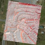
The GIS mapping services division of GEO Jobe has been quite active with UAV technology over the last year. We’ve turned to cutting edge hardware and software solutions to take to the sky and support some of our existing clients (and new ones) with imagery & analysis derived from UAV (drone) data acquisition.
UAS Magazine Announces Final Agenda for 2017 UAS Summit & Expo
Produced by UAS Magazine, UAS Summit will provide attendees with a comprehensive overview of the current state of the unmanned aircraft systems industry
NOAA Picks Black Swift Technologies’ sUAS for Nighttime Fire Observation eXperiment (NightFOX)

Aircraft to Provide Wildfire Measurements in Support of FIREX and Fire Weather Forecasting
West Wilson Utility District Turns to GEO Jobe for UAV Data Capture & Orthophoto Updates

Wilson County & Utility District (WWUD) are now in the fortunate situation where instead of the Orthophotos being the most out of date GIS layer, their Orthos are leading the change detection and data capture processes.
SimActive Optimizes Vineyard Performance with Drones
Montreal, Canada, June 6th, 2017 – SimActive Inc., a world-leading developer of photogrammetry software, is pleased to announce that Noveltis, a French company, has been using its Correlator3D™ software for precision viticulture. Based on multispectral drone imagery, mapping products are generated to determine vine health and detect missing plants.