WASHINGTON – The federal government is actively providing support to states, local communities, and tribes as Hurricane Harvey, now downgraded to a Tropical Storm, continues to impact the coastline and inland areas of Texas. FEMA’s National Response Coordination Center (NRCC) in Washington, D.C., and Regional Response Coordination Center (RRCC) in Denton, Texas, continue 24-hour coordination of […]
Hurricane & Flood Handbook: Before the Storm
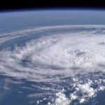
Newswise — The 2017 Atlantic hurricane season, which begins June 1 and runs for six months, is expected to have a near-average number of storms. This season’s forecast, according to the National Oceanic Atmospheric Administration (NOAA), includes 11-17 named storms, between five and nine hurricanes and at last two major hurricanes.
New USGS models help predict storm effects on beaches
As the 2016 hurricane season opens, weather forecasters, emergency managers and coastal residents have access to tools developed by the U.S. Geological Survey that predict, more precisely than ever, where beach erosion and beachfront flooding will take place during hurricanes and other storms
Change Detection analysis of Farquhar Island, Seychelles, after major hurricane
On April 16th, 2016, Farquhar Island, located in the Seychelles archipelago, has been hit by the cyclone “Fantala” which developed in a major hurricane. The eye of this hurricane, classified at the ultimate category 5 tropical cyclone, passed directly over Farquhar Island. Gusty winds of over 300km/h have been recorded, causing many damages.
Thousand-year deluge in South Carolina
What does it take for a weather event to eclipse in attention the development of a Category 4 hurricane just offshore of the southeast U.S. coastline? The answer: rainfall amounts that are measured by the foot.
NASA Global Hawk arrives in Virginia to begin NOAA-led mission to improve hurricane forecasts
With this weekend’s arrival of the NASA Global Hawk unmanned aircraft on Virginia’s eastern shore, scientists and pilots are now ready to start the NOAA-led mission to improve hurricane forecasts of track and intensity using data collected by the Global Hawk during the season’s hurricanes.
10 Years Later: Hurricane Science that Weathers the Storm
On August 29, 2005, the only thing that USGS scientists in Louisiana and Mississippi could focus on was going to the aid of the thousands trapped in New Orleans and the surrounding Gulf Coast. Indeed, for the next several weeks, USGS offices all over the country marshalled their resources to meet the immediate recovery needs […]
Track Tropical Storm Erika with Interactive Esri Map
As Florida declares a state of emergency in preparation for Tropical Storm Erika, you can track the storm’s progress with Esri’s Hurricane Public Information Map.
Understanding Storm surge Risk with new Hurricane Center maps
Storm surge risks will be easier to understand with new Hurricane Center maps
Lessons Learned from SuperStorm Sandy Response Activities to Aid in Future Disaster Preparedness and Response
Hughes, the All Hazards Consortium and the Multi-State Fleet Response Working Group Announce a Strategic Data Sharing Partnership