
Weather Reminder 2.0 app is released on iOS. The app lets make plans not for specific dates – but for specific weather conditions: to wash a car, have a picnic or take a stroll in clear weather, to read a book at home or take an umbrella when it’s rainy or to fly a kite […]
The future is here: iPhone X

Packed with Innovative Features Including a Super Retina Display, TrueDepth Camera System, Face ID and A11 Bionic Chip with Neural Engine
iPhone 8 and iPhone 8 Plus: A new generation of iPhone

Featuring New Glass and Aluminum Design, Retina HD Displays, A11 Bionic Chip, New Single and Dual Cameras with Support for Portrait Lighting, Wireless Charging and Optimized for Augmented Reality
Mappedin & Apple bring indoor mapping to leading retail properties
With the release of iOS 11, Mappedin customers will be able to export accurate map data to the Apple Maps platform to create a more interactive shopping experience
TerraGo® Adds Topcon® GNSS Receiver Integration to Mobile Data Collection Platforms
With TerraGo Magic, partners and customers can build custom mobile apps integrated with Sokkia high-accuracy receivers that deliver RTK cm-level performance to smartphones and tablets.
TerraGo and Laser Technology Partner to Integrate Industry-Leading Rangefinders with Advanced Field Data Collection Apps
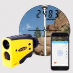
TerraGo Magic, the industry’s first zero-code platform for building custom apps, now includes support for TruPulse® laser rangefinders to improve accuracy, efficiency and safety of field data collection work in numerous industries including energy, utilities, transportation, environmental, engineering and more
LidarMag Feature – GIS Mapping Services are on the Cutting Edge with UAV Collected Imagery
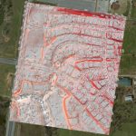
The GIS mapping services division of GEO Jobe has been quite active with UAV technology over the last year. We’ve turned to cutting edge hardware and software solutions to take to the sky and support some of our existing clients (and new ones) with imagery & analysis derived from UAV (drone) data acquisition.
Trimble Introduces New Android Application for Field Surveying and Data Collection
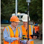
Sunnyvale, Calif., July 26, 2017—Trimble (NASDAQ: TRMB) introduced today Trimble® Penmap® for Android™, a cloud-connected application for field surveying and high-accuracy Geographic Information System (GIS) data collection that works on mobile handhelds, smartphones and tablets.
CompassCom to Release CompassTracker App for iOS & Windows Mobile Smart Phones at Esri User Conference
CENTENNIAL, Colorado, 6 July 2017 – CompassCom Software, developers of industry-leading Mobile Resource Management (MRM) solutions, will release CompassTracker for iOS and Windows Mobile at the 2017 Esri User Conference. The CompassTracker App enables organizations using the CompassCom MRM solution to track their field personnel in real time within the same Esri ArcGIS environment where they track […]
Structural Integrity Chooses TerraGo Magic to Build Customized Field Data Collection App
Using the TerraGo Magic zero-code platform-as-a-service, Structural Integrity is building a cloud-enabled mobile inspection app integrated with Trimble® high-accuracy GNSS receivers