GIS user technology news

News, Business, AI, Technology, IOS, Android, Google, Mobile, GIS, Crypto Currency, Economics

  • Advertising & Sponsored Posts
    • Advertising & Sponsored Posts
    • Submit Press
  • PRESS
    • Submit PR
    • Top Press
    • Business
    • Software
    • Hardware
    • UAV News
    • Mobile Technology
  • FEATURES
    • Around the Web
    • Social Media Features
    • EXPERTS & Guests
    • Tips
    • Infographics
  • Blog
  • Events
  • Shop
  • Tradepubs
  • CAREERS
You are here: Home / Archives for **Front Page / Top Text Lead Story

Inaugural World Lidar Day to Launch Feb. 12 at Geo Week Conference in Denver

February 12, 2024 By GISuser

world lidar day

This annual day has been established to spotlight the value of lidar and its applications worldwide.

Filed Under: Business, Earth Imaging - Remote Sensing, LiDAR, Top Text Lead Story Tagged With: Business, conference, day, Denver, earth, feb., Geo, imaging, inaugural, launch, lead, LiDAR, remote, sensing, story, text, top, week, world

SimActive Announces Enhanced Cloud Capabilities

January 26, 2024 By GISuser

SimActive Announces Enhanced Cloud Capabilities

Montreal, Canada, January 23rd, 2024 – SimActive Inc., a world-leading developer of photogrammetry software, announces the enhancement of Correlator3D™ for improved cloud environment productivity. With Correlator3D’s distributed processing capabilities, clients can seamlessly scale their processing in line with operational needs.

Filed Under: Earth Imaging - Remote Sensing, Top Text Lead Story Tagged With: announces, capabilities, cloud, earth, enhanced, imaging, lead, remote, sensing, SimActive, story, text, top

Maxar Intelligence Wins NGA Contract for Precision3D Data

January 13, 2024 By GISuser

WESTMINSTER, Colo.–(BUSINESS WIRE)–Maxar Intelligence, a provider of secure, precise, geospatial intelligence, today announced that it received a contract to provide the National Geospatial-Intelligence Agency (NGA) with a Precision3DTM Data Suite bundle covering 160,000 square kilometers within the U.S. Indo-Pacific Command area of responsibility.

Filed Under: DATA, Earth Imaging - Remote Sensing, Top Text Lead Story Tagged With: contract, Data, earth, featured, for, imaging, Intelligence, lead, maxar, NGA, precision3d, remote, sensing, story, text, top, Wins

Esri Integrates with Microsoft Fabric to Deliver Leading Spatial Analytics Capabilities

November 15, 2023 By GISuser

Esri Integrates with Microsoft Fabric

Esri’s Interactive Mapping and Data Exploration Delivers 140 Spatial Analytics Tools and Functions into the Fabric User Experience

Filed Under: Business, Top Text Lead Story Tagged With: ESRI, fabric, Microsoft

Marine Institute and TCarta Student Internship Program Makes Major Data Contribution to Seabed 2030 Project

November 8, 2023 By GISuser

Marine Institute and TCarta Student Internship Program Makes Major Data Contribution to Seabed 2030 Project

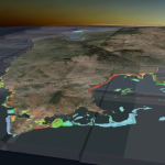
TCarta Marine, a global provider of hydrospatial products and services, has delivered three major satellite derived bathymetry (SDB) data sets to The Nippon Foundation-GEBCO Seabed 2030 project. Students in Canada participating in a 2023 summer internship program created the SDB products for the entire coastline of Madagascar, Newfoundland, and two Canadian Arctic research areas.

Filed Under: Business, Environment, Top Text Lead Story Tagged With: Marine, TCarta

New Edition of Esri’s ArcGIS Pro Guide Is Revised and Streamlined for Learning Latest Workflows

October 4, 2023 By GISuser

arcgis pro tutorial

The Best-Selling Book Is Updated for ArcGIS Pro Version 3.1 Tools

Filed Under: Business, Research, Top Text Lead Story Tagged With: arcgis, books, ESRI

Space Flight Laboratory (SFL) Announces Performance Milestone for GHGSat Greenhouse Gas Monitoring Microsatellites

September 6, 2023 By GISuser

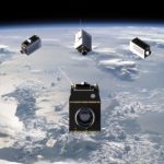
TORONTO, Ontario, Canada, 6 September 2023 – Space Flight Laboratory (SFL) is pleased to announce the SFL-built GHGSat greenhouse gas monitoring microsatellites have achieved sustained detection and measurement of methane emissions at double the design capacity of the satellites. Under contract to GHGSat, SFL developed all nine operational 15-kilogram GHGSat spacecraft on its low-cost, high-performance NEMO microsatellite […]

Filed Under: Business, Earth Imaging - Remote Sensing, Top Text Lead Story

SimActive Announces New Pricing for Larger Drone Cameras

July 19, 2023 By GISuser

Montreal, Canada, July 18th., 2023 – SimActive Inc., a world-leading developer of photogrammetry software, announces new pricing for its Correlator3D software.  Larger drone cameras of up to 61 megapixels are now covered under the low-priced UAV license option, which was previously capped at 50MP.

Filed Under: Business, Hardware, Top Text Lead Story, UAV/UAS Tagged With: Camera, UAV

The Essentials of Cloud – 2023 Kit

May 19, 2023 By GISuser

The Essentials of Cloud - 2023 Kit

The Essentials of Cloud – 2023 Kit includes the latest in information, coverage of important developments, and expert commentary to help with your Cloud related decisions.

Filed Under: Business, Research, Top Text Lead Story Tagged With: cloud, research

Biden-Harris Administration Announces New Steps for Climate Resilience and Forest Conservation

April 22, 2023 By GISuser

At President Biden’s Direction, USDA and Interior Release Inventory of Mature and Old-Growth Forests, Set Reforestation Targets for Federal Lands

Filed Under: Business, Environment, Top Text Lead Story Tagged With: forests, USDA

« Previous Page
Next Page »

Recent Industry News

Why Bathroom Renovation Services Often Change More Than Just the Bathroom

May 20, 2026 By GISuser

The Drift Between Early Notes and Final Case Files in Abuse-Related Legal Support

April 29, 2026 By GISuser

Aerial Surveys Int’l and Global Marketing Insights to Present GEOINT 2026 Workshop on Multi-Domain Geospatial Fusion for Automated Infrastructure Monitoring

April 24, 2026 By GISuser

Why Timing Matters More Than You Think With Spray Seal (And Why People Often Get It Slightly Wrong)

April 22, 2026 By GISuser

Hot News

State of Data Science Report – AI and Open Source at Work

HERE and AWS Collaborate on New HERE AI Mapping Solutions

Virtual Surveyor Adds Productivity Tools to Mid-Level Smart Drone Surveying Software Plan

Categories

Copyright gletham Communications 2015 - 2026

Go to mobile version