Just like the previous 11 years that I’ve attended the Esriuc, the event kicked off on Monday morning with Jack Dangermond’s welcome address and plenary session. Speaking to a packed hall, full to capacity with GeoGeeks from around the world, the multi-media rich presentation served to introduce what has been estimated at 15,000 Geo professionals, to ArcGIS 10.1, the current state of the company, and the road ahead for Esri.
The purpose of this event, like so many prior to this, being together, learning from each other, sharing and growing together… As he always does, Dangermond asked us all to meet each other, swap a quick story, and shake hands with a neighbor. So, who were we? Apparently we were part of the largest gathering ever to attend the esriuc, over 15,000 , coming from 126 countries from every reach of the World, and impressively, about 1/3 of the attendees this year came from outside the USA. According to Dangermond about one-third of those in attendance were here for the first time.
Entertaining as ever, we were presented with a quick look at who the customers of Esri are and shown briefly the kinds of solutions that people are solving all around the World, thanks to solutions, technology, and services provided by Esri. Enthusiastic and passionately, Dangermond went on to quickly boast (much like a proud father would) how his customers and partners are using the power of GIS in many areas including: Sea floor mapping, managing natural resources, groundwater management, geologic exploration, trip planning, utility management (now exploding with visualization,),AT&T is creating coverage maps, green building potential, wind modeling, energy assessment, homeland security, and situational awareness. The use of GIS, Dangermond pointed out, has resulted in a huge effort towards crowd sourcing and more government transparency [clap]… “this is good because it’s using a language that you all created.”
The following are just some of the key points of interest discussed by Dangermond during the morning address:
- Think of our growing Spatial data infrastructure as a “National GIS”
- This years theme – GIS understanding our World. GIS [Esri] Users are helping to create a better understanding of the World and the role that humans play in changing it Climate, land use, security, poverty, these affect us as individuals and as organizations. Understanding change is all about knowing, about real experiences, and knowing enables us to think, predict, explain, and have meaning.
- GIS is changing rapidly, evolving (an organic thing co-evolving) growing loads of data which we need to deal with. Struggle with crowd sourcing, how to deal with security issues, computing is evolving, new technology like the cloud…usability is a huge issue, trying to make it so anyone can engage with the World and understand the world.
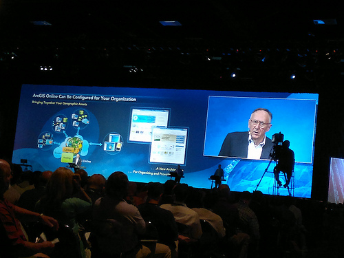
- A new pattern is emerging, making GIS available to everyone (think ArcGIS Online)… the reach extends to all, helped tremendously by social media.
See our photos from the ESRIUC