GIS user technology news

News, Business, AI, Technology, IOS, Android, Google, Mobile, GIS, Crypto Currency, Economics

  • Advertising & Sponsored Posts
    • Advertising & Sponsored Posts
    • Submit Press
  • PRESS
    • Submit PR
    • Top Press
    • Business
    • Software
    • Hardware
    • UAV News
    • Mobile Technology
  • FEATURES
    • Around the Web
    • Social Media Features
    • EXPERTS & Guests
    • Tips
    • Infographics
  • Blog
  • Events
  • Shop
  • Tradepubs
  • CAREERS
You are here: Home / Blog / arcgis / US PLSS Data Projection Oops from BLM With ArcGIS.com

US PLSS Data Projection Oops from BLM With ArcGIS.com

December 5, 2011 By Editor

An interesting result when you attempt to add the BLM US public land survey system data into an ArcGIS.com map… these PLSS data are available from a KML file at www.geocommunicator.gov. I haven’t run into any projection issues within ArcGIS.com yet to date so I found it a little ironic that this issue crept up when working with official PLSS data! Any tips?

The KML format PLSS data layer can be accessed here (KML link)

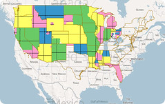
US PLSS Data Oops from BLM
Originally uploaded by @gletham GIS, Social, Mobile Tech Images

Filed Under: arcgis, gis, surveying

Editor’s Picks

FireWhat? Mobile GIS Lab, Emergency Incident Mapping and HP Mobile Workstations

Feature: Social Media Mapping is Crucial for Market Research and your Social Strategy

Social Media is an Increasingly Important Part of Webmaps, Data Analysis, Analytics and Visualizations

Global Mapper 17.2 Released with New Map Book Creation Tool and Cutaway Terrain View

See More Editor's Picks...

About Editor

Glenn is a geographer and a GIS professional with over 20 years experience in the industry. He's the co-founder of GISuser and several other technology web publications.

Recent Industry News

The Drift Between Early Notes and Final Case Files in Abuse-Related Legal Support

April 29, 2026 By GISuser

Aerial Surveys Int’l and Global Marketing Insights to Present GEOINT 2026 Workshop on Multi-Domain Geospatial Fusion for Automated Infrastructure Monitoring

April 24, 2026 By GISuser

Why Timing Matters More Than You Think With Spray Seal (And Why People Often Get It Slightly Wrong)

April 22, 2026 By GISuser

The Quiet Planning Stage Most People Don’t See When Building a Pool in Brisbane

April 22, 2026 By GISuser

Hot News

State of Data Science Report – AI and Open Source at Work

HERE and AWS Collaborate on New HERE AI Mapping Solutions

Virtual Surveyor Adds Productivity Tools to Mid-Level Smart Drone Surveying Software Plan

Categories

Copyright gletham Communications 2015 - 2026

Go to mobile version