Fairmont, WV, August 11, 2021 — RedTail LiDAR Systems, a leader in microelectromechanical systems (MEMS) mirror-based LiDAR technology, today unveiled the market introduction of the RTL-450 LiDAR sensor. The product will be launched at the XPONENTIAL 2021 Trade Show which is being held in Atlanta, Georgia from August 16-19.
The RTL-450 incorporates a lightweight MEMS mirror and a precision navigation system to generate accurate data for the most demanding of aerial surveying missions. The high-resolution, three-dimensional point clouds created by the RTL-450 provide operators an unsurpassed ability to conduct advanced analytics of geographic and manmade features on the earth’s surface.
The RTL-450 – which is designed and assembled in the U.S. – incorporates patented LiDAR sensor technology to achieve superior performance. The innovative LiDAR system, which weighs in at just over 4 pounds, is designed to operate independently of a drone platform, providing great flexibility for drone integration. The modular nature of the design facilitates quick and efficient integration onto user selected platforms. To date, the RTL-450 has been integrated onto the FLIR SkyRaider, Freefly Alta-8, 4D-X6, DJI Matrice 300 and DJI Matrice 600. The simple and easy to use software interface – coupled with a comprehensive online training curriculum – allows system operators to be up and running in no time.
The system operates in a raster scan mode for surveillance missions and a side-to-side line scan mode for area mapping. The intuitive command and control, and high-brightness display integrated into the ground control station (GCS) allows operators to monitor and optimize data collection missions, an offering that that is unique in the world of small UAV LiDAR systems.
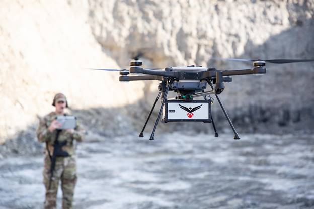
Military operator flying the RTL-450
“We are thrilled to introduce RedTail LiDAR Systems’ RTL-450. This LiDAR system has been enhanced for use on a wide variety of small, user selected drones. The innovative MEMS mirror technology ensures that drone operators create one of the best, high-quality point clouds in the industry,” said Brad DeRoos, President and CEO of RedTail LiDAR Systems.
The RTL-450’s high-resolution point clouds – generated at a rate of up to 400,000 pulses per second and 5 returns per pulse – are extremely well-suited to numerous military, first-responder and commercial applications, including mission planning, battle damage assessment, force protection, emergency response, remote surveillance, construction and resource management, and infrastructure development. What makes the RTL-450 unique is that all laser pulsed are transmitted toward the ground toward the area of interest.
The detail contained within the 3D LiDAR images makes them ideal for use with Artificial Intelligence and Machine Learning (AI/ML) algorithms for the autonomous detection and classification of objects of interest with no human intervention required. The fact that 3D point clouds are created using the light from the pulsed laser ensures images can be collected both day and night. Receiving up to 5 returns from every light pulse transmitted enhances through canopy light transmission, thereby allowing the ground to be imaged even under heavily foliated conditions – an important capability that cannot be provided by photogrammetric imaging techniques.

High-resolution point cloud images captured by the RTL-450
About RedTail LiDAR Systems
RedTail LiDAR Systems is a company division of 4D Tech Solutions, Inc. RedTail has become a world leader in the development and delivery of long-range MEMs mirror LiDAR sensors. Design, integration and product delivery have been performed for numerous commercial applications as well as government-funded efforts for the U.S. Army, Navy, and Department of Homeland Security.
4D’s exclusive licenses from the Army Research Laboratory for the MEMS mirror-based LiDAR technology cover all manned and unmanned vehicle applications as well as surveillance. 4D is actively expanding its capabilities and product portfolio through a U.S. Navy funded effort that will transition the technology to underwater vehicles such as unmanned undersea vehicles (UUVs) and Remotely Operated Vehicles (ROVs), and an internally funded effort to develop a long-range imaging product for unmanned ground vehicle (UGV) applications. 4D’s ability to rapidly customize the performance to suit specific application requirements for government customers sets the company apart in the world of LiDAR product providers.
4D Tech Solutions is a research and development (R&D) and manufacturing company that works with commercial and government customers to develop advanced, technology-based solutions to challenging problems. 4D is a Service-Disabled Veteran-Owned small business and SBA-certified HUBZone small business.
For more information, visit our:
Website: www.redtaillidar.com
Facebook: https://www.facebook.com/RedTailLiDAR/